Welcome to the miracle of Alay, Sary-Mogol
enjoy your travel in Kyrgyzstan!
Overview of the Route
- Day1. Osh to Kojo-Kelen
- Day2. Kojo-Kelen to Kosh-Moinok
- Day3. Kosh-Moinok to Aigul yurt camp before Sary-Mogol pass
- Day4. Aigul yurt to pasture of Sary-Mogol after Sary-Mogol pass
- Day5. Sary-Mogul’s pasture to Kara-Kabak
- Day6. Kara-Kabak to Damjailoo
- Day7. Damjailoo to Sary-Mogol
- Day8. Sary-Mogol to Tulpar-Kol
- Day9. Tulpar-Kol to Osh

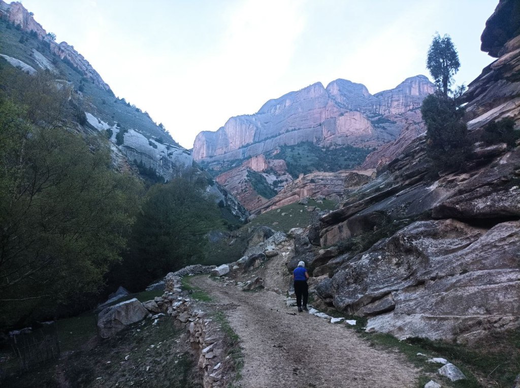
Day 1. Osh- Kozho-Kelen (about 100 km 3.5 hours)
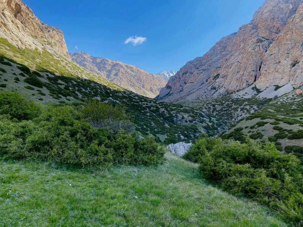
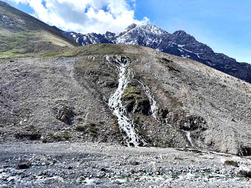
Drive from Osh to Kozho Kelen. Along the road you can see exotic nature (mountains,
herbs, flowers and shepherds life). As well visible on the way The Papan reservoir, that
provides all Osh city residents with water and it is used for irrigation the agriculture of
Kyrgyzstan and Uzbekistan. The road is 100km about 3.5 hours to reach the Kojo-Kelen.
The condition is dirty but not bad. The road goes along the Ak-Buura river and both sides
of road surrounded with green juniper mountains. Upon arrival to Kozho Kelen (2230m
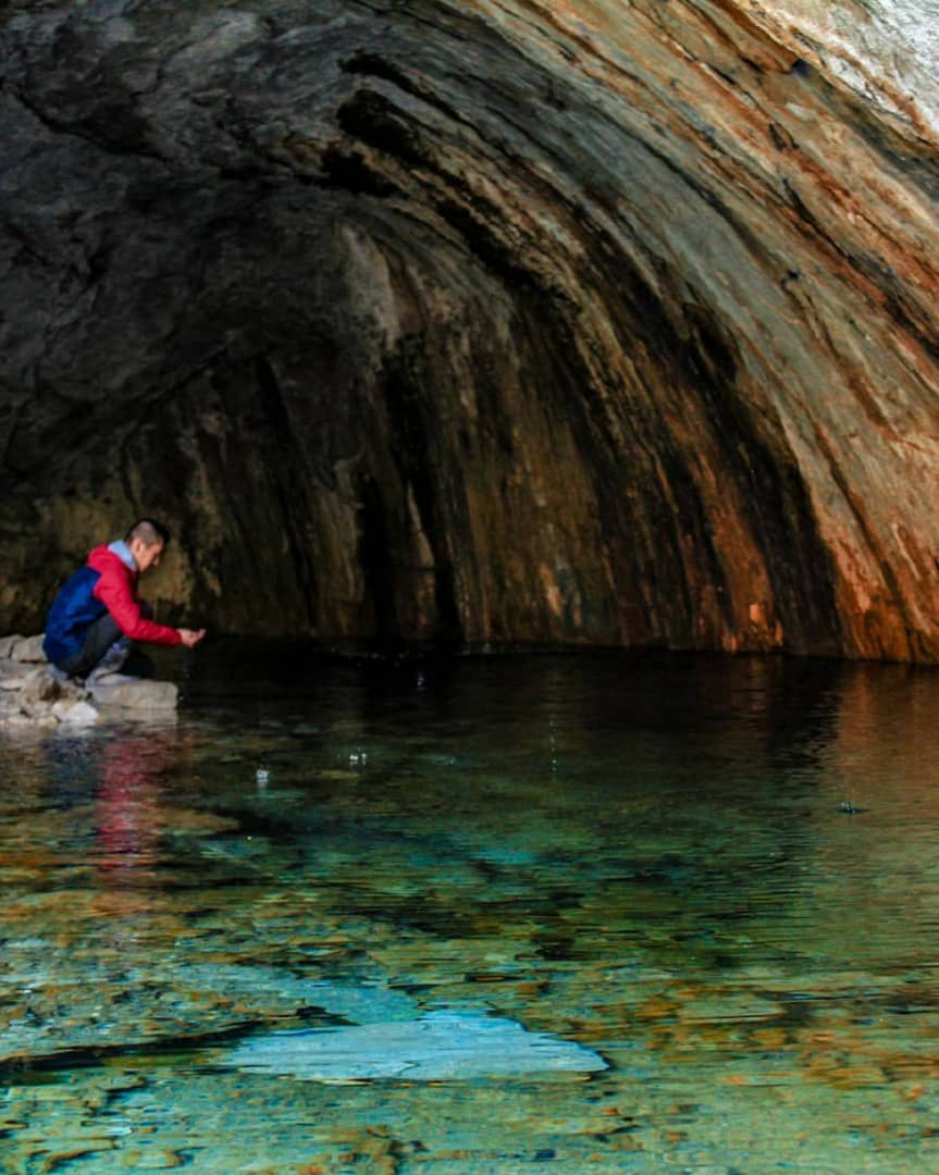
asl) we will have lunch at guest house and have an acclimatization hike (2-3 hours). We will
visit Blue Grot and waterfall. We will return back to guest house and have a rest and
dinner.
Day 2. Kozho Kelen– Kosh Moinok
(14 km; 4 hours riding and total spending time is 7 hours)
•Departure after breakfast.
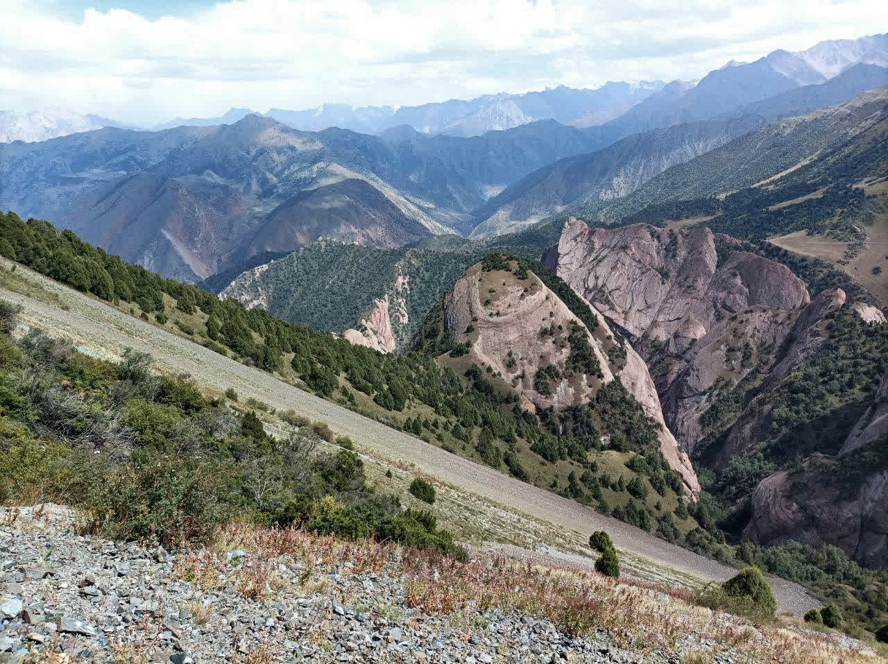
•We will the tour on the slopes of the beautiful Cretaceous mountains of Kichi-Alay. First
we cross the Sary-Bel pass (3150m). Sary Bell is a picturesque spot known for its scenic
landscapes. The name «Sary Bell» translates to «Yellow Hill» in Kyrgyz, which might refer to
the area’s terrain or the appearance of the hills in certain seasons.
•From Sary Bell we go down to another scenic gorge Kosh Moinok. This location is known
for its stunning mountain scenery and tranquil environment. It’s often frequented by those
looking to explore the Trans-Alay mountain range and enjoy activities such as trekking and
camping. The name «Kosh Moinok» roughly translates to «Two Pastures,» reflecting the
region’s pastoral landscape.
Day 3. From Kosh-Moinok to yurt camp before the Sary-Mogol pass.
(17km 5 hours riding)
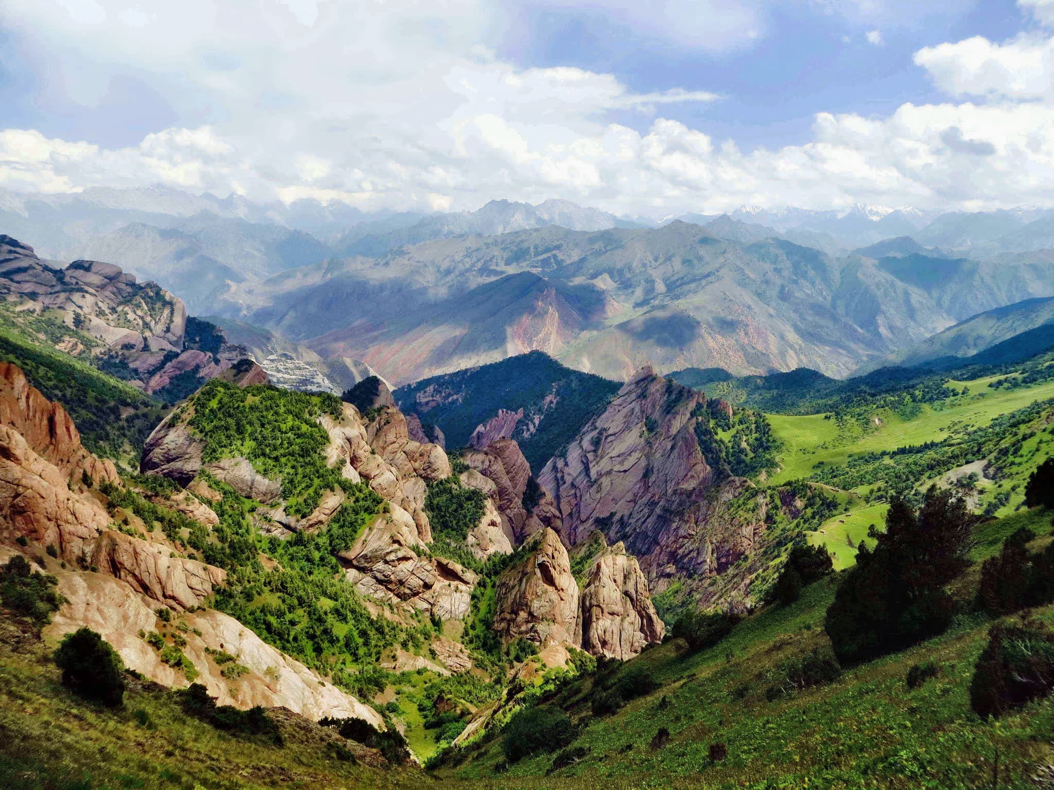
After a little passage from Kyzyl-Chara there is a small village Sary-Mogul from here we forward to the
south side then Go up along the mountain river, in both sides there are cliffs and subalpine and alpine
meadows represent a very diversity of landscape.
First of all while riding, every step is visible of crying marmots,
Birds in these natural zones are also numerous, and a large number of them are predators: the neck,
bearded vulture, golden eagle, owl, and hawk and also exists in this area of rarely visible animals wolf,
fox, badger, wild boar, mountain goats, jackals
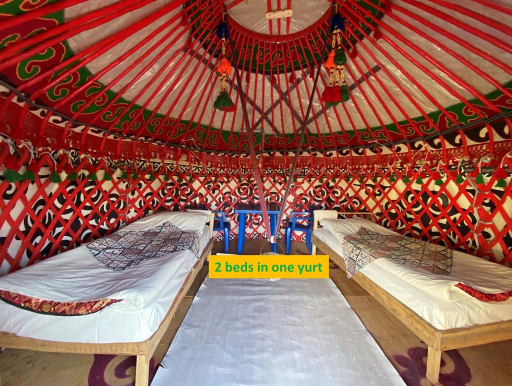
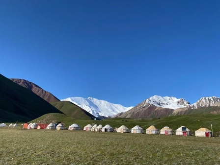
As we approach the Sary-Mogol pass, It can be visible the yurts for overnight and stay (the yurts are
simple for travelers provided meals by owner)
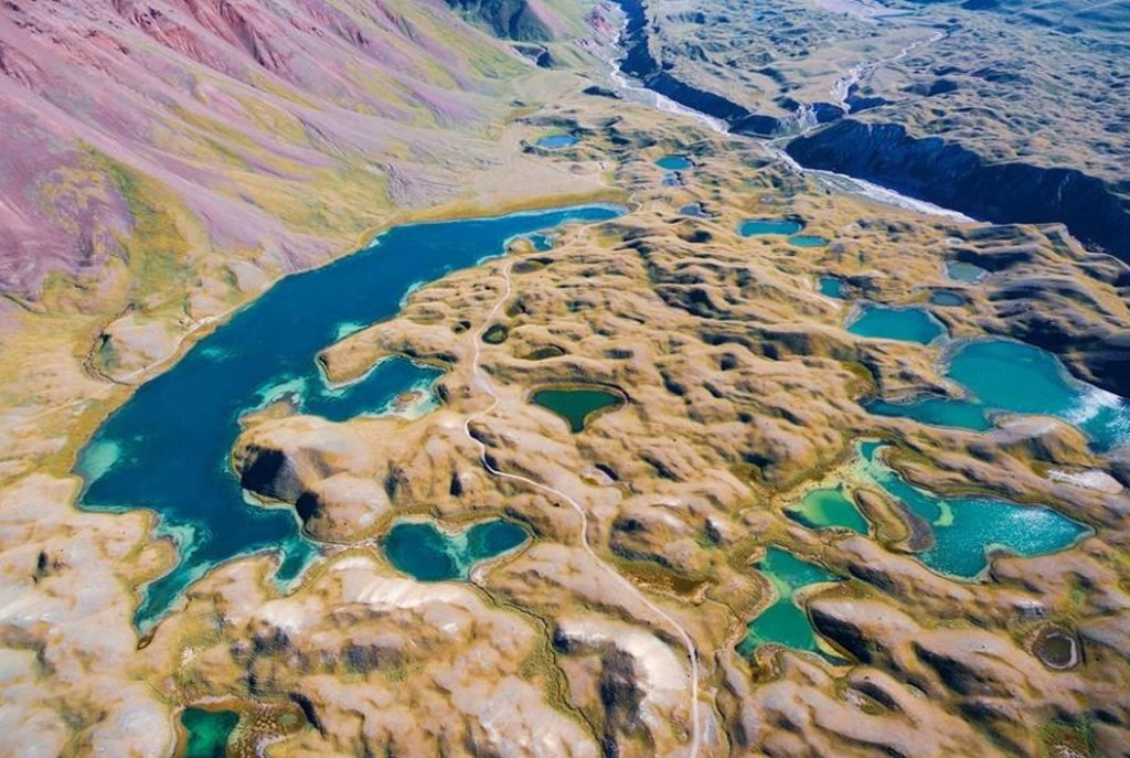
Day4. Cross the Sary-Mogol’s pass (4300m)- Camp of Sary-Mogol pasture.
12km; 6 hours riding to camping point
Steep pass In fact the distance is not long, but the pass takes time. An incredible sense
of the landscape, you feel like in the sky, the height of the Pamir-Alay begins from the
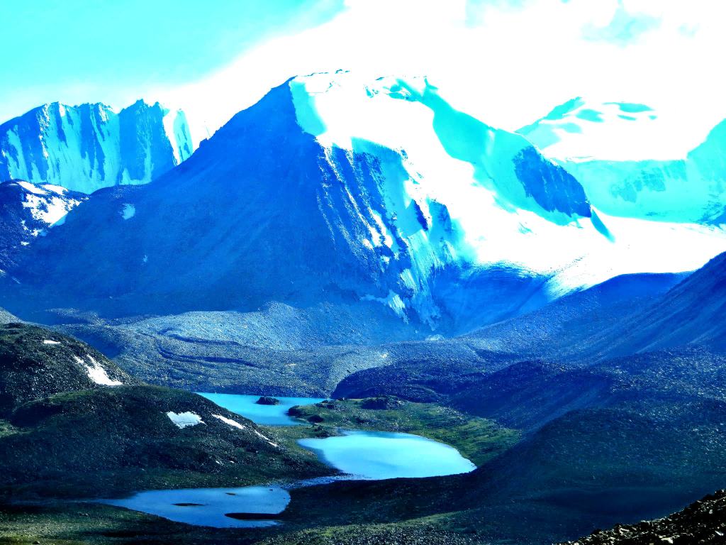
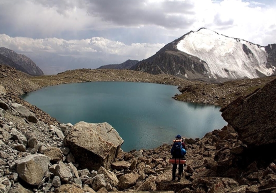
Sary-Mogol pass (4300 m) and down the pass lie amazing 4 rocky lakes (Besh-Kol) and
the water that connects the lakes with each other, finally flows into the cave.
Approximately after 15km the trail brings to a locals yurts near the mountain river and
night will be in a tent.
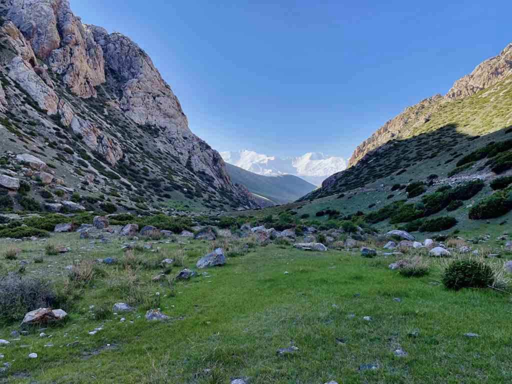
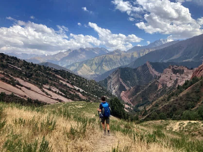
Day5. Riding to next camp over Kara-Kabak (20km 7hours riding)
The trail begins with a gradual ascent before becoming steeper as you approach the pass. Riders will
cross rocky terrain and may encounter snow patches, even in summer.
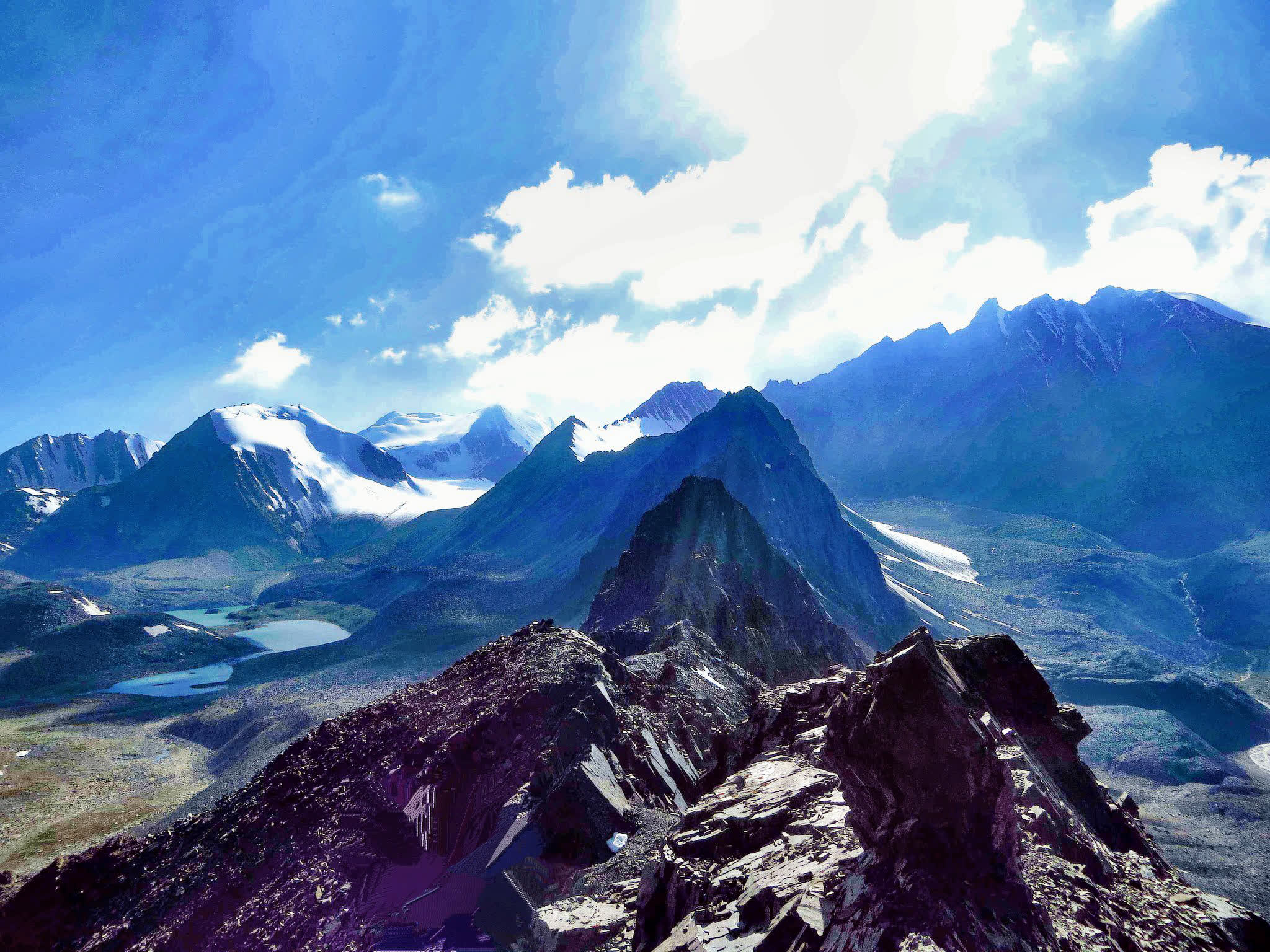
Karakabak Pass offers breathtaking panoramic views of the Alay Valley and the towering Lenin Peak
(7,134 m). The scenery includes rugged cliffs, jagged peaks, and expansive glaciers.
After reaching the pass, you can choose to either return the same way to Tulpar-Kol or continue
descending into the Karakabak Valley.
The descent is steep but manageable, taking you through high-altitude pastures where herders often
graze their livestock in summer.
The valley is less frequented by tourists, giving you a chance to experience the untouched wilderness
of the region.
If there is time, we continue our journey to Kashka-Suu pasture.

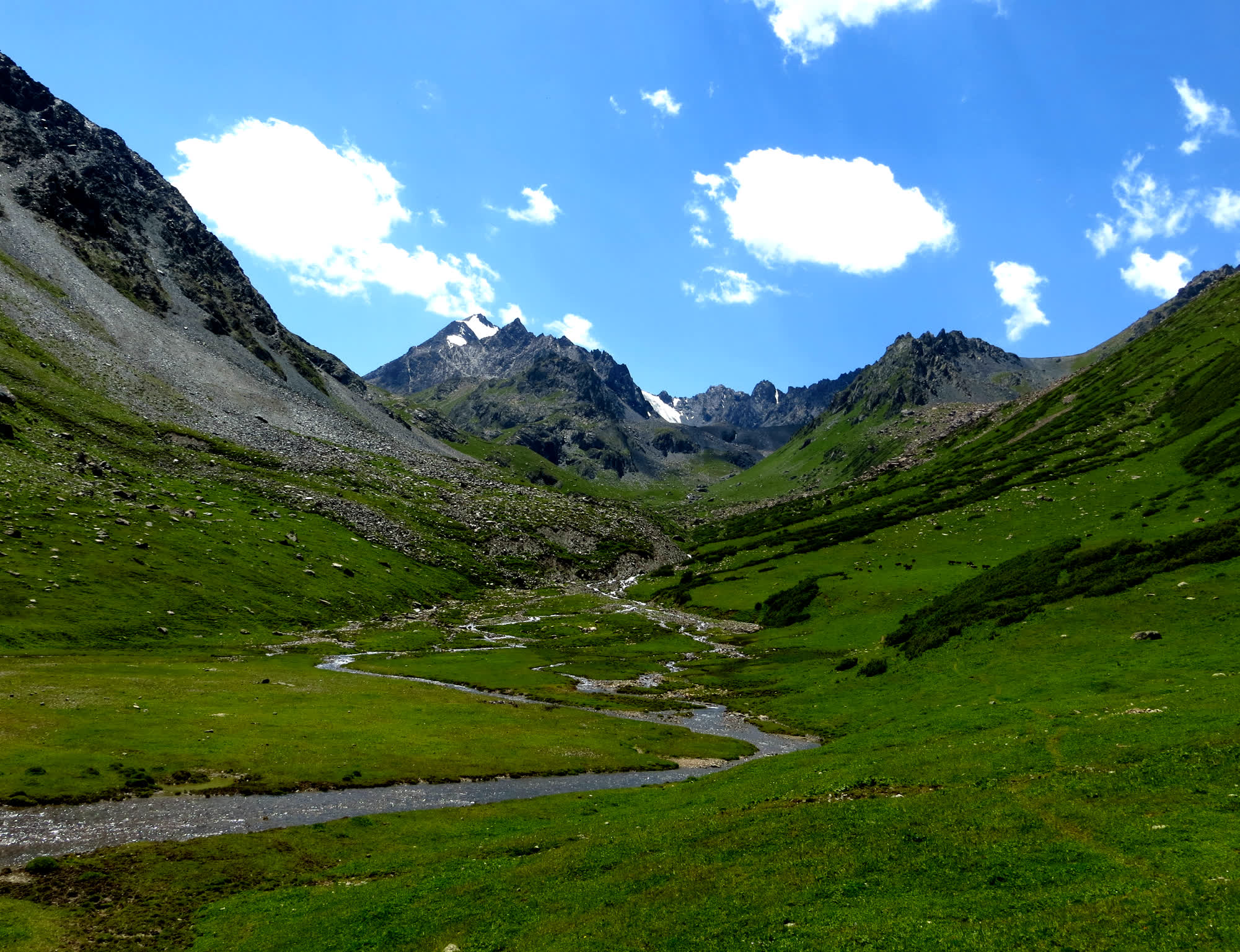
Day6. Kara Kabak- Damdjailoo; 8 hours:
Today we pass a quite upper riding day After passing the hill on right side, we go up to the
Kashka-Suu valley. A path between the juniper and other bushes, in a narrow gorge. Arrival
in the valley Kok Djar, the landscape takes on the width. Crossing over Kok Djar to 4120 m.
Descent into lakes and Daimjaïloo Kosh Kol. Setting up camp. Dinner and overnight in tents
at 3870m.
Time: 8 hours
Distance: 20 km
Max Elevation: 4150 m
Min Elevation: 3300m
Overnight at 3870m
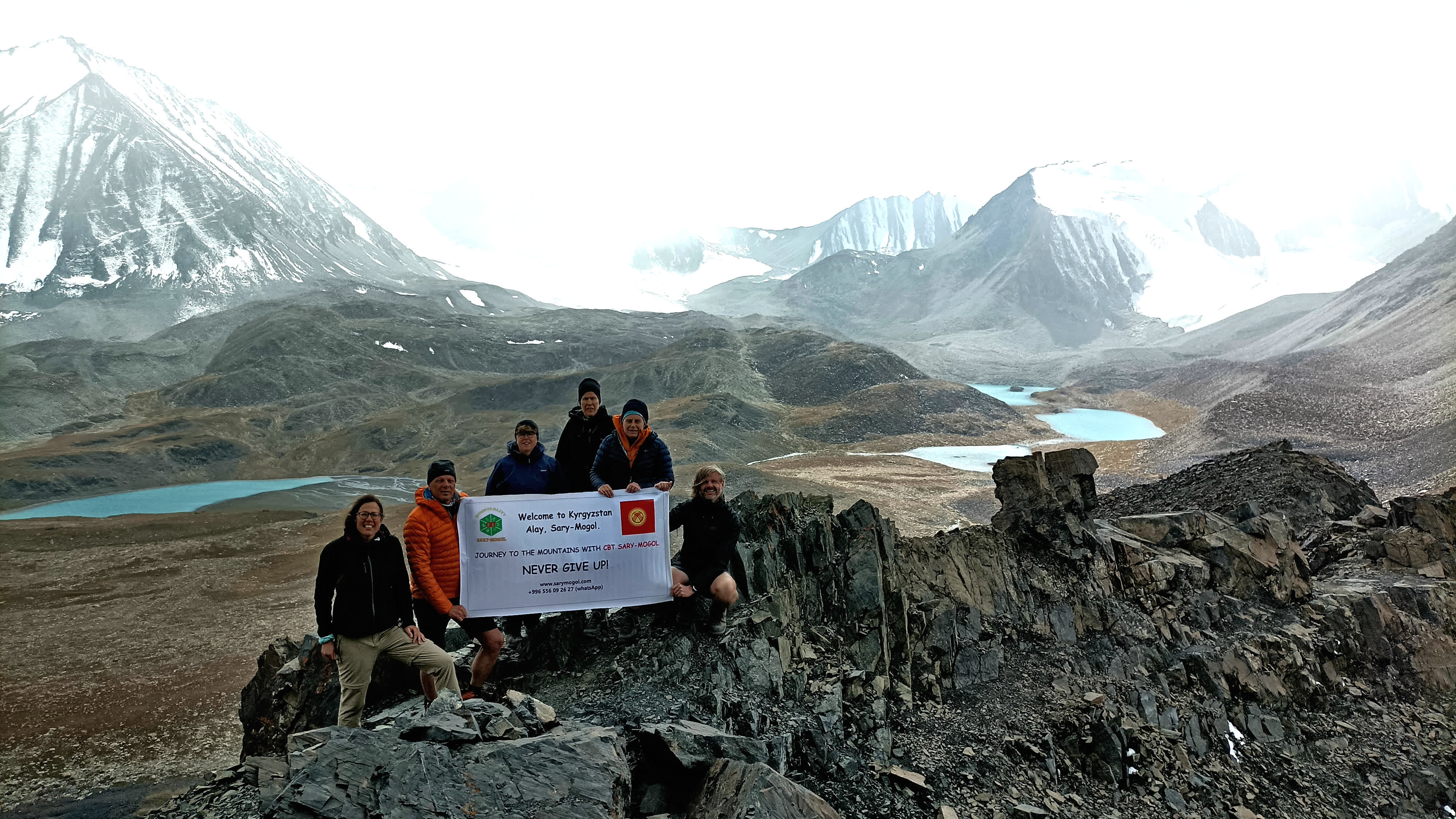
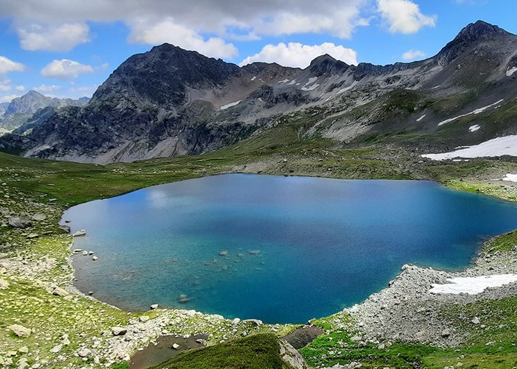
Day7. Walking around the Kosh kol lakes. Then riding to Damjailoo, futher transfer to Sary-Mogol
On this day we will walk up to 4130m on the upper couple of lakes to have more explore. We leave our
stuff in camp, just take lunch boxes and light things; we see two and above there couple of lakes then
return down to the same camp.
Time: 2-3 hours, Distance: 2+2 km, Max Elevation: 4150 m
Min Elevation: 3870m, Overnight at 3870m
Kosh kol lake is one of the most high-mountainous lakes which is located at 4120m above sea level. At
first entrance two rocky and above there other twin rocky lakes are located
After exploring the lake, return along other routes on decent route to Kashka-Suu village and then
transfer to Sary-Mogol (25km 30min drive)

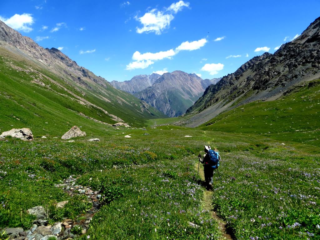
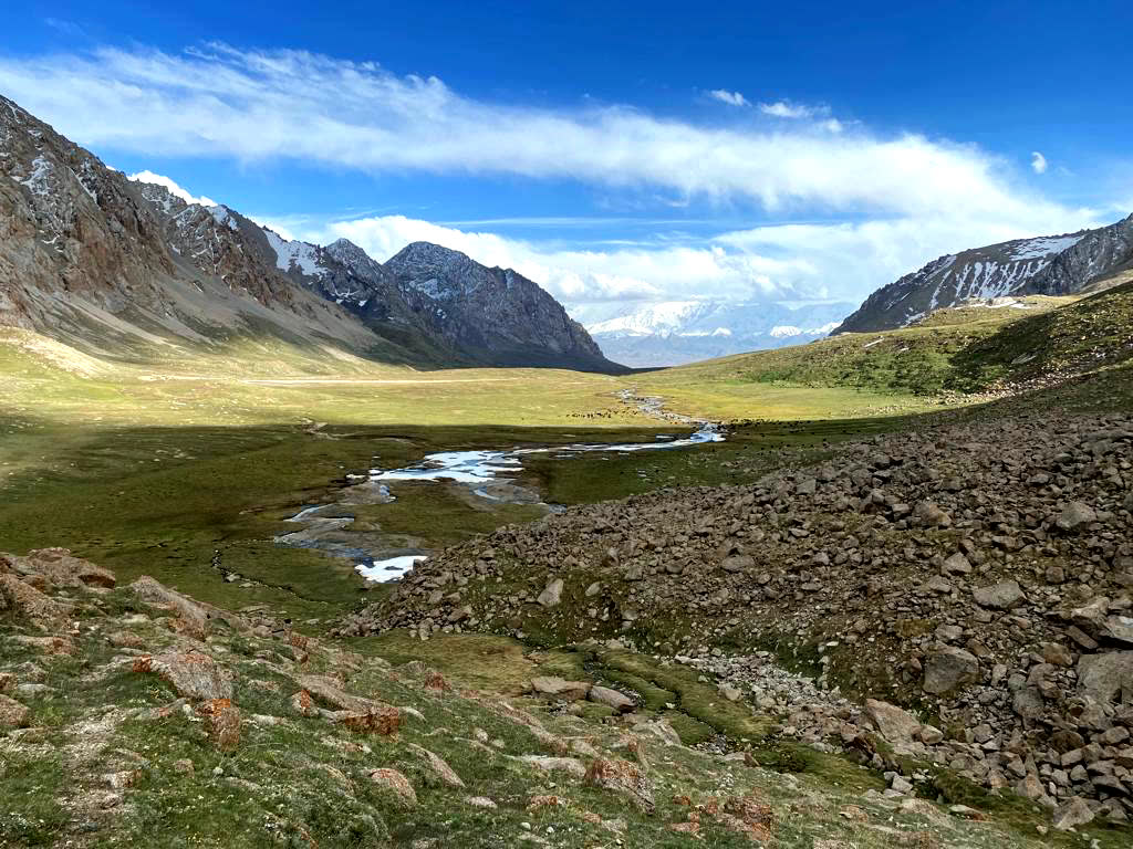
Day8.Sary-Mogol-Tulpar-Kol
After breakfast, Our driver takes you to yurt camp (25km, 1hour driving). Start walking from
Tulpar Kol yurt camp, leave the heavy bags in yurt
This walk-up to the Travellers’ Pass of Lenin Peak or just until the best view of onion glade, it offers
a challenging yet rewarding adventure through some of the most spectacular mountain scenery in
Central Asia. Make sure to pack appropriately, including sturdy hiking boots, warm clothing, and
lunch-box for the journey
Begin the Trek: Once acclimatized, start your trek towards the Travelers’ Pass. The trail winds its
way through rugged terrain, passing by glacial streams, rocky slopes, and alpine meadows. It
started from Tulpar-Kol and time of reaching is 7 hours (go and back) the altitude is 4120m and
the distance is approximately 14km in total hiking way.
Enjoy the Views: Take some time to rest and soak in the breathtaking scenery from the pass.
Capture photos, enjoy a snack, and reflect on the incredible journey you’ve undertaken.
Day9. Tulpar-Kol-Osh.
This route not only provides a practical connection between the remote mountain
village of Sary-Mogol and Osh but also offers a journey filled with spectacular
scenery and cultural experiences along the way
Route Overview
Distance: ~245 km
Duration: 5 hours by car
Road Conditions: from Tulpar-Kol until Sary-Mogol is gravel, onward 220km is
paved road.
Elevation: Starts at ~3,500 meters in Tulpar-Kol, descending to ~900 meters in
Osh
| Number of person | Number of horse guides to accompany tourists | Price per group |
| 2 | 1 | 1800$ |
| 3 | 1 | 2300$ |
| 4 | 2 | 3420$ |
| 5 | 2 | 3930$ |
| 6 | 2 | 4670$ |
| 7 | 2 | 5180$ |
| 8 | 2 | 5680$ |
| 9 | 2 | 6210$ |
| 10 | 2 | 6700$ |
Included: In the price 10 nights (two nights in Osh and 8 nights in tours
(yurts, guesthouses, tents and meals three times a day (breakfast, lunch
and dinner), horses for riding and horse guides and Transfer from Osh to
Osh
Not included: Pack horses for large bags.Location:
Sary Mogol, village of Alaysky district, teacher 37
Contact us:
+996 556 092 627
