
Day1. Sary-Mogol town via Sary-Mogol pass to yurt camp
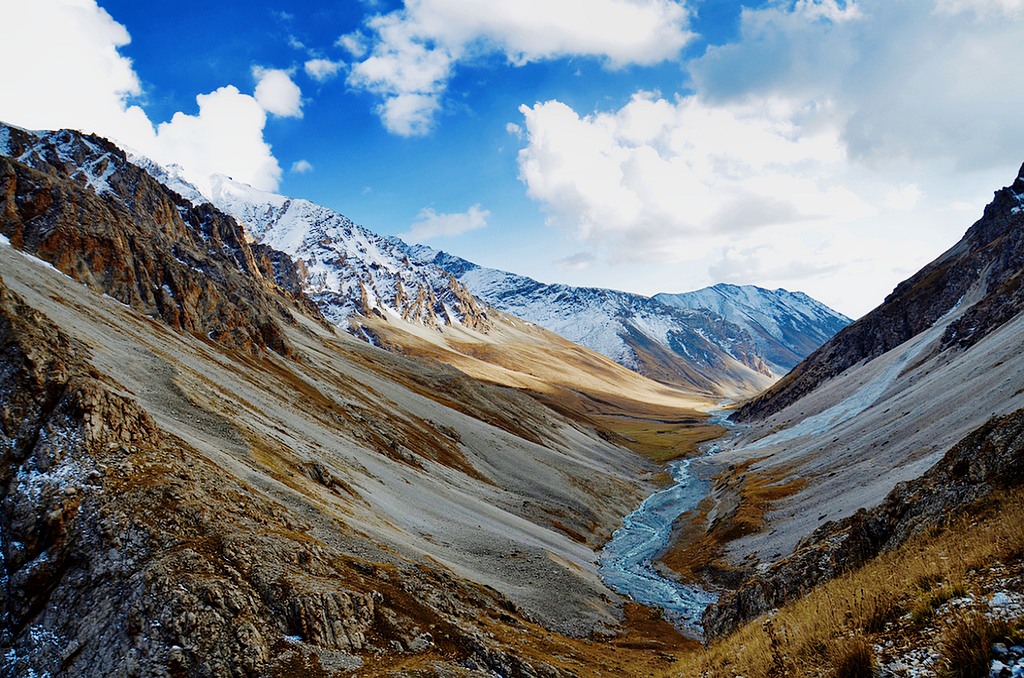
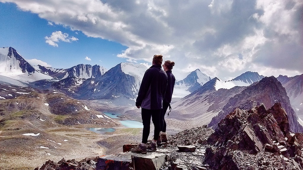
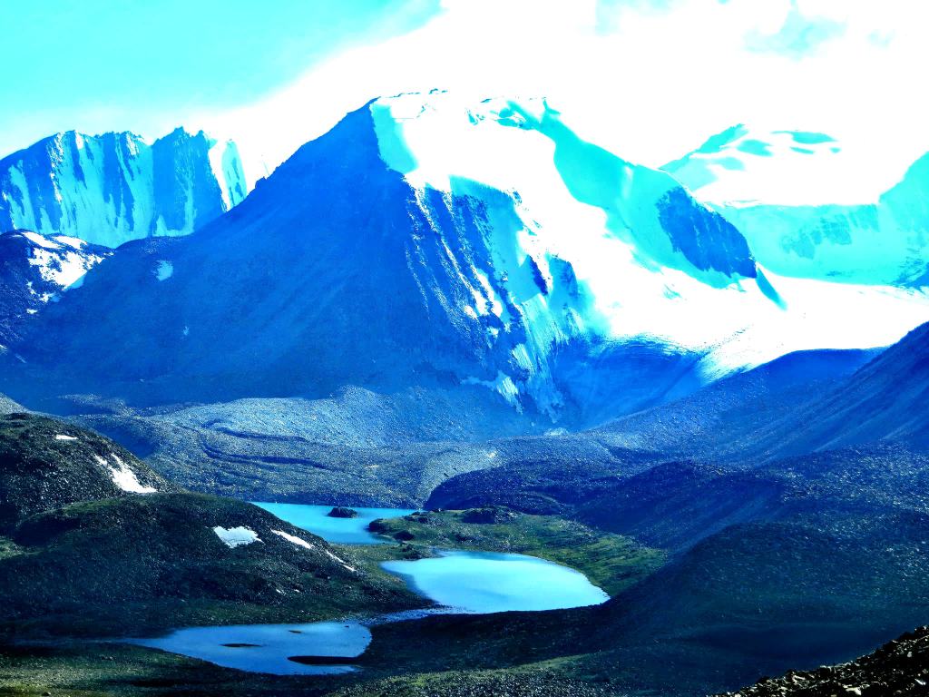
Today we continue our trekking in north range of Allay valley (Trans-Alay). From Sary-Mogol to trailhead we go by car (1h) then trekking starts it is going to be bit taught trek because we go up to the pass called Sary-Mogol pass (4270 meters) and Besh-Kol lake. Our daily route takes for 6-8 hours of walking up in rocky path. At the top of the pass we enjoy the stunning scenery of Besh-Kol lakes. Then keeping the way to other side until the yurt camp.
- Approximate trekking distance: 14km, 8.70 miles
- Time of hiking: excluding driving 14km 6hours
- Ascent/Descent: 910/790 meters
- Highest and lowest points: 4270/3380 meters
- Accommodation altitude: 3382.00 Meters | 11095.80 Feet
- Connection: No electricity, internet and signal (power bank is recommended)
Despite the lack of roads, local families Orozgul and her daughter Aigul set up yurts for overnight stays (shared living) with flush toilet to make travelers more comfortable as they did not have to carry a lot of things.
Day2. Walking to Koshmoinok (6hours)
Head east following the river and slightly descending to the end of the beautiful mountain gorge. Enjoy grandiose views of the Kichik Alay or Trans Alay mountain range, at first we cross a small village under Sary-Mogol further direction of travel turns to the right on the dirty auto road after 2-3 hours we reach a small village Kyzyl-Chara and stop here for lunch in home stay or at a cafes on the way, then forward go on to yurt camp in Koshmoinok.
- Approximate trekking distance: 18km (11.18miles)
- Hiking time: 7h (excluding lunch and break time)
- Ascent/Descent: 830/1460 meters
- Highest and lowest points: 3467 /2467meters
- Accommodation altitude 2822.00 Meters | 9258.53 Feet
- Connection: No electricity, internet and signal (power bank is recommended)
Despite the lack of roads, local family from Kyzyl-Shoro village (name of owner is Begali and Nurdoolot) installed solar (water) heater shower and water running toilet. There 2 share yurts and a hut for eating.
Day3. Koshmoinok to Kojo-Kelen village (6hours)
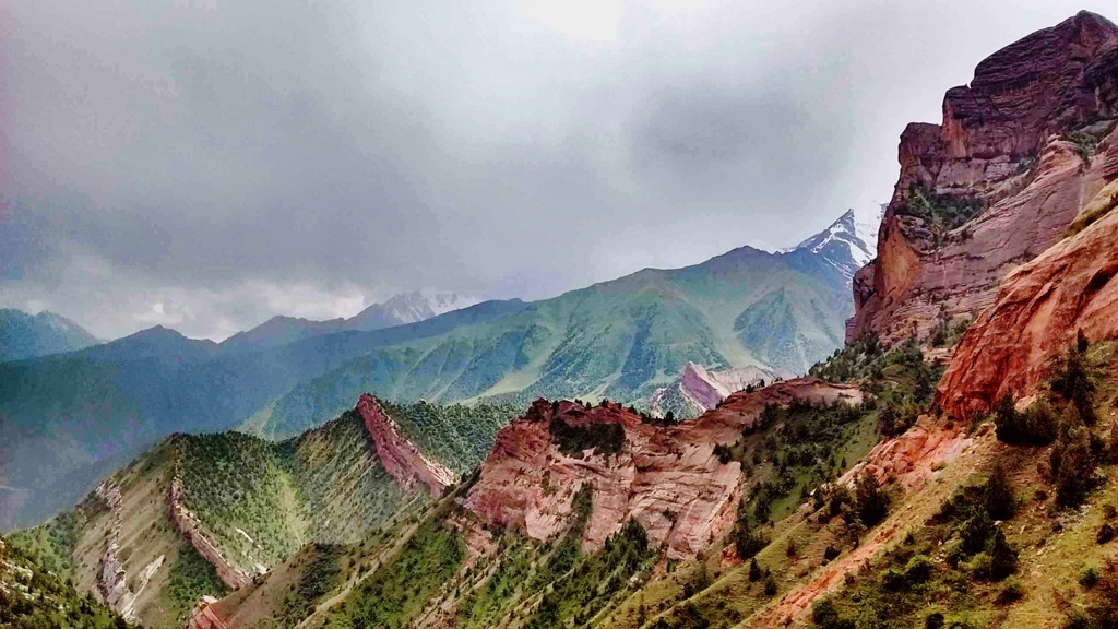
We will begin along the way, enjoy panoramic views of Sary-Bel (3150m) pass and untouched nature, with the sound of birds and rushing rivers as your companions. This scenic trail leads you to the picturesque village of Kojo-Kelen, renowned for its red rock formations and authentic charm.
Evening Experience in Kojo-Kelen:
Upon arrival, settle into a cozy homestay where you’ll be welcomed with warm Kyrgyz hospitality. Before dinner, take a short walk to discover two local gems:
Waterfall: A hidden cascade that offers a refreshing ambiance, perfect for relaxation and photography.
Blue Cave Pool: A magical spot where the turquoise water glows inside a natural cave—ideal for a quick dip or simply admiring its beauty.
End your evening with a stroll around the village, immersing yourself in the peaceful rural lifestyle, before enjoying a hearty dinner featuring local dishes.
- Approximate trekking distance: 10km (6.50miles)
- Hiking time: 6h (excluding lunch and break time)
- Ascent/Descent: 340/960 meters
- Highest and lowest points: 3127 /2230meters
- Accommodation altitude 2230.00 Meters | 7316.27 Feet
- Accommodation type: local homestay, share rooms in the traditional floor blankets with hot shower and flush toilet.
- Connection: there is electricity and Wi-Fi
Day4. Kojo-Kelen – Return to Osh (95 km, 3-hour drive)
- Scenic Drive Back: Depart in the morning for Osh via a dirt but incredibly scenic road. Along the way, enjoy:
- Papan Reservoir – A perfect stop for photos of the turquoise waters against a backdrop of mountains.
- Traditional Kyrgyz Villages – Observe daily rural life and experience the charm of remote mountain settlements.
- Arrival in Osh: End of the tour, with an optional visit to Sulaiman-Too Mountain and city excursion
