
Day1. Osh-Karakoi
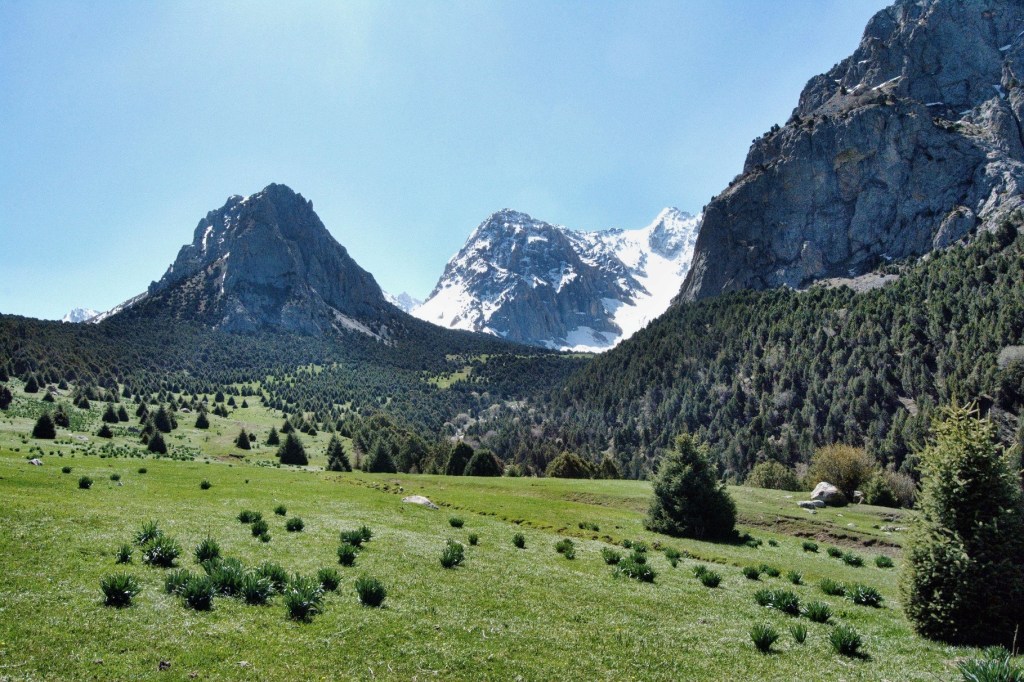
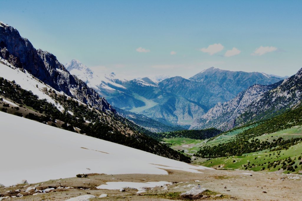
Morning departure from Osh on the P-152 highway. After 70 km, passing through rural and urban areas, you will arrive at the Kara-Koy National Park. The park is located in one of the most beautiful corners of Kyrgyzstan, offering not only stunning views but also a variety of ecosystems.
Kara-Koy National Park is an important natural area known for its rich flora and fauna. It is a place where rare species of plants and animals have been preserved, and it attracts nature lovers and ecotourism.
Park features:
The park is located in a mountainous area, which means that its entire landscape is high peaks, deep gorges, alpine meadows and dense forests. The park offers magnificent views of the surrounding mountains, and rare species of animals and plants can be seen throughout the park. Once you reach the national park, you leave your heavy luggage in the yurt, then the smooth path to the Kumbel pass (3860m) will be a walking tour, where you will have a magnificent panoramic view of the incredible gorge, along the way you will get acquainted with the trekking routes through Kumbel to another area (Kojo-kelen and further Alay Valley), reaching the maximum point, then return to the yurt camp of Anipa and stay in the yurts of the local service provider.
This is a great place to relax, enjoy the clean air, immerse yourself in the atmosphere of wild nature and admire the sky strewn with stars.
- Starting Point: From Osh
- Ending Point: Kara-Koi (yurt camp)
- Level: Easy
- Total distance: 84 km, 52 miles
- Hiking distance: 14 km round trip, 8.70 miles (4hours hiking)
- Driving distance: 70km 43 miles (until Yurt camp)
- Hiking accent and descent: 2560/3140 meters
- Highest and lowest points (hiking): 3850 /2560meters
- Accommodation type: yurt camp (twin beds)
- Accommodation altitude: 2560 m (above sea level)
- Connection: There is signal, electricity and Wi-Fi is available
Day2. Kara-Koy to Kojo-Kelen
Breakfast at 7:00 AM. Afterward, depart from the yurt camp by car, traveling through several picturesque mountain villages. The journey continues into a stunning gorge, where towering rock formations rise dramatically on either side. From there, the route follows a scenic dirt road leading to the charming village of Kozho-Kelen.
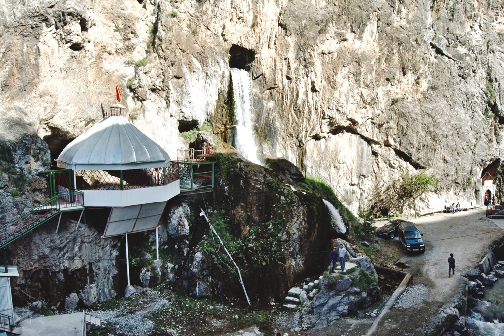
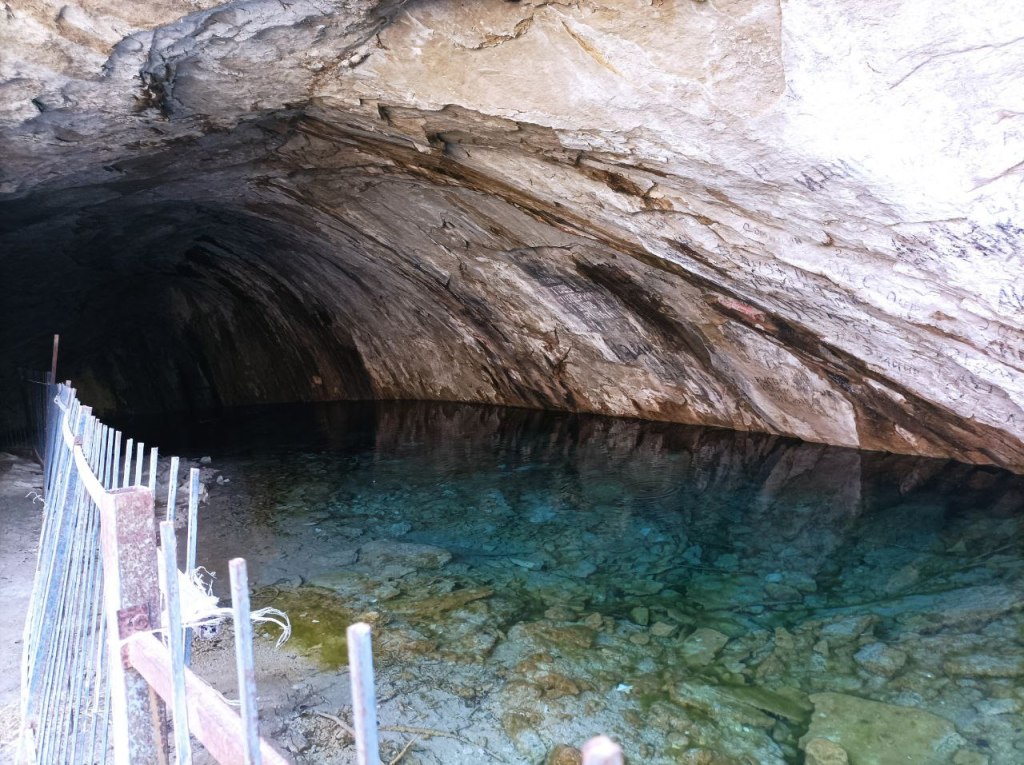
Upon arrival, enjoy a delicious lunch at a local guesthouse. After lunch, embark on a walk to explore the area’s natural wonders, including a serene waterfall and a unique cave pool nestled beneath the rocks. Conclude the day by taking in the breathtaking landscapes of the village (ayil), immersing yourself in its tranquil beauty and local charm.
- Total distance: 104 km, 65 miles
- Level: Easy
- Hiking distance: 12 km round trip, 7 miles (2hours hiking)
- Driving distance: 92km 43 miles (until Yurt camp)
- Accent and Descent: 2560/3140 meters
- Highest and lowest points (hiking): 2420 /2170meters
- Accommodation type: homestay (share beds)
- Accommodation altitude: 2200 m (above sea level) Connection: There is signal, electricity and Wi-Fi is available
Day3. Kojo-Kelen to Alpine hotel in Alay valley.
Today is packed with exciting activities, including short walks, stunning scenic views, and adventurous long drives.
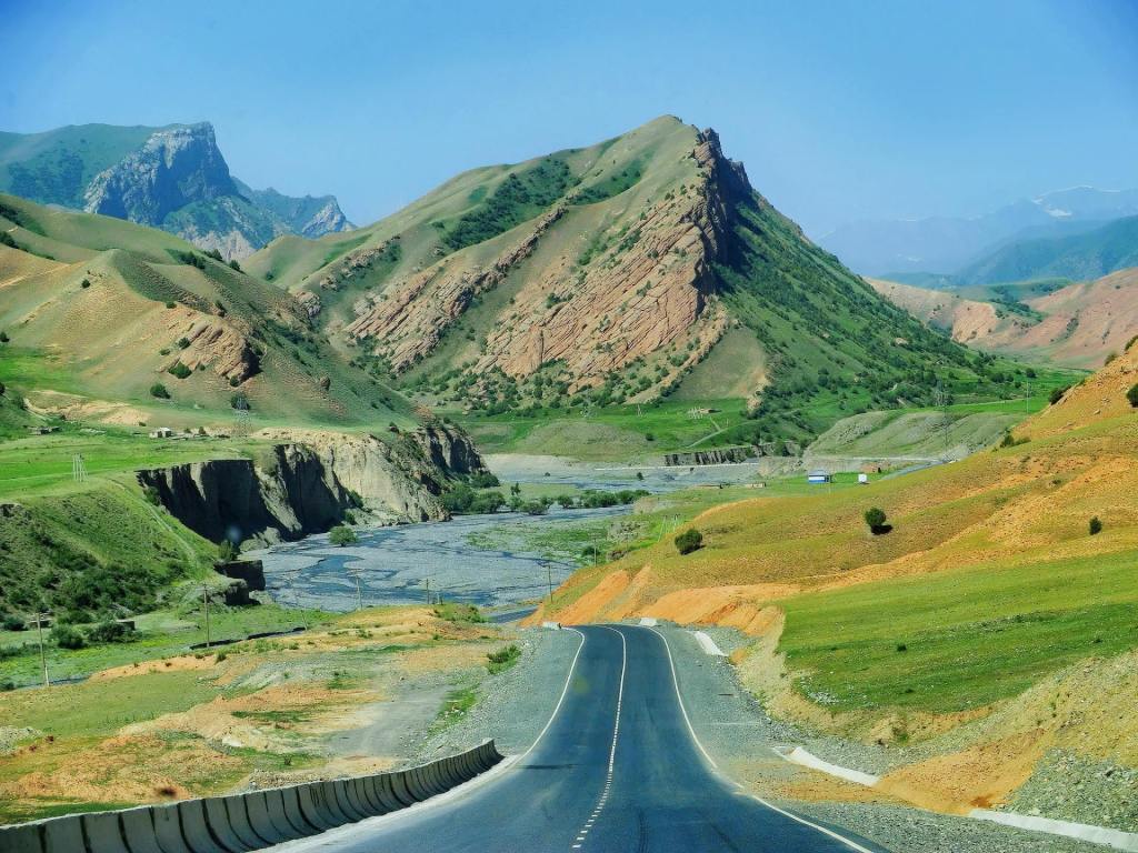
We begin by departing Kojo-Kelen along a country road leading to the Papan Reservoir. From there, the route takes us through picturesque hills until we reach Mady village. The journey includes a stretch of dirt road (80 km), followed by driving on asphalt to our first stop at the Gulcho Museum.
After exploring the museum, we continue to the beautiful Bulolu Gorge, where we’ll enjoy a delicious lunch. Following lunch, take an easy hike to a scenic viewpoint overlooking nearby villages then drive toward the Kolduk Lakes and we’ll walk around a couple of serene lakes, taking in their tranquil beauty.
The adventure continues as we ascend the Taldyk Pass, located at an impressive altitude of 3,615 meters. The pass is renowned for its steep, serpentine structure, offering spectacular views along the way. After descending from the pass, our accommodation for the night—a cozy hotel—will come into view, providing the perfect end to an eventful day.
- Total distance: 280 km, 168 miles
- Level: Easy
- Hiking distance: 10 km total trip, 6 miles (2hours hiking)
- Driving distance: 270km (95km unpaved and 180 paved)
- Accent and Descent: 5570/4350 meters
- Highest and lowest points: 3610 /1070meters
- Accommodation type: mountain hotel
- Accommodation altitude: 3460 m (above sea level)
- Connection: There is no signal, solar electricity and Wi-Fi is available
Day4. Drive to trekking trail then walk up to Peak Panorama and descend to Tulpar-Kol
After breakfast, we set off to enjoy the breathtaking views of the Pamir Mountains. Along the way, you’ll witness the stunning panorama of snow-capped giant peaks as we descend into the village of Sary-Tash. From here, you’ll glimpse the road leading to China, just 75 km away, as well as the route to the Pamirs, with the Kyzyl-Art border located only 50 km from this point.
Continuing to the right, we head toward the Alai Valley, a region of exceptional beauty. After approximately 50 km of travel, we arrive at the majestic Alai Mountains, home to the iconic Lenin Peak. Upon reaching the foot of the mountain, our guide will accompany you to the incredible viewpoint known as Tulpar-Köl Panorama Peak, offering unparalleled views of the surrounding landscapes.
Pik Panorama is a stunning viewpoint of Tulpar-Kol lake, offering a breathtaking panoramic view of Lenin Peak, the Alay Valley, and the series of glacial lakes collectively known as the «40 Lakes.» Reaching this point is a challenging yet rewarding hike, making it a highlight for experienced trekkers and photographers.
Elevation: Approximately 4,000 meters
The trail offers breathtaking panoramic views of the Alai Valley and surrounding peaks, making it a perfect spot for photos and moments of reflection in the serene high-altitude environment. After soaking in the stunning scenery, descent to the yurt camp.
- Total distance: 71km, (44miles )
- Driving distance: 65km (40miles)
- Hiking distance and time: 6km, 6 hours (excluding lunch and break time)
- Ascent/Descent of hiking: 738/640 meters
- Highest and lowest points of hiking: 4100/3400 meters
- Level: Moderate to challenging (where is walking up to top)
- Accommodation altitude: 3500.00 Meters | 11482.94 Feet
- Accommodation type: yurt camp (twin, double and single beds in yurts are available) solar water heater shower, water running western toilets,
Connection: there is solar electricity for phone charge, signal (megacom, beeline, O) and Wi-Fi in 5G
Easy and short option: - If you’re tired from previous hikes, you can simply walk along the lakeside with below path to Tulpar-Kol
Day5. Hiking to see the eternally snow-capped giant mountains then return to Osh.
After breakfast, you need to pack your things and immediately set out on a hike to see the second highest peak in Central Asia and an easy (no technical skills required) summit among the world’s seven-thousanders.
- Distance: ~6 km round trip
- Duration: 2–3 hours
- Difficulty: Easy to moderate
Description:
This is one of the most popular short hikes in the region. Starting from Tulpar-Kol, the trail ascends gradually to the Lenin Peak Base Camp at 3,600 meters or by time and availability of walks, the guide will take you to an incredible view where the path will take you along the left bank of the river.
You’ll enjoy panoramic views of the glacier and the massive Lenin Peak. The area around the base camp is bustling with climbers during the summer.
