Start with us on an unforgettable journey through the stunning landscapes of Kyrgyzstan, a country renowned for its breathtaking natural beauty, rich culture and warm hospitality. This adventure tour will take you through some of the most iconic destinations, showcasing the country’s highlights from the northern of Kyrgyzstan to the southern city of Osh. This carefully crafted itinerary offers the perfect combination of scenic drives, cultural experiences and outdoor activities.
If you will be from 1-4 person we arrange by jeep or a larger group it is provided by minibus (5-15) and the tour is designed to be flexible and adaptable to your preferences.
With a mix of daily commutes and opportunities for hiking and exploration, this tour is the perfect way to discover Kyrgyzstan’s hidden gems.
The Highlights of Kyrgyzstan:
| Destination | Bishkek | Cholpon-Ata | Karakol |Bokonbaevo | Song-Kol | Kazarman | Jalal-Abad | Arslanbap | Sary-Mogol | Tulpar-Kol | Tuyuk | Osh |
|---|---|
| Depature | Yes Required |
| Departure Time | Contact us for more information |
| Return Time | Contact us for more information |
| Included |
|
| Excluded | |
 |
|
Price
| Number of tourists | 2 | 3 | 4 |
|---|---|---|---|
| Price in USD Dollar for the group | $3850 | $4990 | $6040 |
Overview of the route:
Arrival at Manas International Airport: (30km 30min).
Meeting at the airport, transfer to the hotel and rest after long flights.
Bishkek, the capital city of Kyrgyzstan, serves as the cultural, economic, and political heart of the nation. Nestled at the foothills of the Tian Shan Mountains, it combines Soviet-era architecture, bustling bazaars, and green parks with a backdrop of stunning peaks if you prefer to see something in Bishkek, we recommend to visit Ala-Too Square This is the central square of the city, ideal for getting to know Kyrgyz culture and history. Here is the State Historical Museum (you can visit it) and a giant Kyrgyz flag, guarded by soldiers in full dress uniform.
The place where national holidays, festivals and evening fountain shows are held.
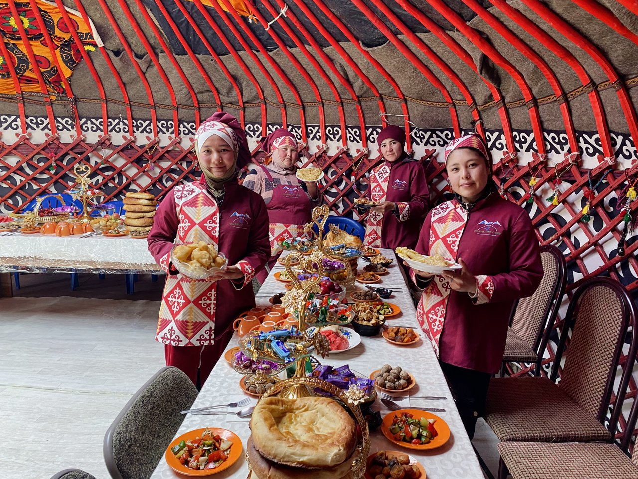
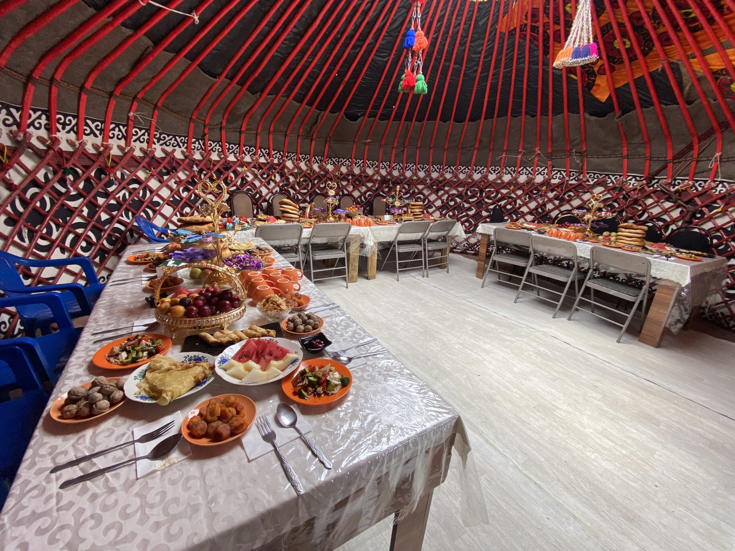
In the evening, enjoy Kyrgyz cuisine, the popular national food are below:
Beshbarmak: A traditional noodle dish with meat and broth.
Manty: Steamed dumplings filled with meat or vegetables.
Plov: A flavorful rice dish cooked with meat and spices.
Shorpo: A hearty meat soup.
Shashlik: Skewered and grilled meat, similar to kebabs.
Samsa: Flaky pastries filled with meat or vegetables.
These dishes are best enjoyed at local restaurants or cafes that specialize in authentic Kyrgyz flavors.
After leaving Bishkek in about 1.30 hour you can start first visit from an ancient tower Burana which is belong to 11th century then away heading to Cholpon-Ata (resort town) on the northern shore of Lake Issyk-Kol.(second alpine lake in the world).
Visit the petroglyphs at Cholpon-Ata, which date back thousands of years.
Enjoy a leisurely walk along the beach and swimming in the pools or boat ride on Issyk-Kul Lake.
Total distance: 285 km, 177 miles.
Level: Easy.
Hiking: 1 hour.
Driving distance: 285km 177 miles.
Accent and Descent: 2090/1200 meters.
Highest and lowest points: 1660 /730meters.
Accommodation type: hotel.
Accommodation altitude: 1650.00 Meters | 5413.39 Feet (above sea level).
Connection: There is signal, electricity and Wi-Fi is available.
Drive to Przhevalsky Dedicated to Nikolay Przhevalsky, an explorer who mapped much of Central Asia.
• A unique mosque built entirely of wood, without the use of nails. Сombines Chinese and Islamic architectural styles. Constructed in 1910 by the local Dungan community, an ethnic group of Chinese Muslims.
Other walking through the city center and soak up the local atmosphere. Check into your accommodation. Enjoy a traditional Kyrgyz meal at a local restaurant.
Total distance: 150 km, 93 miles.
Level: Easy.
Hiking: 2 hours.
Accent and Descent: 870/770 meters.
Highest and lowest points: 1770 /1610meters.
Accommodation type: guesthouse.
Accommodation altitude: 1750.00 Meters | 5741.47 Feet (above sea level).
Connection: There is signal, electricity and Wi-Fi is available.
After breakfast in Karakol, drive along the southern shore of Issyk-Kul Lake toward Bokonbaevo. On the way, stop at Jeti-Oguz (“Seven Bulls”), a famous red sandstone rock formation surrounded by forested slopes. You can take a short walk to enjoy the panoramic view and learn about the local legends connected to the rocks.
Continue driving west and make another stop at Skazka Canyon (“Fairy Tale Canyon”). Here you will walk among colorful sandstone formations shaped by wind and erosion, resembling castles, animals, and fantastic figures. A short hike inside the canyon offers beautiful views of Issyk-Kul Lake. After the visit, continue to Bokonbaevo village.
Total distance: 160 km, 99 miles.
Level: Easy.
Drive: 4 h / Hiking: 3 hours.
Accent and Descent: 1240/1170 meters.
Highest and lowest points: 2080 /1610meters.
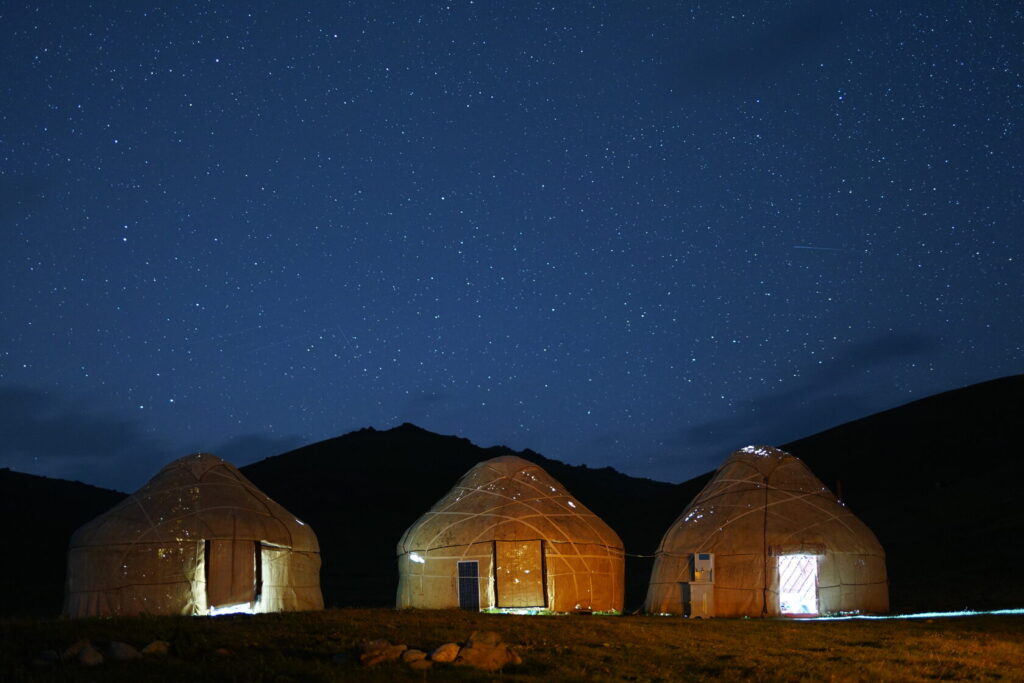
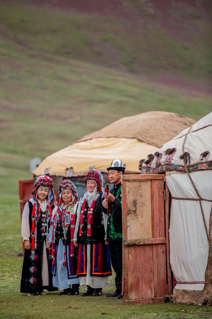
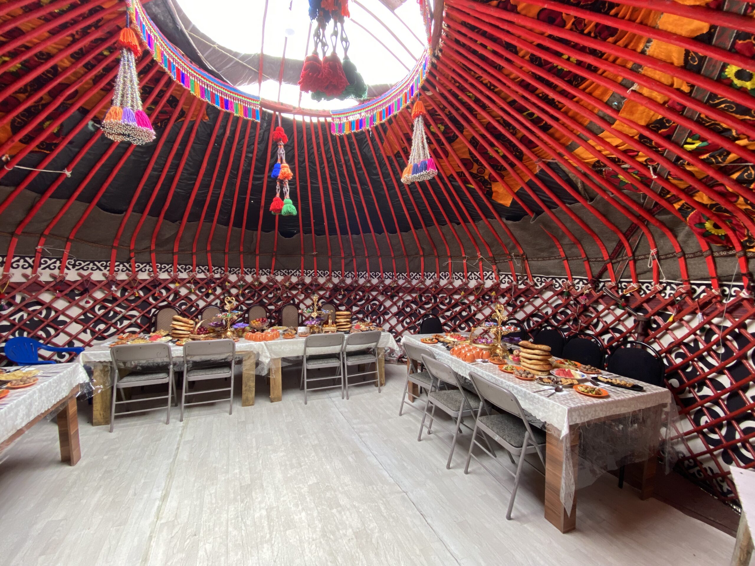
Accommodation type: yurt camp.
Accommodation altitude: 1830 Meters | 6000 Feet (above sea level).
Connection: There is signal, electricity and Wi-Fi is available.
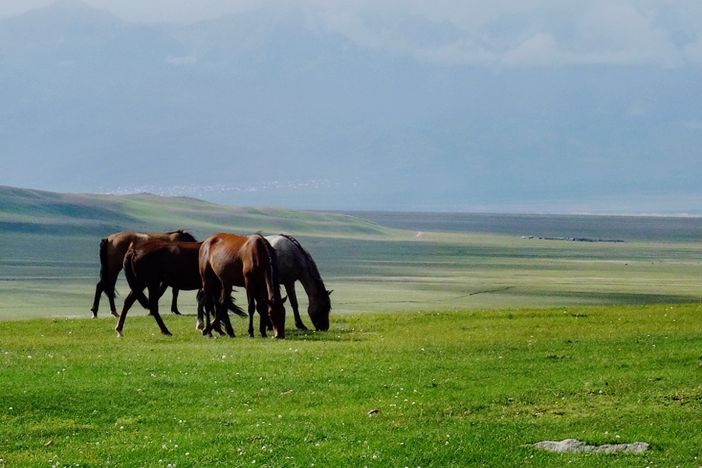
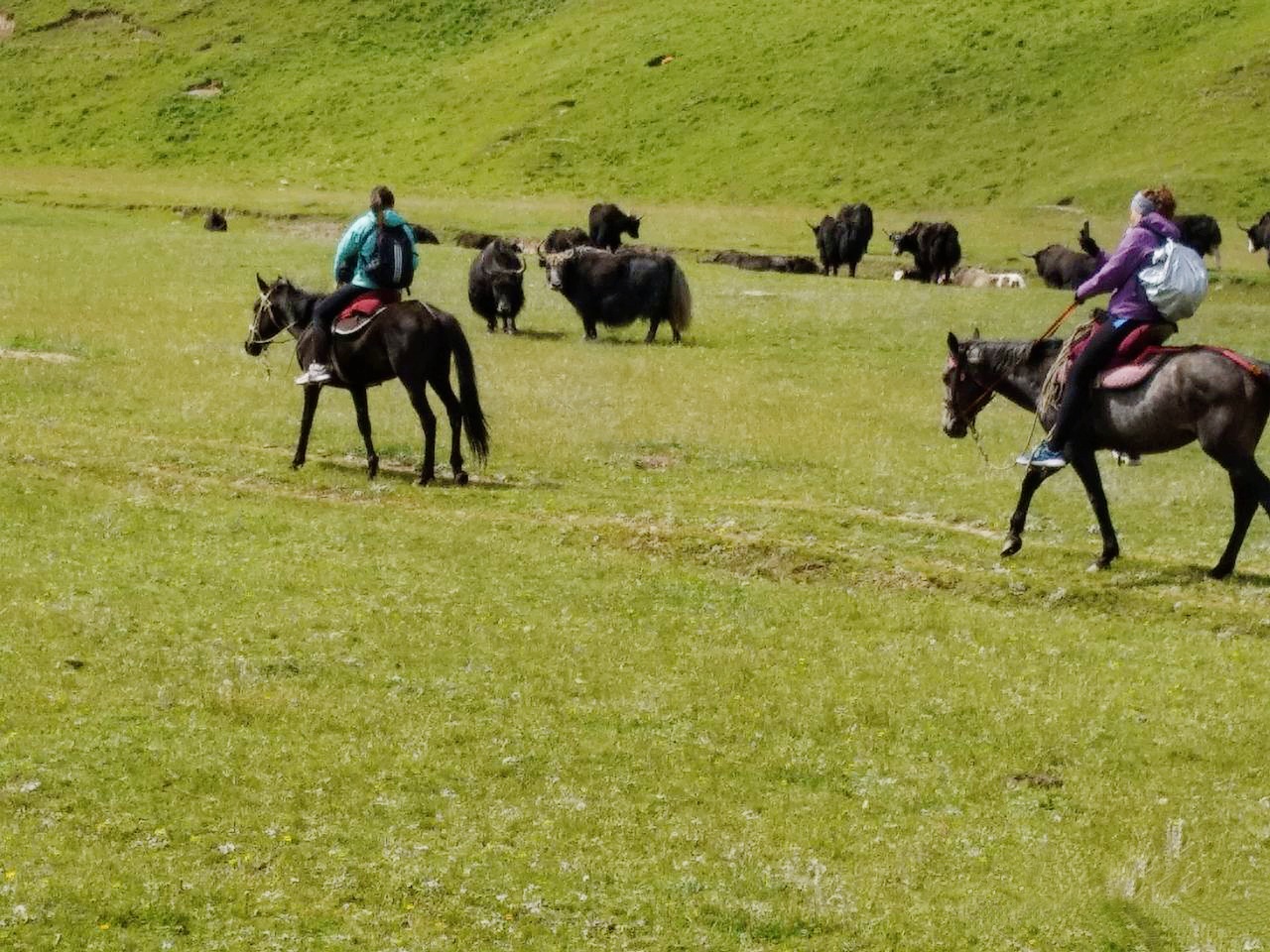
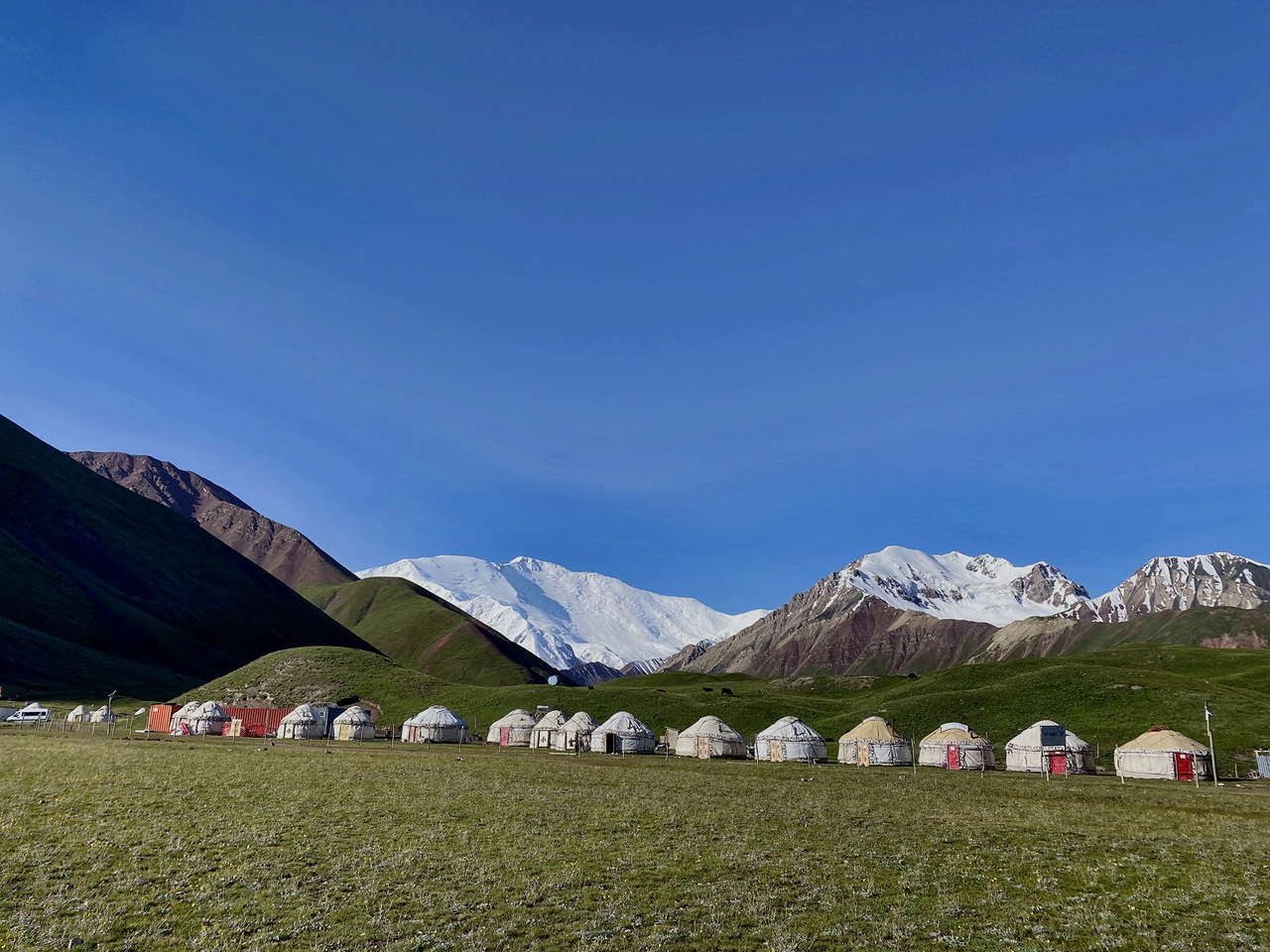
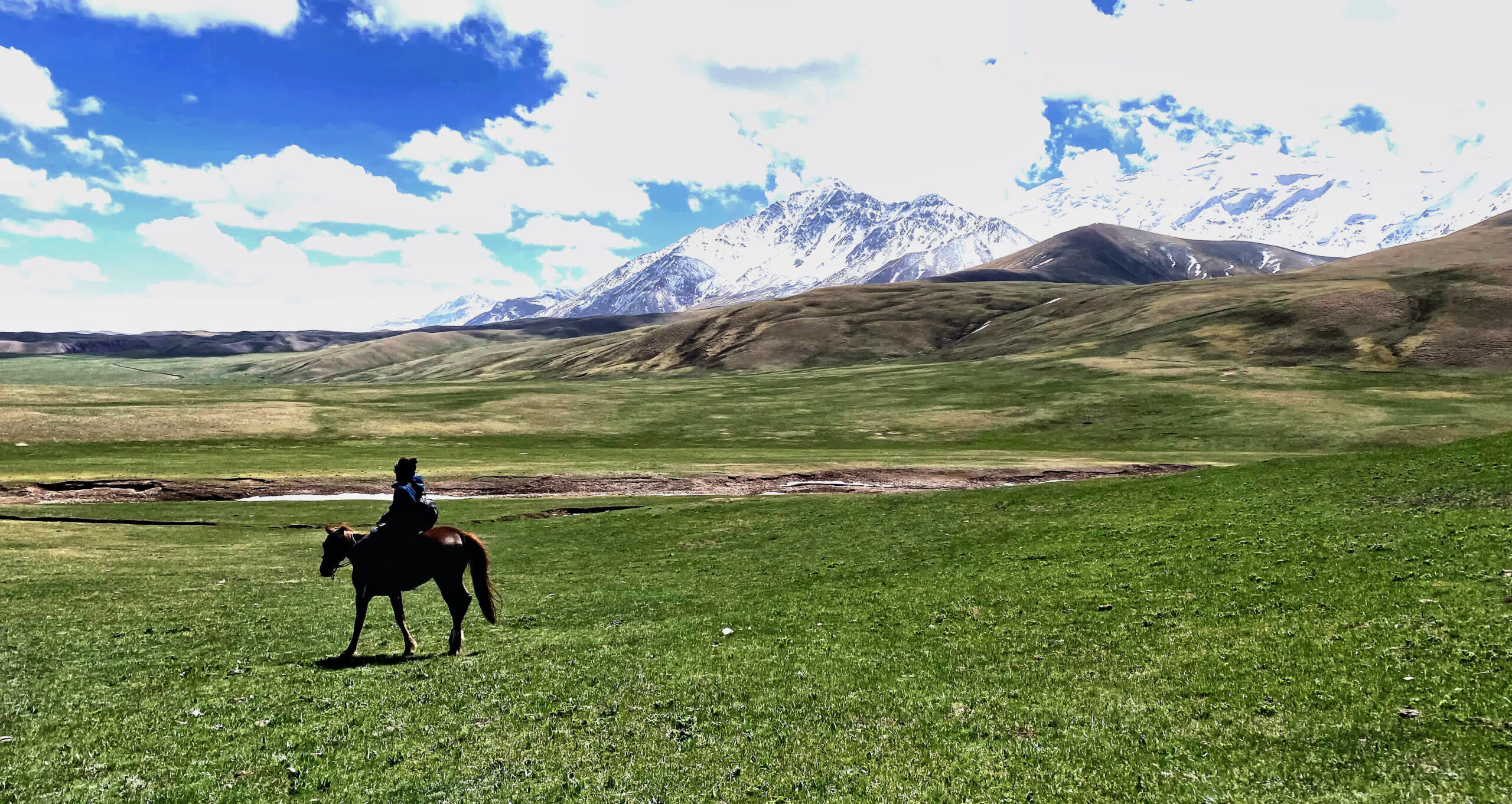
Drive to Song Kul Lake, which is situated at an altitude of approximately 3,016 meters (9,895 feet). Enjoy the scenic drive through the mountains, passing by picturesque valleys and yurt-dotted landscapes. Arrive at Song Kul Lake and check into a yurt camp for a genuine nomadic experience. Take a horseback ride or hike in the nearby hills, which offer panoramic views of the lake and the surrounding mountain ranges. Enjoy the serenity of the area, take photographs, and immerse yourself in the traditional nomadic culture.
Total distance: 200 km, 124 miles.
Level: moderate (altitude location).
Driving: 4-5 hours /2-3h hiking.
Accent and Descent: 2800/1590 meters.
Highest and lowest points: 3450 /1610meters.
Accommodation type: yurt camp.
Accommodation altitude: 3450.00 Meters | 11318.9 Feet (above sea level).
Connection: There is no signal, no connection.
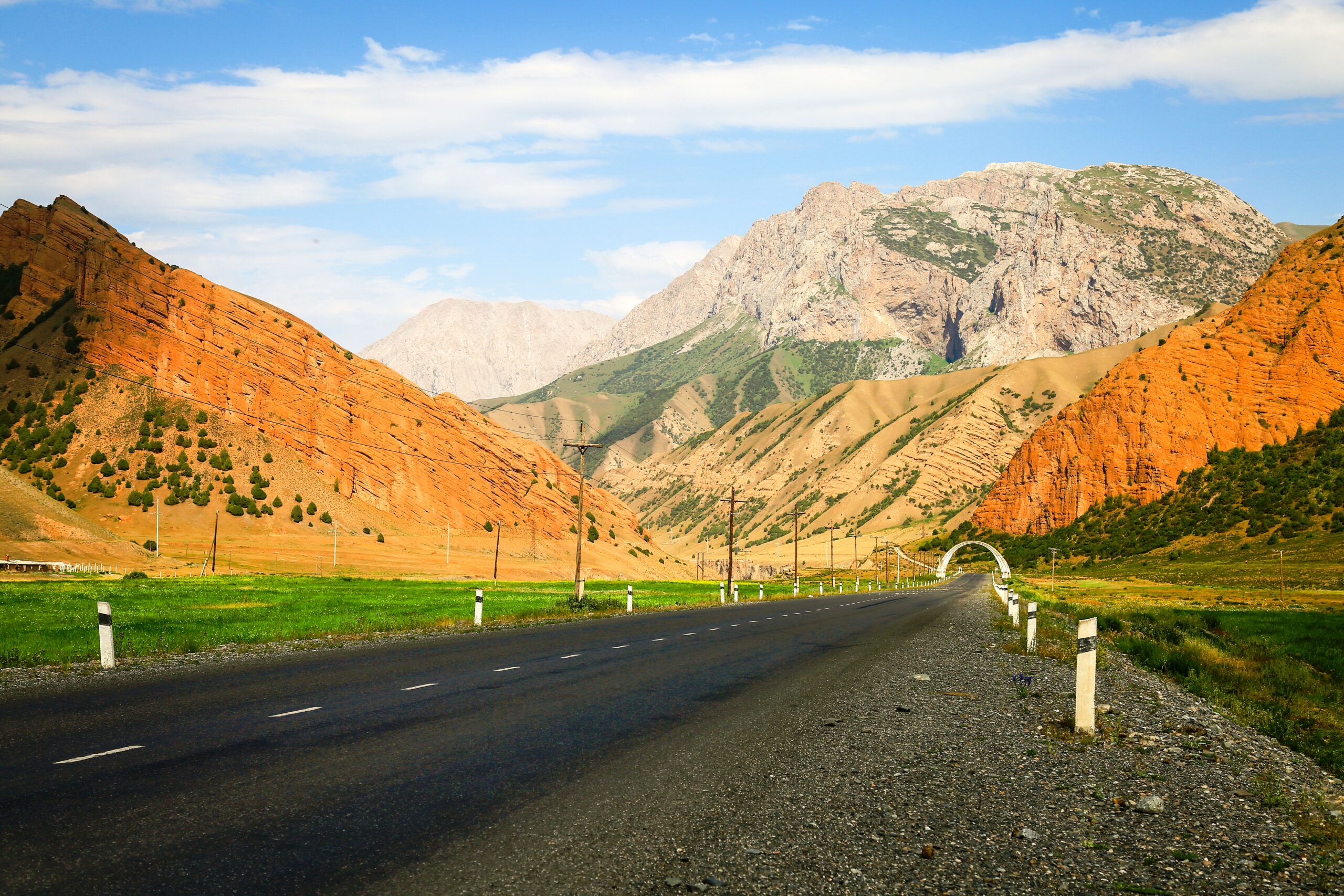
Continue your journey from yurt camp to Kazarman, which will take you through remote mountain roads. The drive may be challenging, but it offers breathtaking views of the Kyrgyz countryside. Arrive in Kazarman and settle into your accommodation for the night.
Brief information on the road:
The road from Issyk-Kul through Kazarman to Jalal-Abad is a new alternative road it is being built on standard condition between the north and south of Kyrgyzstan. 80% of the road is already covered with asphalt, the remaining sections of the road will be completed in the near future.
Total distance: 200 km, 124 miles.
Level: moderate (altitude location).
Hiking: 2-4 hours.
Accent and Descent: 3090/4930 meters.
Highest and lowest points: 3387 /1265meters.
Accommodation type: yurt camp.
Accommodation altitude: 1270.00 Meters | 4166.67 Feet (above sea level).
Connection: There is signal, Wi-Fi in the guesthouse.
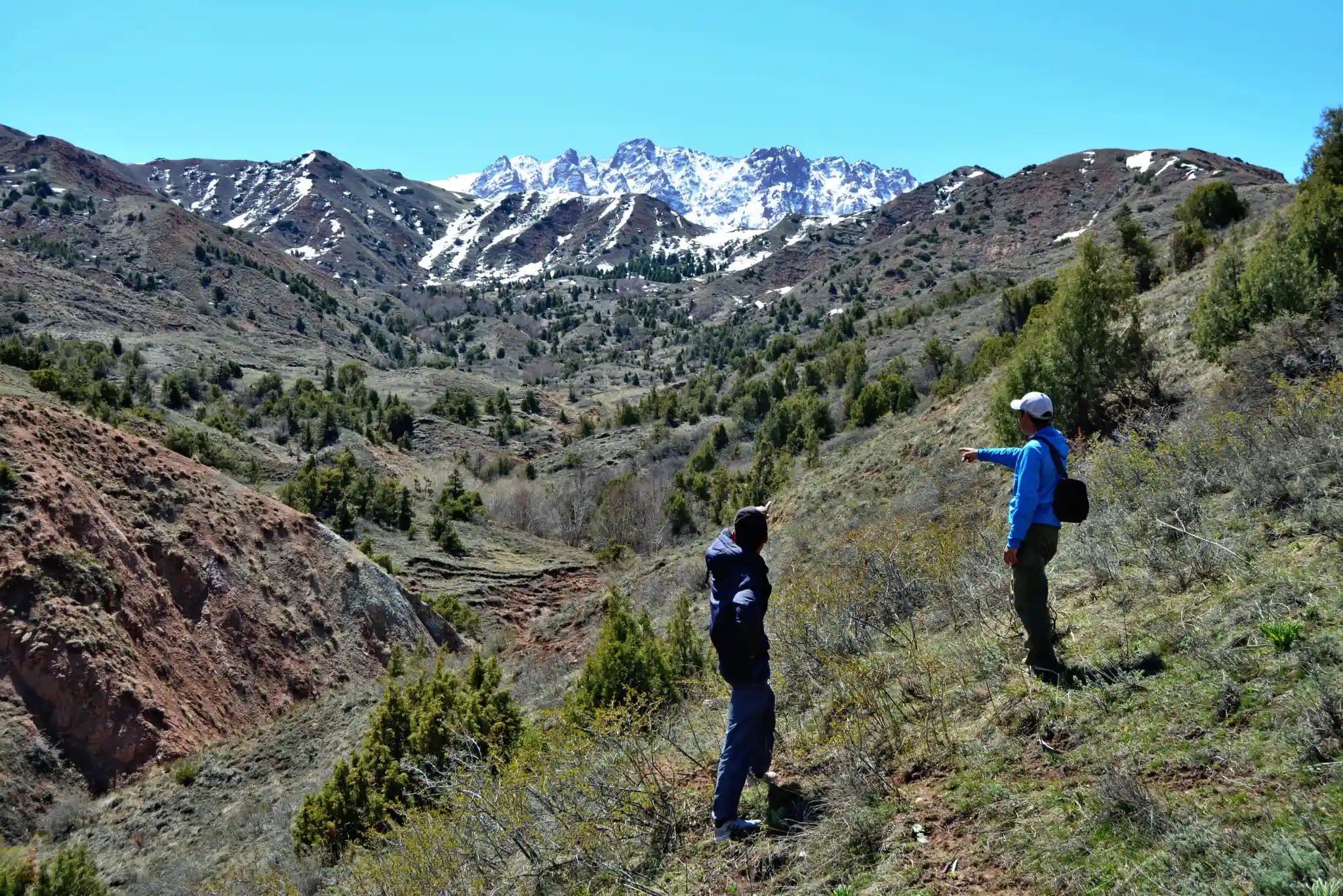
From Kazarman to Arstanbap will provide you with a unique and off-the-beaten-path adventure, offering an opportunity to experience the rugged beauty of Kyrgyzstan's landscapes and the warmth of its local communities.
Arslanbob is famous for having one of the world's largest walnut forests, covering thousands of hectares. The village's economy is heavily dependent on walnut production, and visitors can explore the lush forests and see how the walnuts are harvested and processed.
The village has a diverse population, with both Kyrgyz and Uzbek residents, which creates a unique cultural atmosphere. You can engage with locals, learn about their customs, and experience Kyrgyz and Uzbek traditions.
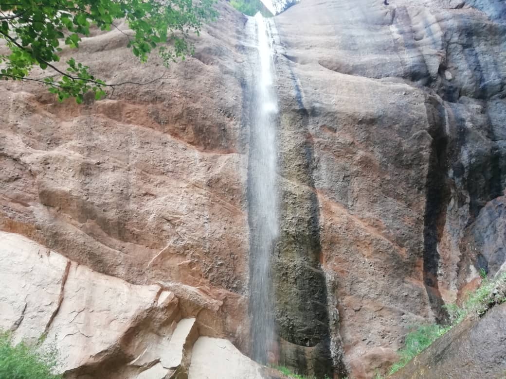
Afternoon hiking to big (85m) and small (35m) waterfalls and market.
Total distance: 230 km, 143 miles.
Level: easy.
Hiking: 2-4 hours.
Accent and Descent: 4000/3780 meters.
Highest and lowest points: 2980 /745meters.
Accommodation type: guesthouse.
Accommodation altitude: 1500.00 Meters | 4921.26 Feet (above sea level).
Village altitude from 1300 to 1700m due to mountain location.
Connection: There is signal, Wi-Fi in the guesthouse.
After breakfast. Continue driving to Uzgen minaret (The Uzgen Minaret is believed to have been constructed in the 11th century during the Karakhanid dynasty's rule. The Karakhanids were a Turkic Muslim dynasty that played a significant role in Central Asian history.) and heading away to Osh arrive at café for lunch then drive to Sary-Mogol.
Total distance: 385 km, 239.228 miles.
Level: moderate.
Accent and Descent: 5048 м/3555 meters.
Highest and lowest points: 3560/960 meters.
Accommodation type: hotel.
Accommodation altitude: 2970 m (above sea level).
Connection: There is signal, Wi-Fi in the hotel.
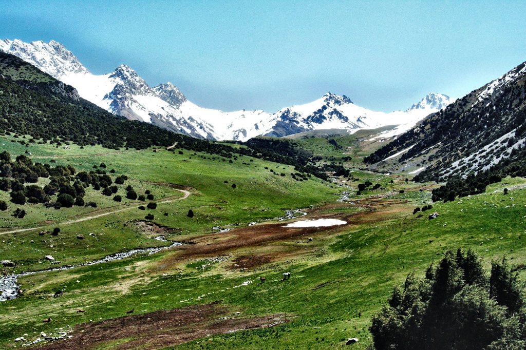
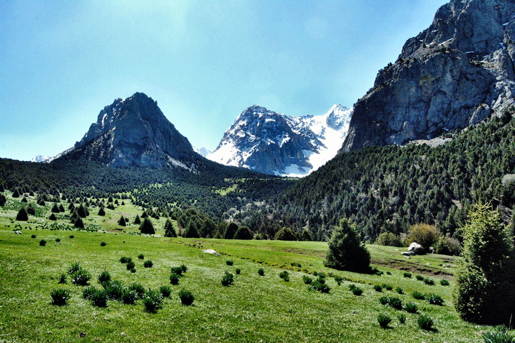
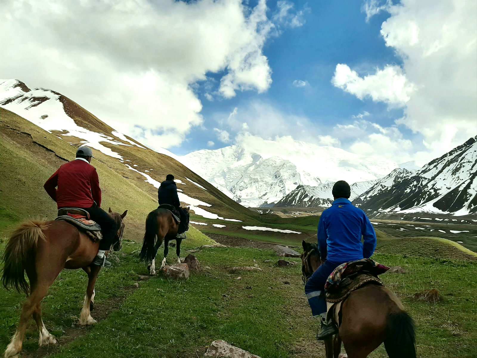
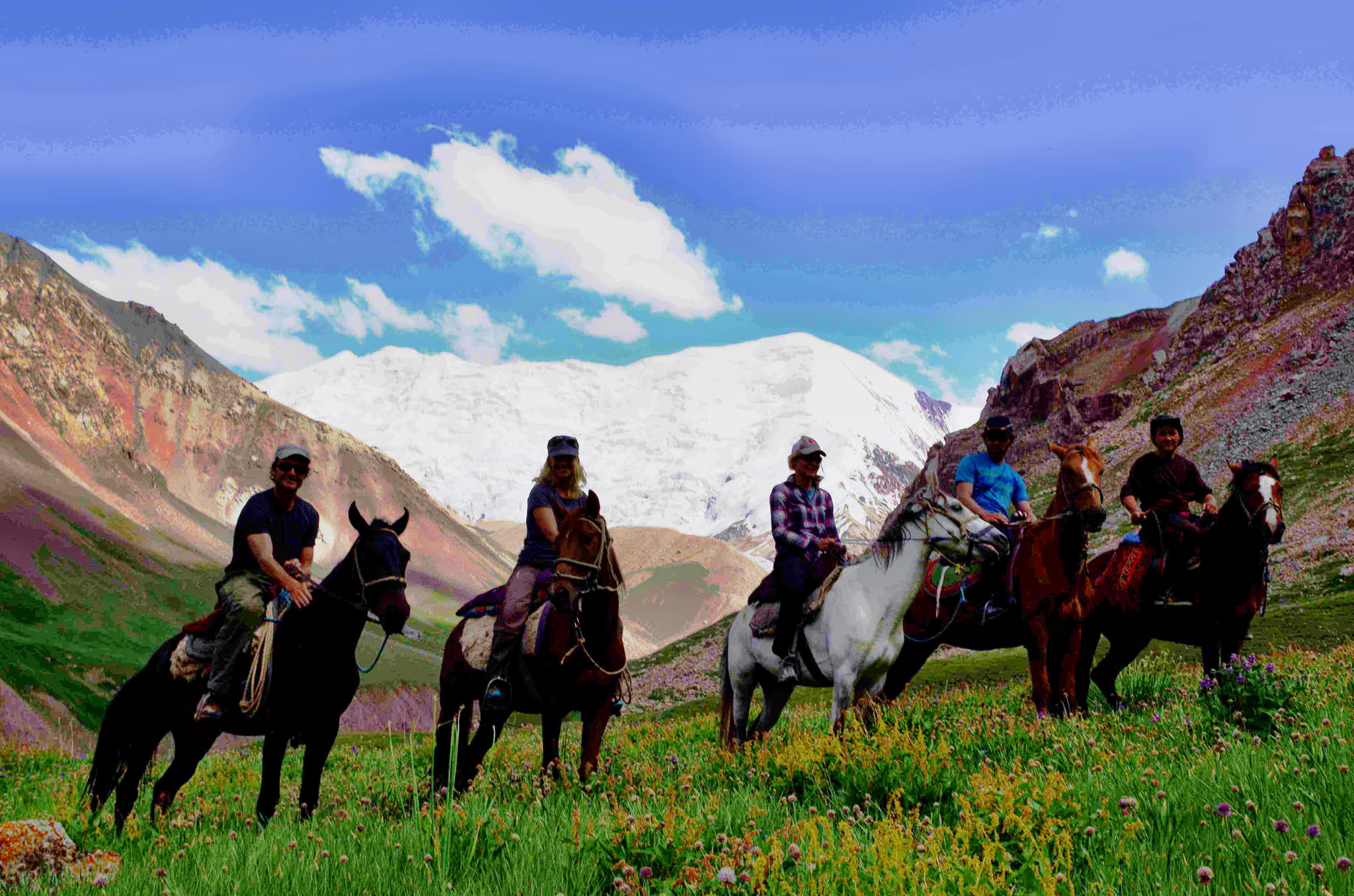
Start from Sary-Mogol and ride to Tulpar-Kol through wide Alay Valley pastures and alpine meadows.The route is mostly gentle, with a few gradual climbs and descents—comfortable for all riding levels.
Peak Lenin (7,134 m) dominates the skyline throughout the day.
Tulpar-Kol (≈3,500 m).
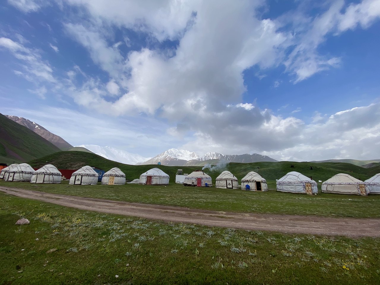
• A serene alpine lake surrounded by yurt camps—perfect for rest and photography.
• Optional short walk around the lake or relax before dinner.
Riding distance: ~22 km / ~14 mi.
Time: 09:00–15:00 (about 5–6 hours riding).
Difficulty: Easy.
Ascent / descent: ~590 m / ~60 m.
Highest / lowest point: 3,500 m / 2,920 m.
Accommodation: yurt camp (2–4 beds on sofas; stove heating; shared outdoor toilet/shower).
Connection: mobile signal available; solar electricity for charging; paid Wi-Fi in some camps.
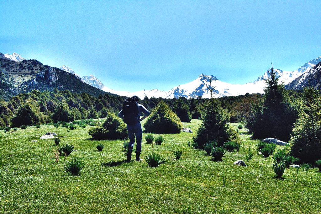
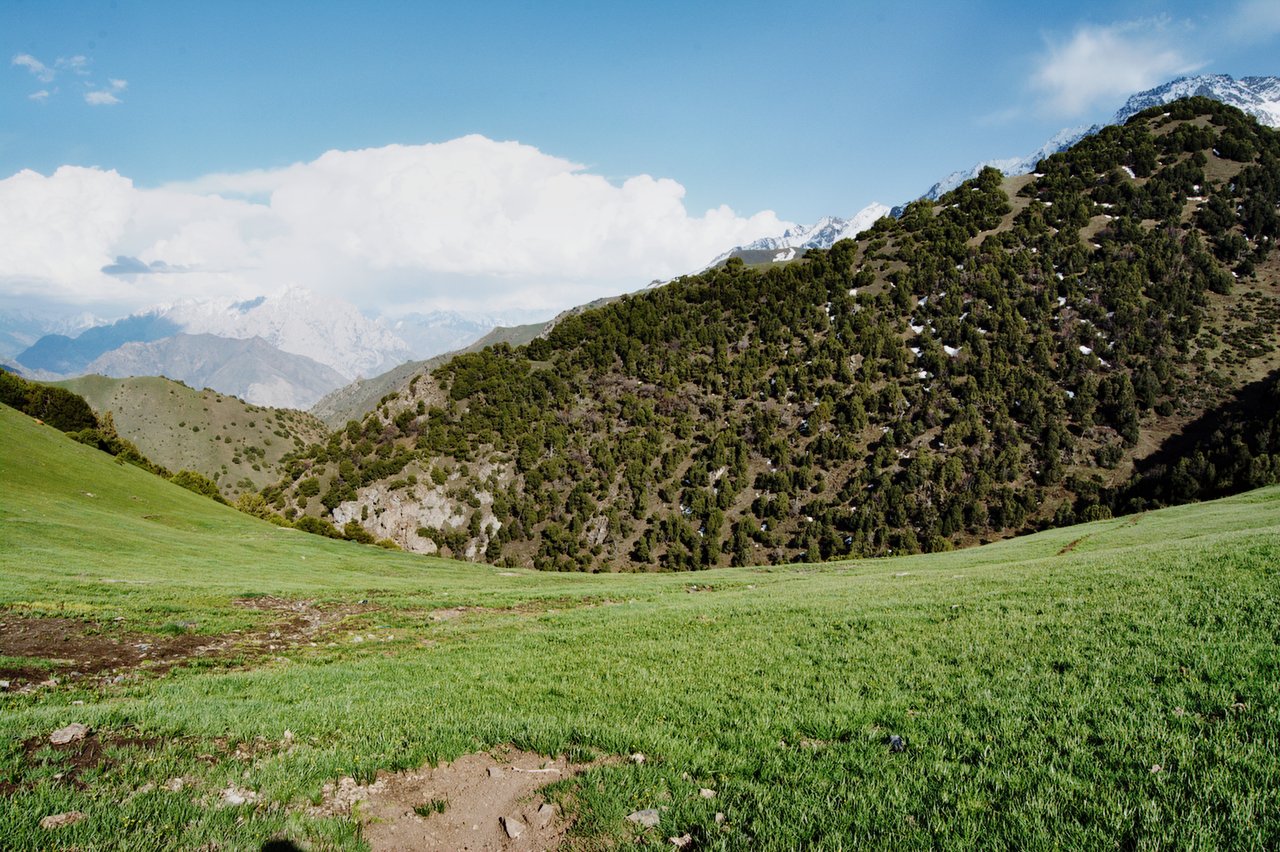
After breakfast we ride towards the Lenin Peak Base Camp area. Along the way you can observe the true atmosphere of the mountains: climbers preparing for the ascent, groups heading to or returning from the route, and local young horsemen transporting expedition luggage. We pass the green meadow known as Lukovaya Polyana (“Onion Meadow”) and continue to a viewpoint where you can see the impressive glaciated valley and the massive moraine in front of Lenin Peak.
If anyone feels tired, it’s possible to turn back earlier without going all the way to the pass. For strong hikers, the guide may suggest reaching the pass area; from there, a short ~50 m walk up to a small viewpoint rewards you with a wide panoramic view of Lenin Peak. After the viewpoint, we return to Tulpar-Kol following the same trail.
Riding distance: ~17 km / ~10.5 mi (round trip).
Time: about 5–6 hours (depending on pace).
Difficulty: Easy–Moderate.
Ascent / descent: ~695 m / ~70 m.
Highest / lowest point: 4,120 m / 3,500 m.
Accommodation: same yurt camp.
Connection: mobile signal (MegaCom, Beeline, O!); paid Wi-Fi in some camps.
Electricity: solar (phone charging and lighting).
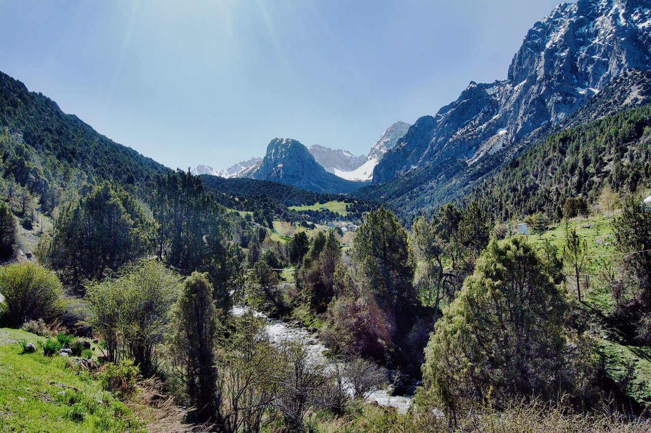
Ride through the magical scenery of Tuyuk Canyon, located about 3 km from Tulpar-Kol. The gorge opens into broad summer pastures with striking views of the snow-capped Estonia and Latvia Peaks. Along the way you may see herds of cattle and families living the traditional nomadic lifestyle in yurts and shepherd huts.
Continue riding back to Sary-Mogol.
Riding distance: ~26 km / ~16 mi.
Time: about 5–6 hours (depending on pace).
Difficulty: Easy.
Ascent / descent: ~100 m / ~660 m.
Highest / lowest point: 3,500 m / 2,920 m.
Start: ~09:00 | Arrival: ~14:00–15:00.
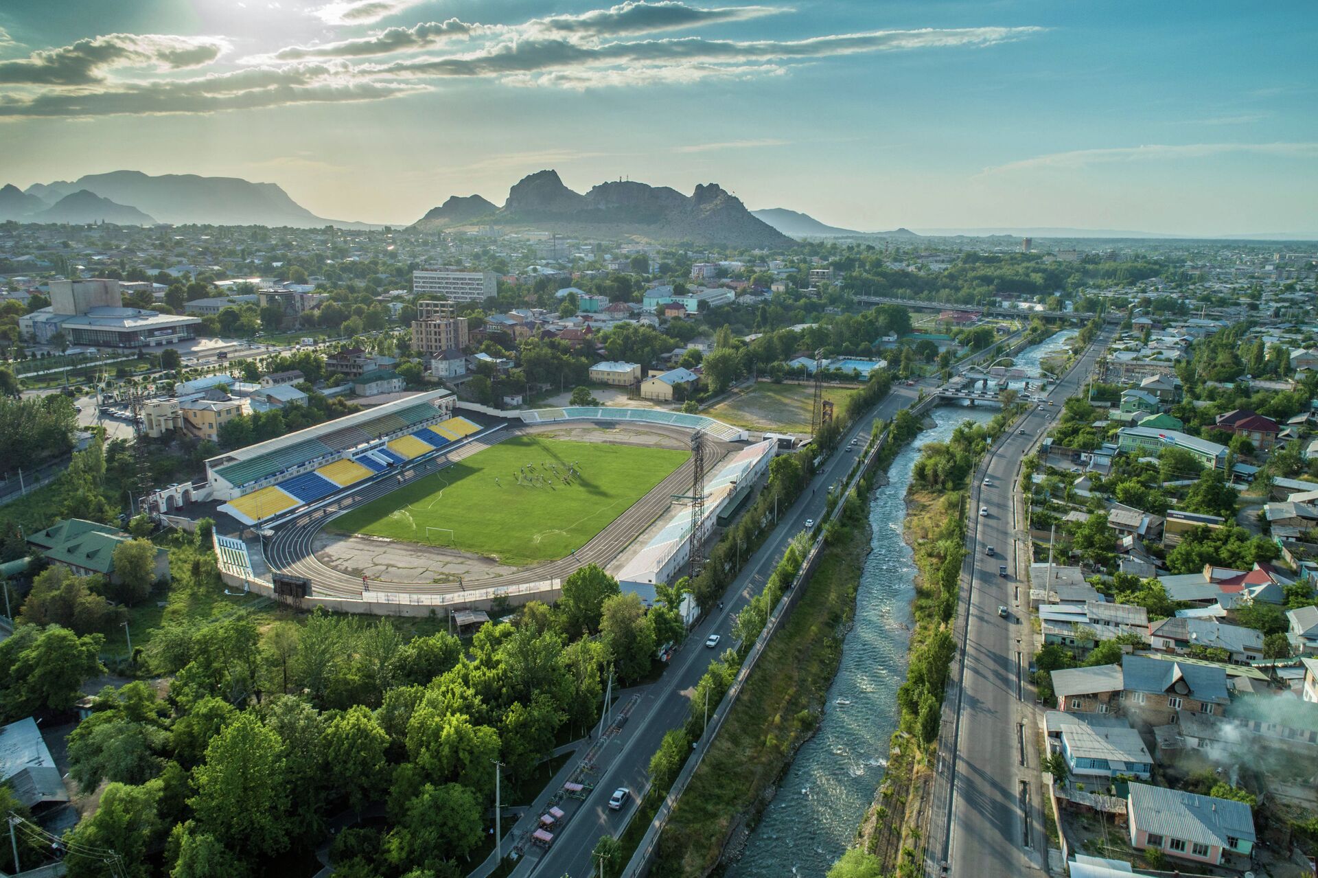
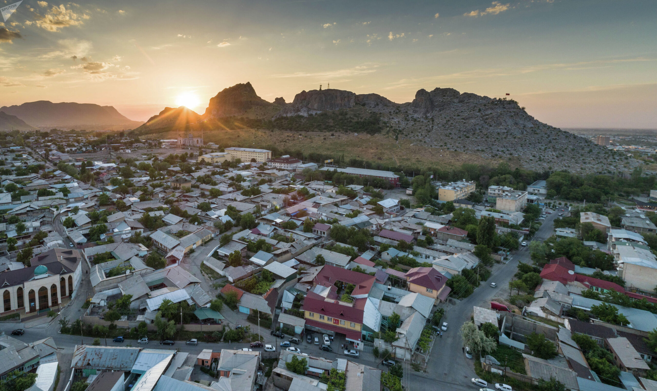
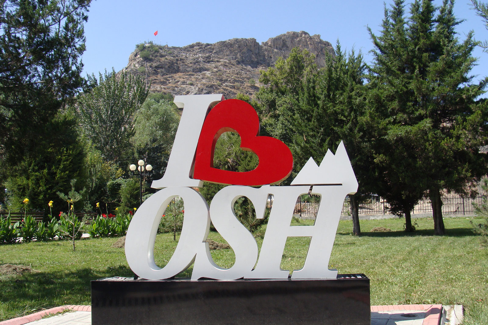
After a leisurely breakfast, we begin our scenic drive back to Osh, the second-largest city in Kyrgyzstan, beautifully located at the foot of the impressive Sulaiman-Too Mountain. The road offers picturesque landscapes of valleys and mountain views along the way. Upon arrival in Osh, if you have not yet explored the city, we can arrange an optional city tour. The highlight is Sulaiman Too, a sacred mountain rising above the city and recognized as one of the most important pilgrimage sites in Central Asia. The mountain features ancient petroglyphs, caves, and a historical museum complex at the summit. From the top, you can enjoy breathtaking panoramic views over Osh and the surrounding landscape. Driving time: approximately 4 hours.


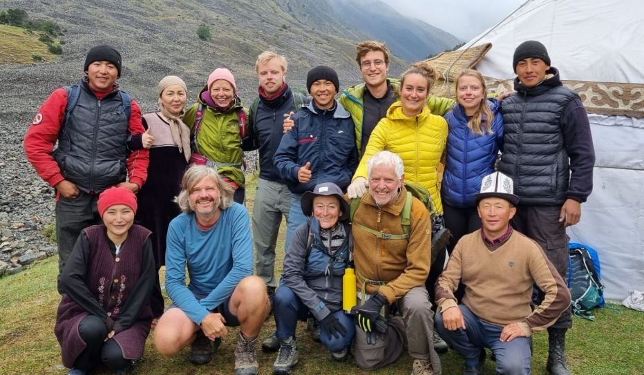
![IMG-20231106-WA0009[1]](https://alaytravelguide.com/wp-content/uploads/2026/05/IMG-20231106-WA00091.jpg)
Write Your Review