Porter Services for Trekking.
We offer porter services upon request. Here’s how it works:
Porter services are available at an additional cost.
If your next route will be in the following directions, then our next tour is ready to accommodate you, and we will be happy to organize it.
Packing Recommendations.
To ensure your safety and comfort, we recommend bringing the following items:
Note: If needed, warm jackets and trousers are available for rent at our office in Sary-Mogol.
Boiled drinking water will be available at overnight stays.
For drinking water en route, bring a water filter or purification tablets for river water.
Facilities in Sary-Mogol:
| Destination | Osh | Kojo-Kelen | Kosh-Moinok | Yurt camp before Sary-Mogol pass | Sary-Mogol town | Tulpar-Kol |
|---|---|
| Depature | Yes Required |
| Departure Time | Contact us for more information |
| Return Time | Contact us for more information |
| Included |
|
|
What to Bring: |
|
 |
|
Price:
| Number of tourists | 2 | 3 | 4 | ||||||
|---|---|---|---|---|---|---|---|---|---|
| Price in USD Dollar for the group | $950 | $1160 | $1390 |
Starting Point: Osh.
Ending Point: Osh.
Duration: Total 6 days (approximately 16km, 10miles daily walking).
Difficulty: Moderate to challenging (due to altitude).
Total distance: 280km, 174 miles.
Hiking distance: 130km, 80miles.
Up and down: 7760 / 5010 meters.
Highest and lowest points: 4300/2200 meters.
Season: From beginning of July to mid of September.
Short itinerary:
Day1. Osh-Kojo-Kelen.
Day2. Kojo-Kelen to Kosh-Moinok.
Day3. Kosh-Moinok to Yurt camp before Sary-Mogol pass.
Day4. Arrive to Sary-Mogol town.
Day5. Sary-Mogol to Tulpar-Kol.
Day6. Tulpar-Kol-Osh.
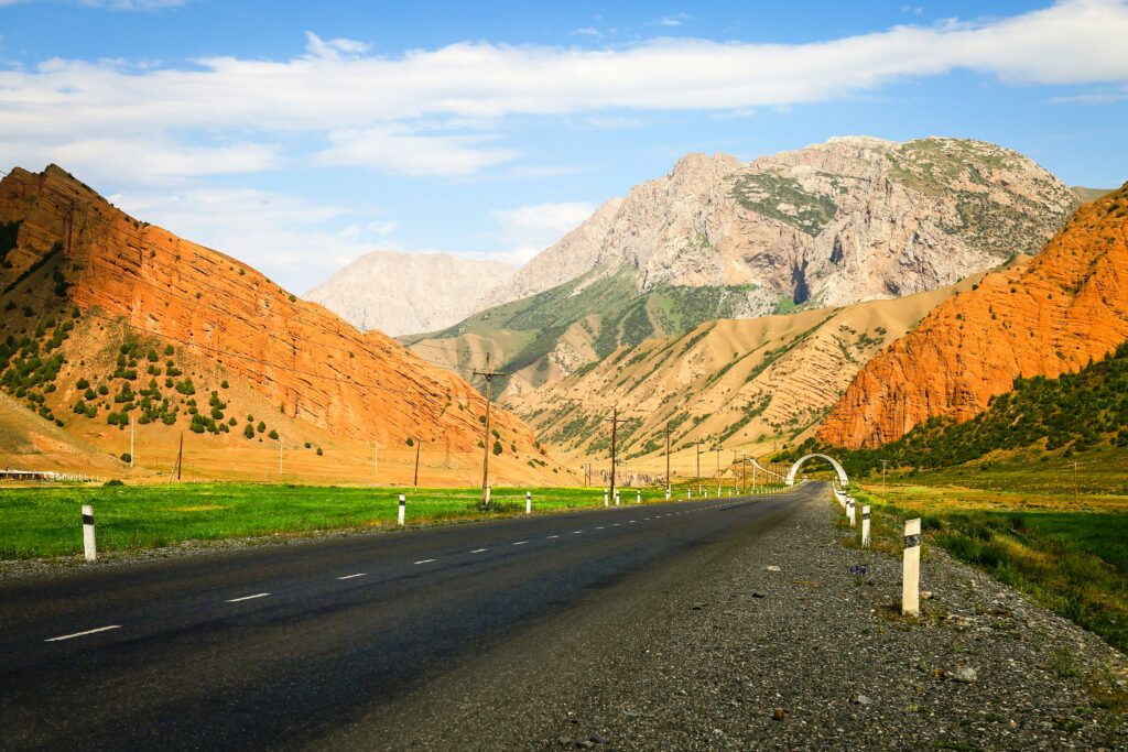
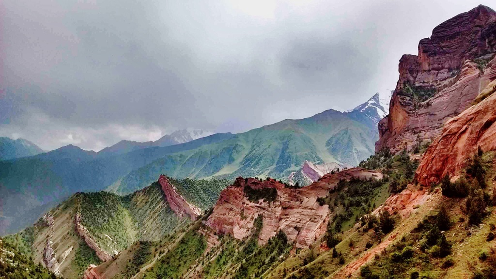
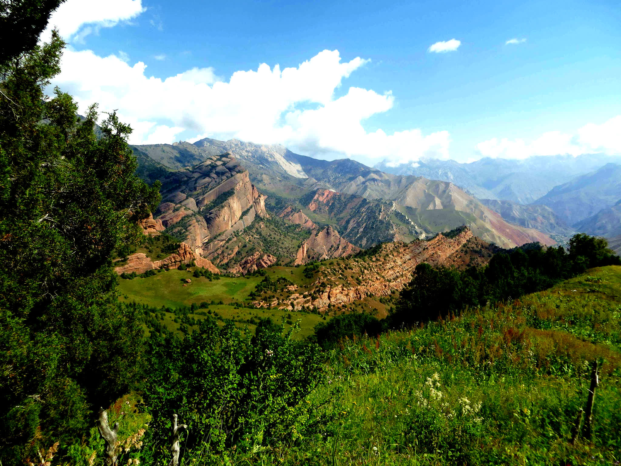
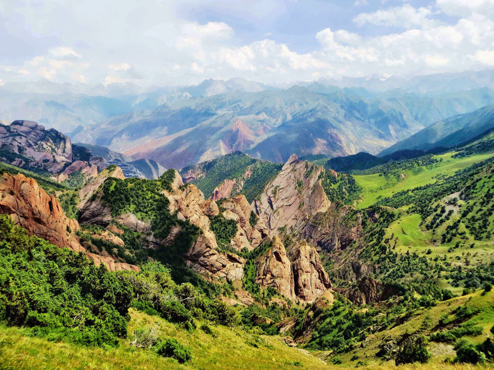
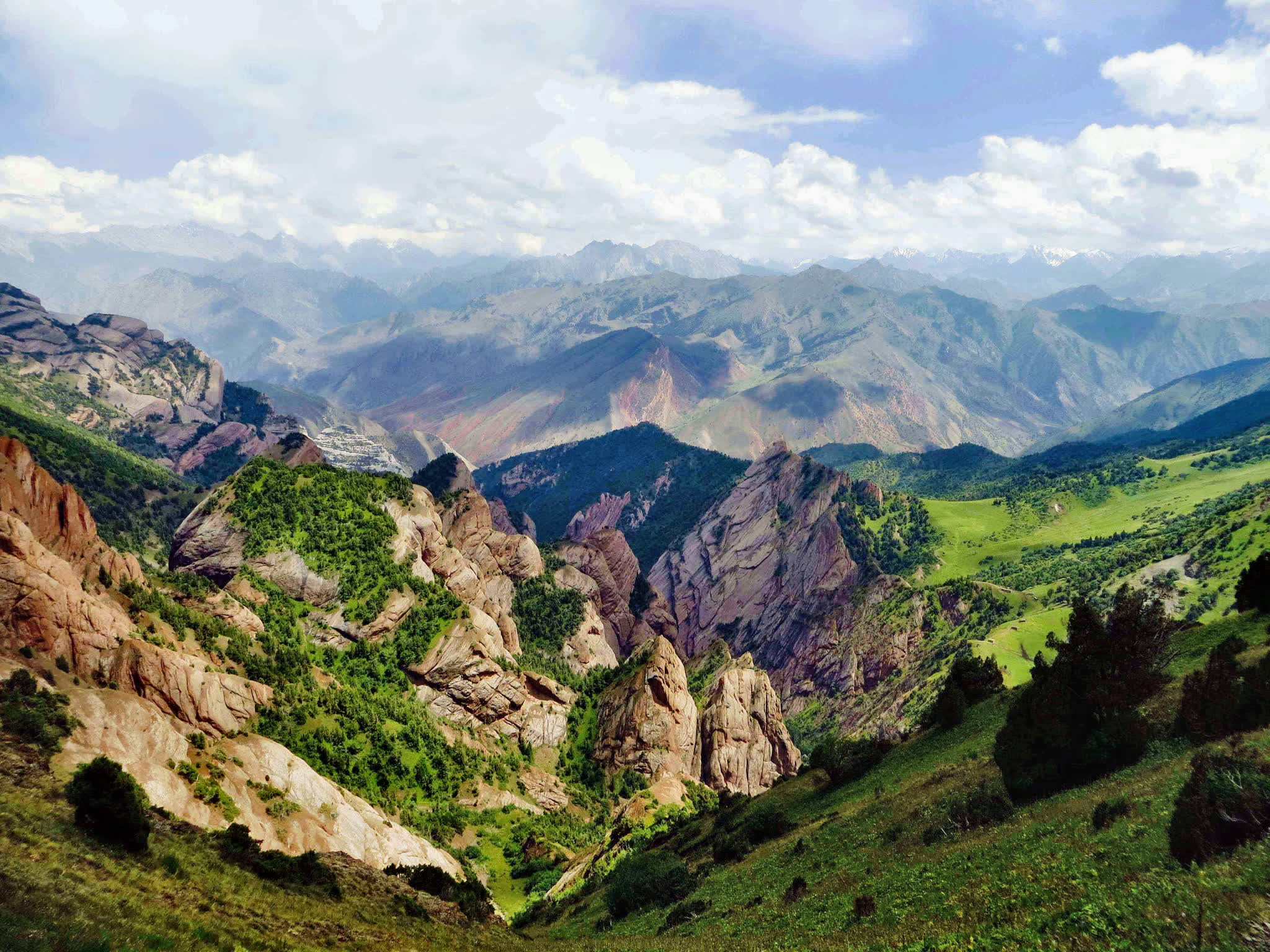
Take a scenic drive from Osh, either from the airport or your hotel, to the picturesque village of Kojo Kelen. Along this 95 km journey, which takes about 3 hours, you will enjoy exotic natural landscapes, including majestic mountains, diverse flora and glimpses of unusually shaped red rocks.
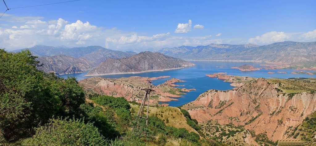
On the way, you will pass by the Papan Reservoir, a vital source of water for the people of Osh and essential for irrigating agricultural lands in both Kyrgyzstan and Uzbekistan.
The road, although not paved, is in reasonable condition and runs alongside the Ak-Buura River, with green mountains covered with juniper lining both sides.
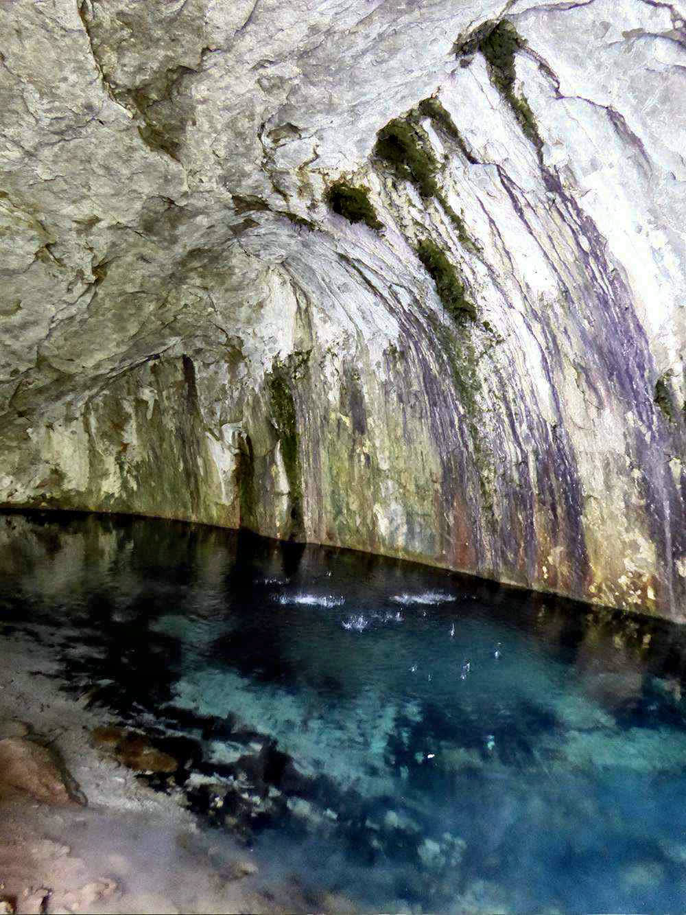
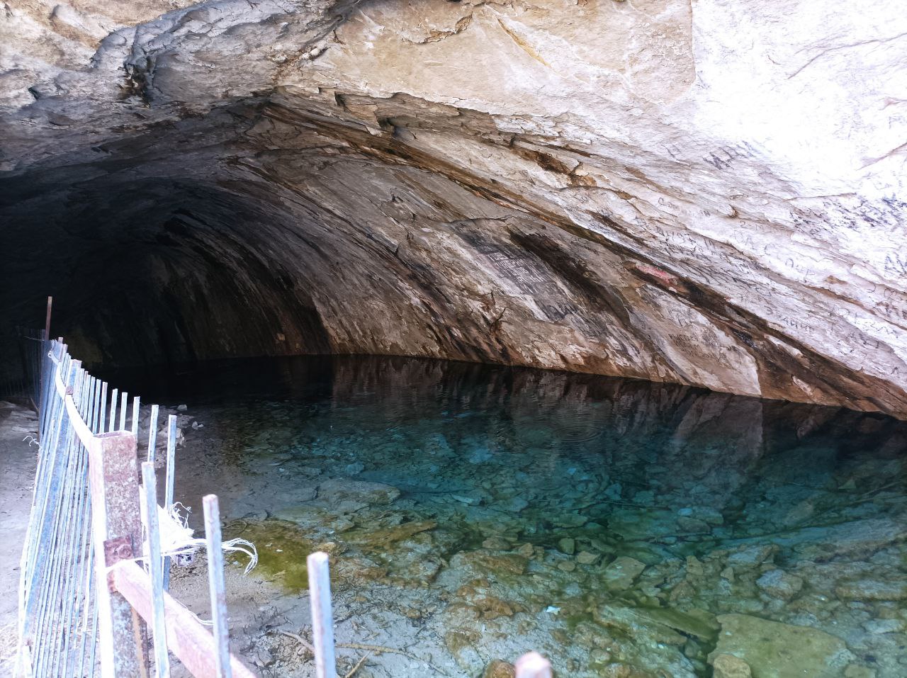
Once you reach Kojo-Kelen, you will enjoy lunch at a local guesthouse. Afterwards, set off on a 2-3 hour acclimatization hike to explore the Blue Grotto and a nearby waterfall.
Accommodation: homestay. The rooms has shared rooms and beds are on traditional floor with hot showers and water running toilets.
Food: lunch and dinner will be prepared by owner in the guesthouse.
Connection: there is electricity, signal (megacom) and Wi-Fi.
Driving distance: 95km, 3hours (excluding stop on the way).
Ascent/Descent: 2260/1050 meters.
Highest and lowest points: 2230 /980 meters.
Accommodation altitude: 2230 meters.
We will begin the second day of the tour on the slopes of the beautiful Cretaceous mountains of Kichik-Alai. First, we cross the Sary-Bel pass (3150m). Then come to camp in Kosh-Moinok.
Kosh-Moinok is another scenic area, located in the south-western part of Kyrgyzstan, not far from Sary-Bell. This location is known for its stunning mountain scenery and tranquil environment. It's often frequented by those looking to explore the Trans-Alay mountain range and enjoy activities such as trekking and camping. The name "Kosh-Moinok" roughly means "double pass through the gorge" reflecting the region's pastoral landscape.
Ascent/Descent: 1010/350 meters.
Highest and lowest points: 3130 /2190 meters.
Accommodation altitude: 2822.00 Meters | 9258.53 Feet.
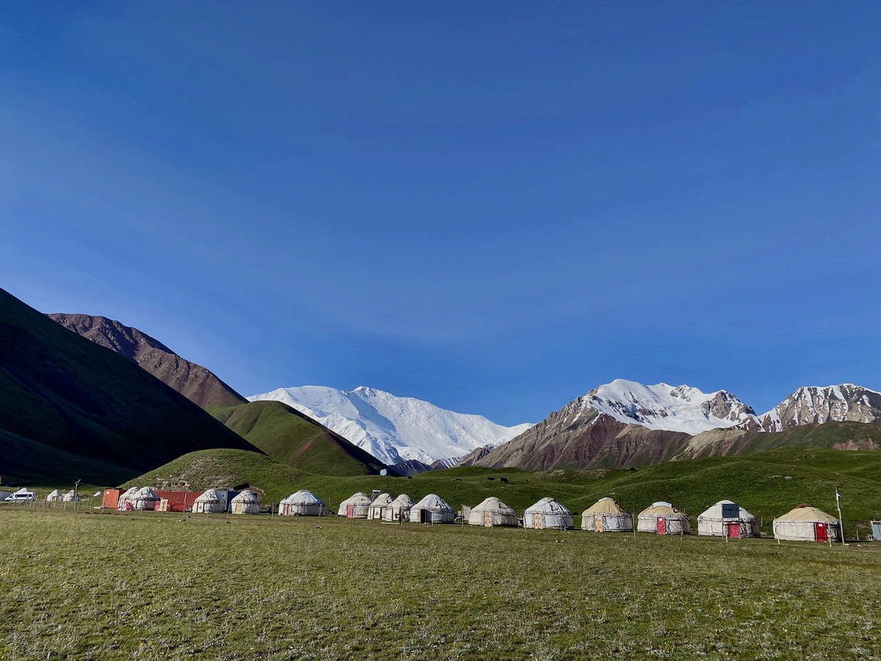
Accommodation: yurt stay (shared nights on traditional floor, matrass and blankets are available) there are solar shower and flush toilet.
Connection: No electricity, internet and signal.
Food: lunch on the route and dinner will be cooked by hosts in yurt.
Host: The name of owner is Nurdoolot and Begali.
After breakfast start crossing from itself of Kosh-Moynok (3220m) After a short transition descent to the village of Kyzyl-Chara then (3-4 kilometers) along the road through the small village of Sary-Mogol , from here you head to the southern side (left), then path directed along the mountain river, on both sides of the towering rocks, and subalpine and alpine meadows represent a very diverse landscape.
During the hike, at every step you can hear the cries of marmots and birds in these natural areas. As you approach the heights, you feel the marvelous embrace of the surrounding spruce cliffs of the Kichik-Alai mountains.
Trekking distance: 18km, 11 miles.
Time of hiking: 7hours (excluding driving, break and lunch).
Ascent/Descent: 1490/820 meters.
Highest and lowest points: 3495/2412 meters.
Accommodation altitude: 3458.00 Meters | 11345.14 Feet.
Accommodation: yurt stay with shared nights on the traditional floor, there are matrass and blankets and water running toilet are available.
Connection: No electricity, internet and signal.
Food: lunch-box on the route and dinner in yurt camps.
Host: name of woman is Orozgul.
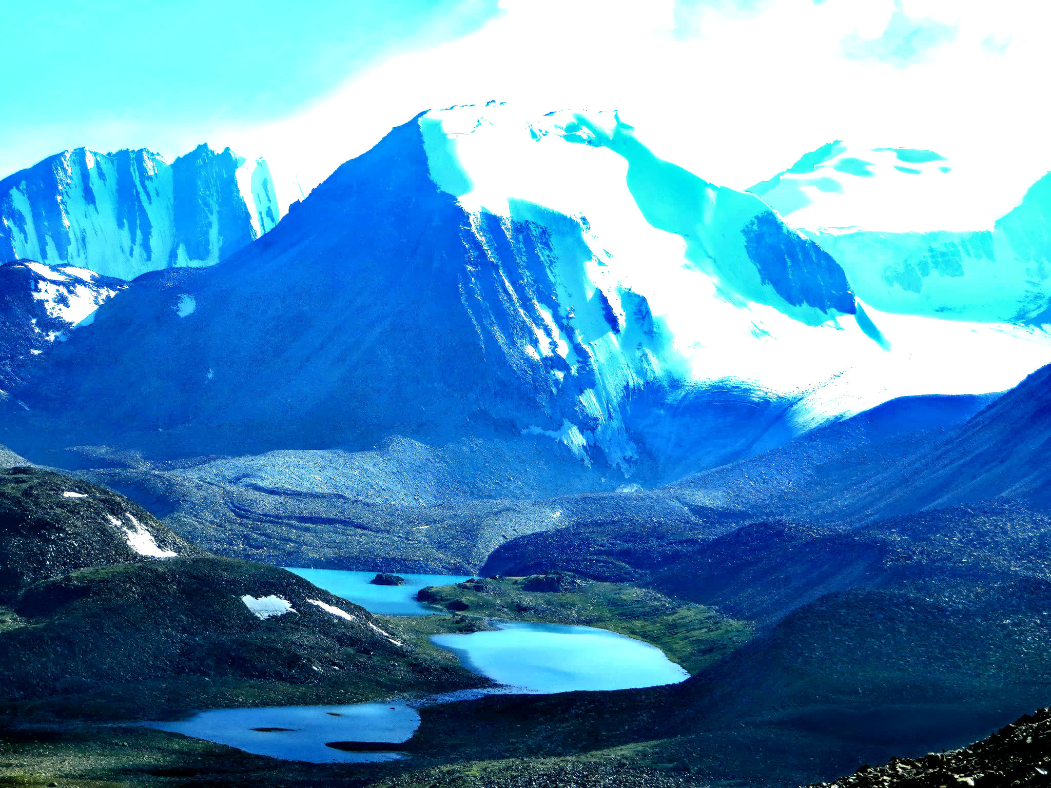
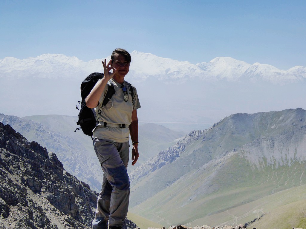
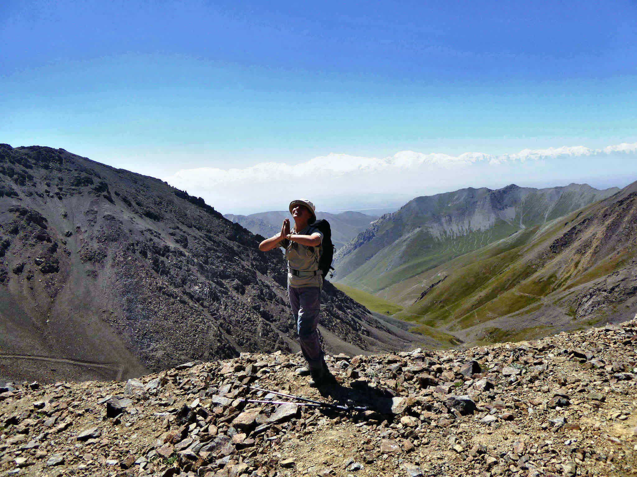
The distance to cross the pass may not be long, but the steep ascent requires patience and effort. From the summit of the Sary-Mogol Pass, the landscape transforms into a magical panorama of rugged beauty. Below, the stunning Besh-Kol Lakes (translated as "Five Lakes") shimmer like jewels in the barren terrain. These four interconnected rocky lakes are linked by streams that weave through the landscape before disappearing into an enchanting underground cave—a fascinating natural phenomenon.
Descending from the pass, the trail leads you to a peaceful area where a shepherd's yurt stands. From here, our driver will take to Sary-Mogol.
Total distance 31km (Driving distance: 17km (1hour by car).
Trekking distance: 14km, 8.70 miles.
Time of hiking: 6hours (excluding driving, break and lunch).
Ascent/Descent: 770/930meters.
Highest and lowest points: 4270 /3354 meters.
Accommodation altitude: 2976.00 Meters | 9763.78 Feet.
Accommodation: Guesthouse (Alay travel house). The rooms has double, twin and single beds with hot showers and water running toilets.
Connection: there is electricity, internet (Wi-Fi) and signal.
Food: lunch-box on the way and dinner will be prepared by cooking team in guesthouse.
Host: Abdilla and Sharapat.
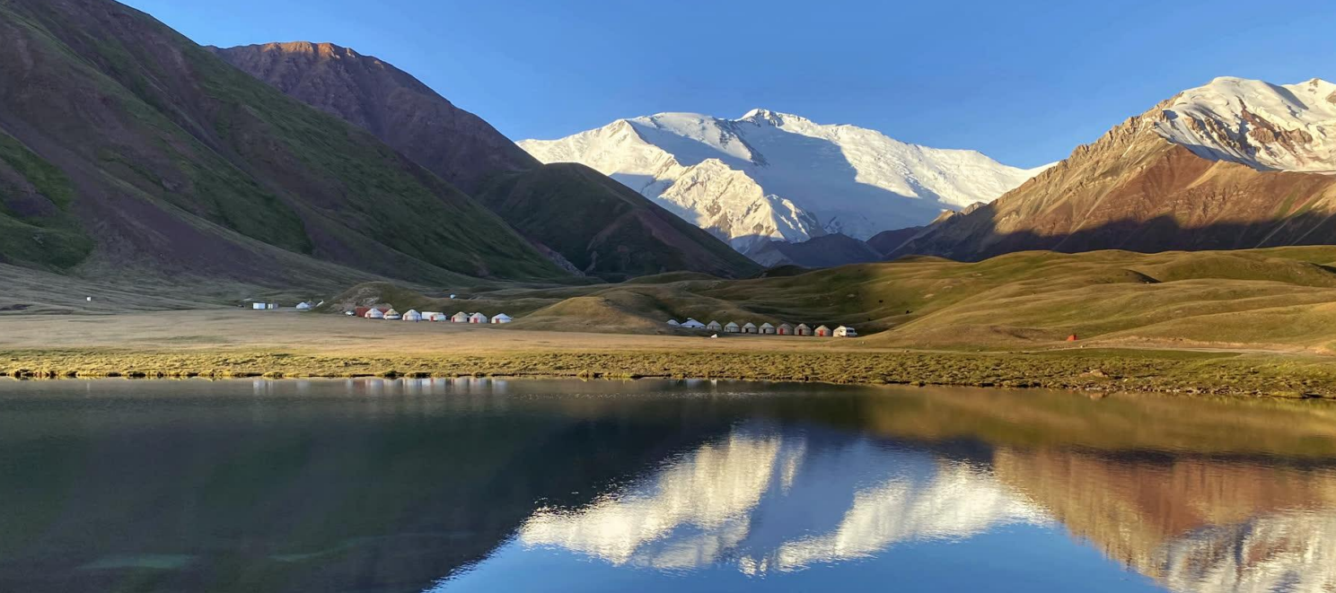
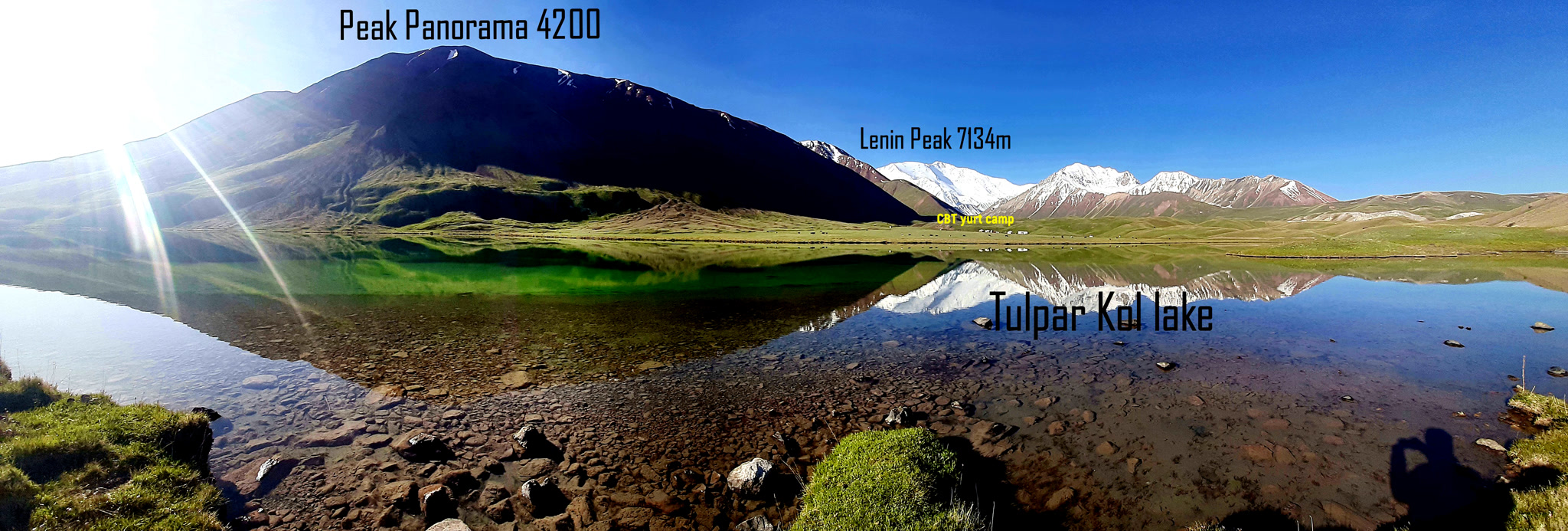
After breakfast, our driver will take you to the Tulpar-Kol Yurt Camp (approximately a 1-hour drive). Once you arrive, leave your heavy bags in the yurt and begin your trek towards the Travel pass (4120m). Return to Tulpar- Kol and night in yurt camp.
Total distance: 37km.
Driving distance: 23km 40min driving.
Hiking time: 14km, 7 hours (including lunch and break time).
Ascent/Descent: 1020/140 meters.
Highest and lowest points: 4100/3500 meters.
Accommodation altitude: 3500m.
Accommodation type: yurt (twin beds and 4 beds).
Connection: there is solar electricity but Wi-Fi in 5G is available.
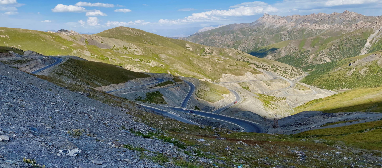
Return to Osh from Tulpar-Kol.Beautiful views along the way, several photo stops at the Taldyk Pass (3,600 m), Uch-Tobo, and other places. The distance is 245 km, travel time is 4-5 hours. Estimated arrival time in Osh is around 1:00 PM, if you leave the camp at 9:00 AM. After lunch, you'll have a free day; a visit to Mount Suleiman is recommended. Our driver will take you to your hotel or destination in Osh, excluding the airport.


![IMG-20231106-WA0009[1]](https://alaytravelguide.com/wp-content/uploads/2026/05/IMG-20231106-WA00091.jpg)
Write Your Review