Start with us on an unforgettable journey through the stunning landscapes of Kyrgyzstan, a country renowned for its breathtaking natural beauty, rich culture and warm hospitality. This 10-day adventure will take you through some of the most iconic destinations, showcasing the country’s highlights from the northern capital of Bishkek to the southern city of Osh. This carefully crafted itinerary offers the perfect combination of scenic drives, cultural experiences and outdoor activities.
If you will be from 1-4 person we arrange by jeep or a larger group it is provided by minibus (5-15) and the tour is designed to be flexible and adaptable to your preferences.
With a mix of daily commutes and opportunities for hiking and exploration, this tour is the perfect way to discover Kyrgyzstan’s hidden gems.
The Highlights of Kyrgyzstan
| Destination | Bishkek | Cholpon-Ata | Karakol | Barskoon | Song-Kol | Tash-Rabat | Kazarman | Jalal-Abad | Arslanbap | Osh | Kojo-Kelen | Kosh-Moinok | Sary-Mogol | Tulpar-Kol | Yukhin Peak |
|---|---|
| Depature | Yes Required |
| Departure Time | Contact us for more information |
| Return Time | Contact us for more information |
| Included |
|
| Excluded |
|
 |
|
Price
| Number of tourists | 1 | 2 | 3 | 4 |
|---|---|---|---|---|
| Price in USD Dollar for the group | $3820 | $4600 | $5200 | $5900 |
Warm and light clothes for trekking (jackets, trousers, shoes) and regular clothes for visiting the city.
Sun protection (cream, glasses, etc.).
Money (some cash in soms just in case), ATMs available (visa, master card) in all regions of Kyrgyzstan.
Three networks available (O, Megacom, Beeline) in all regions of the country.
Day1. Arrival in Bishkek.
Day2. Bishkek-Cholpon-Ata
Day3. Cholpon-Ata-Karakol
Day4.Karakol-Barskoon
Day5.Barskoon-Song-Kol
Day6.Song-Kol- Tash-Rabat
Day7. Tash-Rabat- Kazarman
Day8. Kazarman - Jalal-Abad- Arslanbap
Day9. Arslanbap-Osh
Day10. Osh- Kojo-Kelen
Day11. Trekking from Kojo-kelen to Kosh-Moinok
Day12. Trekking from Kosh-Moinok to Sary-Mogol pass
Day 13. Trekking to Sary-Mogol village
Day14. Trek to Tulpar-Kol via Peak Panorama
Day15. Tulpar-Kol-Advanced camp
Day16. Acsent to Yukhin Peak descent to Tulpar-Kol
Day17. Drive to Osh & city tour then flight to Bishkek.
Bishkek, the capital city of Kyrgyzstan, serves as the cultural, economic, and political heart of the nation. Nestled at the foothills of the Tian Shan Mountains, it combines Soviet-era architecture, bustling bazaars, and green parks with a backdrop of stunning peaks if you prefer to see something in Bishkek, we recommend to visit Ala-Too Square. This is the central square of the city, ideal for getting to know Kyrgyz culture and history. Here is the State Historical Museum (you can visit it) and a giant Kyrgyz flag, guarded by soldiers in full dress uniform.
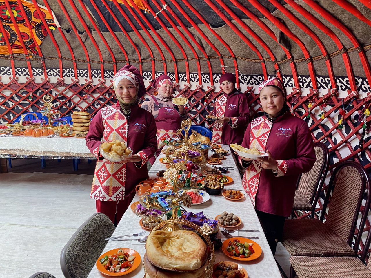
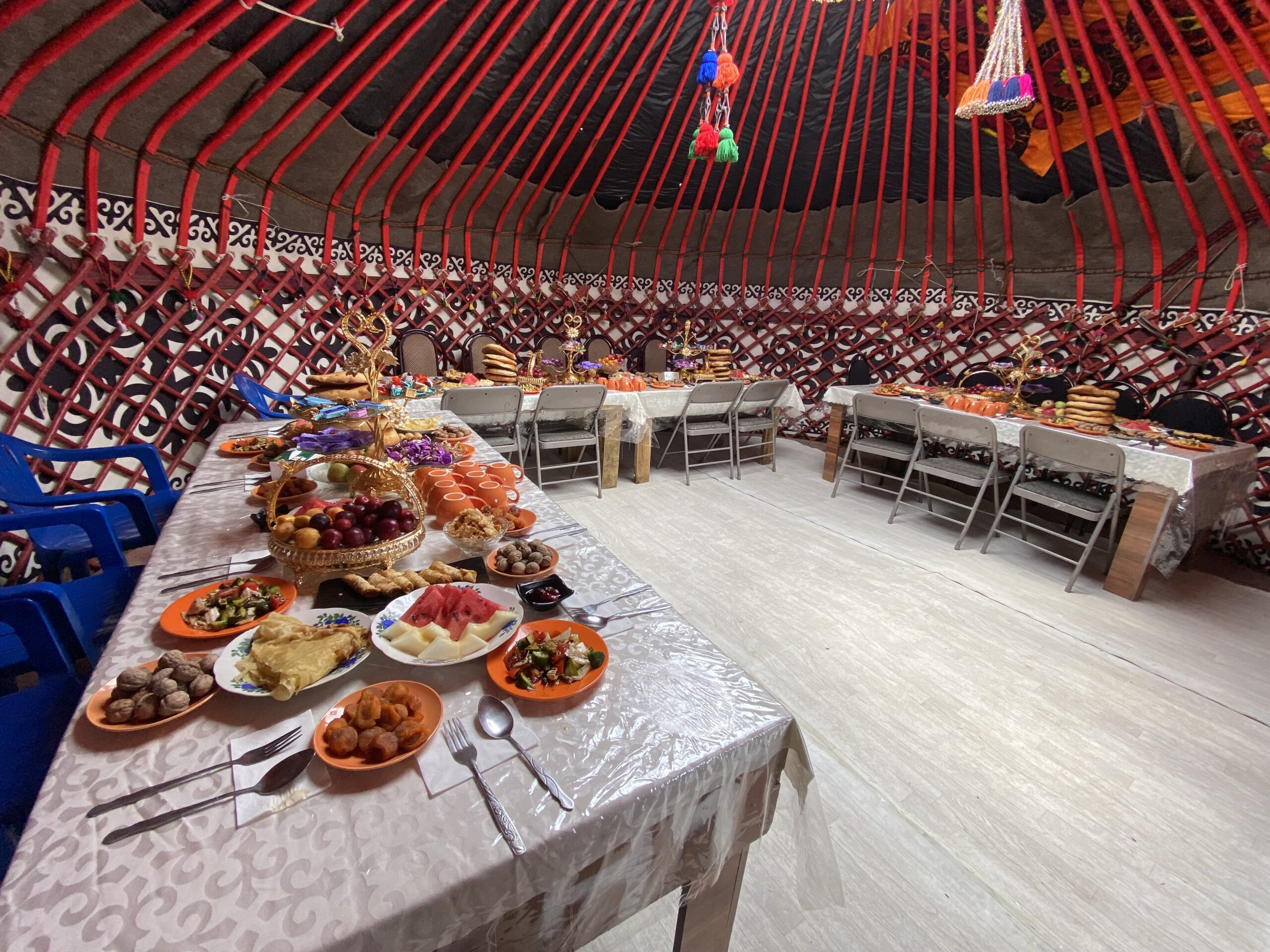
The place where national holidays, festivals and evening fountain shows are held. In the evening, enjoy Kyrgyz cuisine, the popular national food are below:
Beshbarmak: A traditional noodle dish with meat and broth.
Manty: Steamed dumplings filled with meat or vegetables.
Plov: A flavorful rice dish cooked with meat and spices.
Shorpo: A hearty meat soup.
Shashlik: Skewered and grilled meat, similar to kebabs.
Samsa: Flaky pastries filled with meat or vegetables.
These dishes are best enjoyed at local restaurants or cafes that specialize in authentic Kyrgyz flavors.
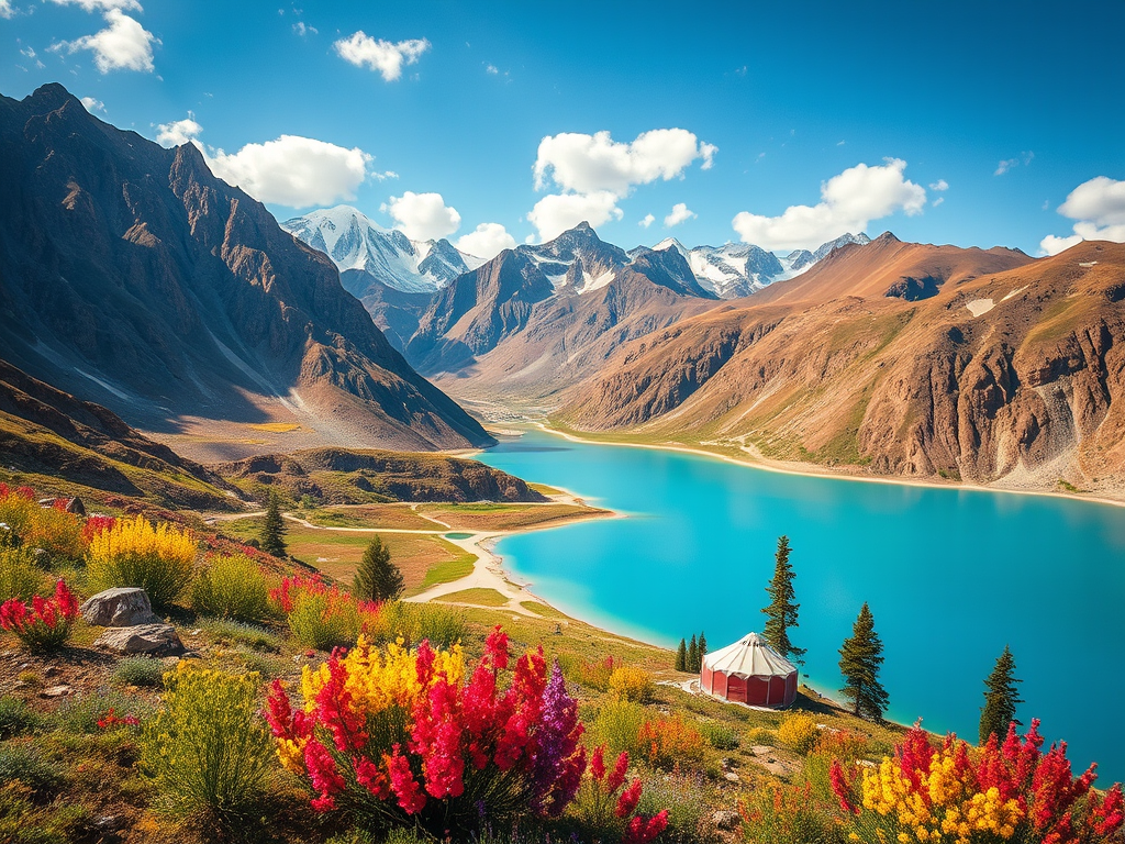
After leaving Bishkek in about 1.30 hour you can start first visit from an ancient tower Burana which is belong to 11th century then away heading to Cholpon-Ata (resort town) on the northern shore of Lake Issyk-Kol.(second alpine lake in the world) Visit the petroglyphs at Cholpon-Ata, which date back thousands of years. Enjoy a leisurely walk along the beach and swimming in the pools or boat ride on Issyk-Kul Lake.
Total distance: 285 km, 177 miles.
Level: Easy.
Hiking: 1 hour.
Driving distance: 285km 177 miles.
Accent and Descent: 2090/1200 meters.
Highest and lowest points: 1660 /730meters.
Accommodation type: hotel.
Accommodation altitude: 1650.00 Meters | 5413.39 Feet (above sea level).
Connection: There is signal, electricity and Wi-Fi is available.
Drive to Przhevalsky Dedicated to Nikolay Przhevalsky, an explorer who mapped much of Central Asia.
• A unique mosque built entirely of wood, without the use of nails. Сombines Chinese and Islamic architectural styles. Constructed in 1910 by the local Dungan community, an ethnic group of Chinese Muslims.
Other walking through the city center and soak up the local atmosphere. Check into your accommodation. Enjoy a traditional Kyrgyz meal at a local restaurant.
Total distance: 170 km, 105 miles.
Level: Easy.
Hiking: 2 hours.
Accent and Descent: 870/770 meters.
Highest and lowest points: 1770 /1610meters.
Accommodation type: guesthouse.
Accommodation altitude: 1750.00 Meters | 5741.47 Feet (above sea level).
Connection: There is signal, electricity and Wi-Fi is available.
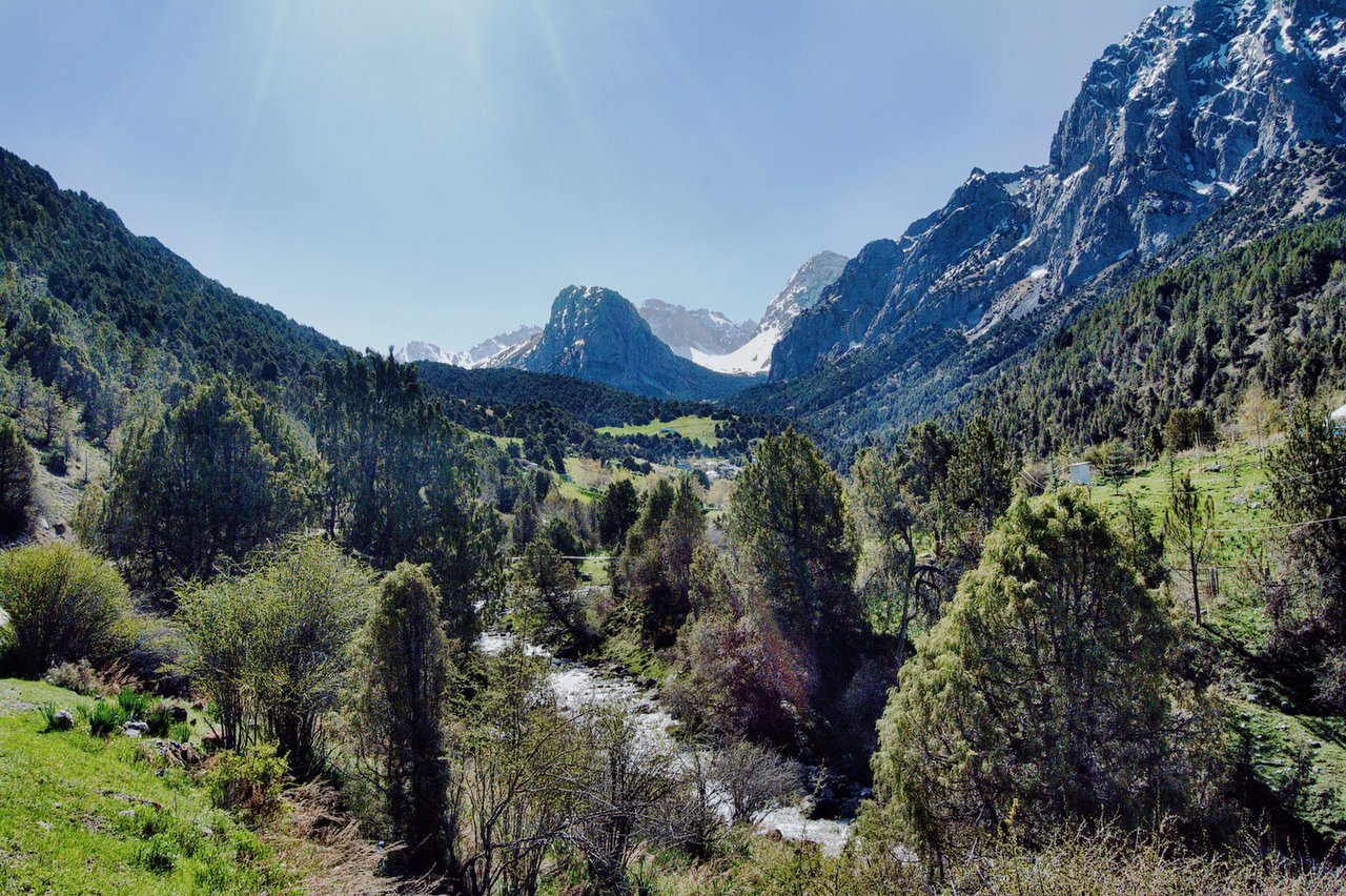
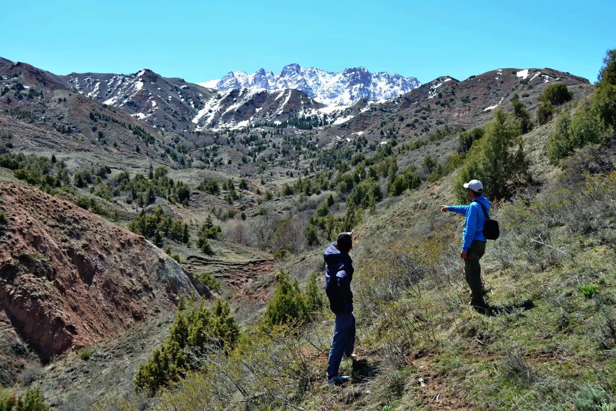
Depart from Karakol on the way pull off the road to look “Broken heart” and “Seven bull” rocks formations, which offer breathtaking photo opportunities. After visiting Jeti-Oguz, head towards the Barskoon Valley.
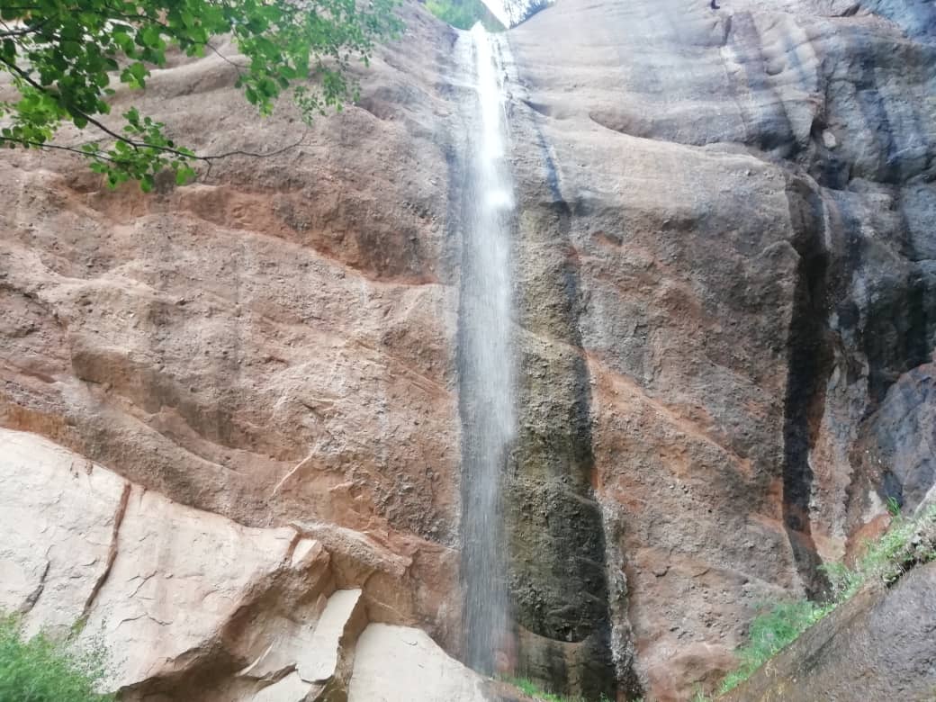
Hike to the Barskoon Waterfall, a picturesque and easily accessible natural wonder. Enjoy the serene mountain landscapes and night here in a cottage or in yurt camp.
Total distance: 176 km, 110 miles.
Level: Easy.
Hiking: 4 hours.
Accent and Descent: 1520/1030 meters.
Highest and lowest points: 2230 /1610meters.
Accommodation type: yurt camp.
Accommodation altitude: 2077.00 Meters | 6814.30 Feet (above sea level).
Connection: There is signal, electricity and Wi-Fi is available.
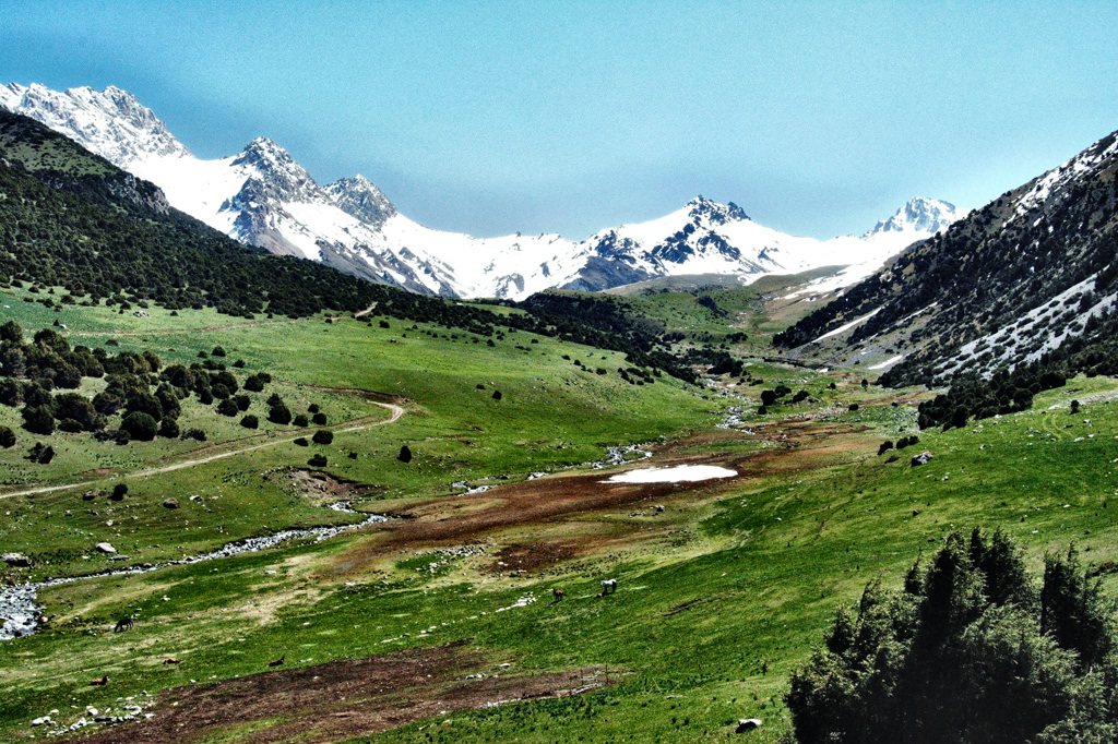
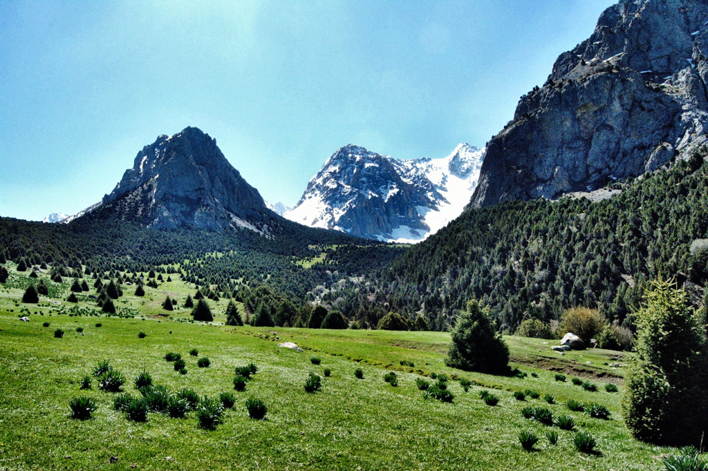
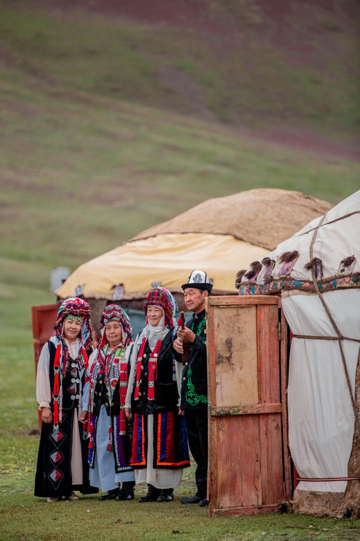
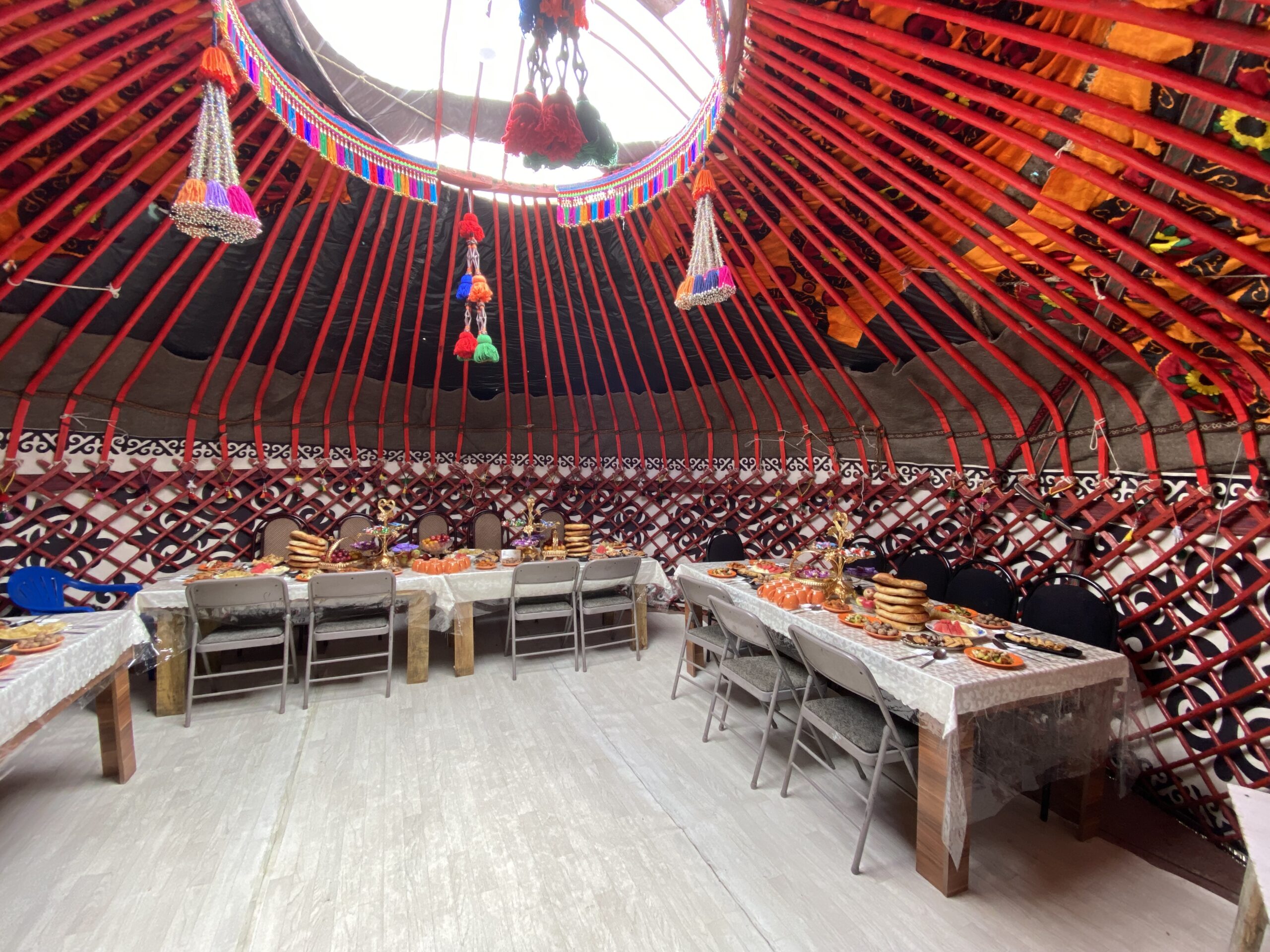
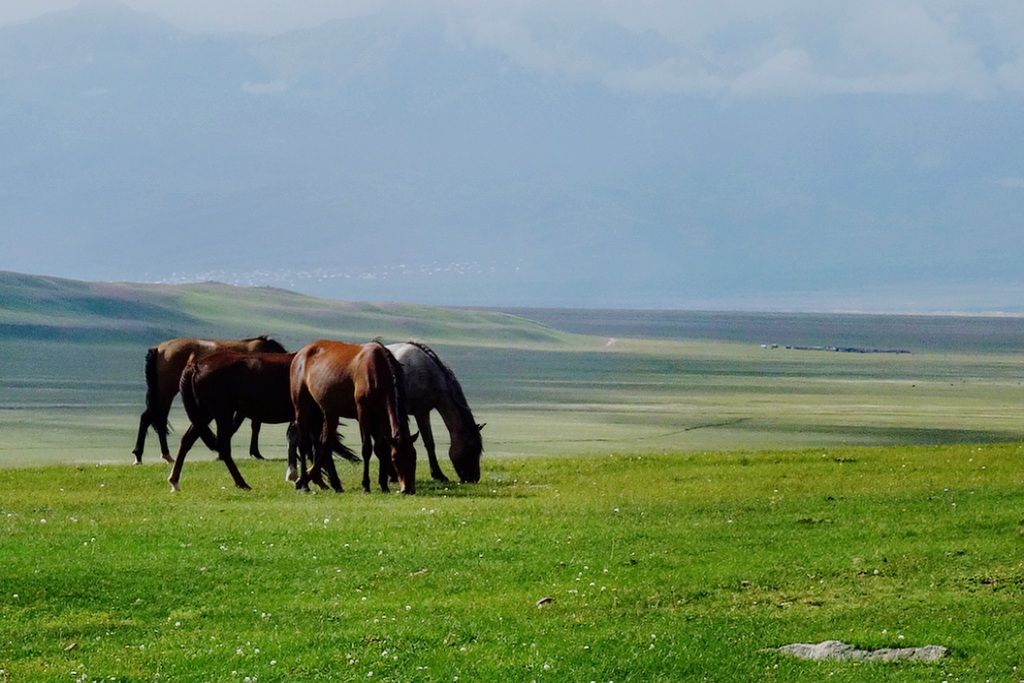
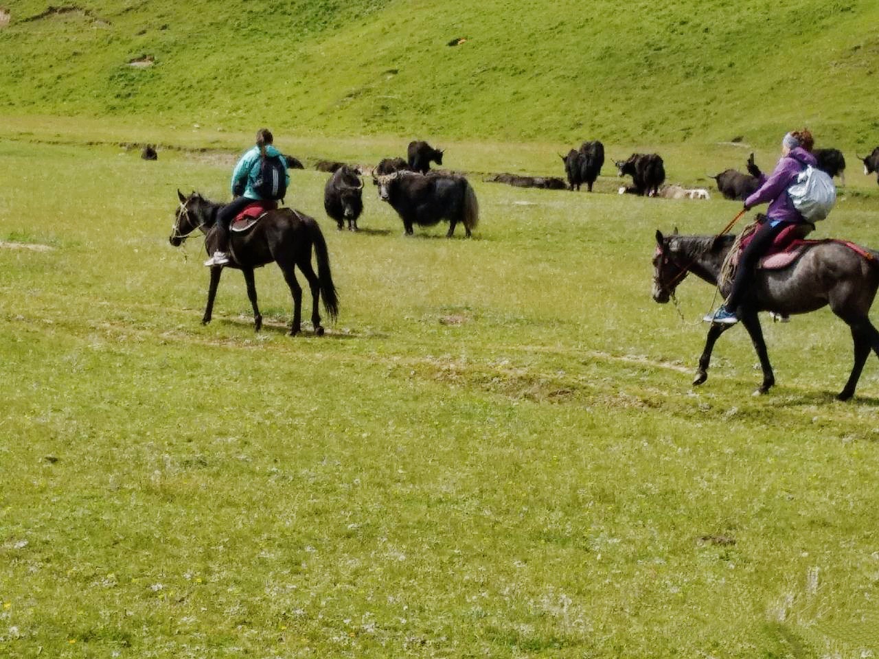
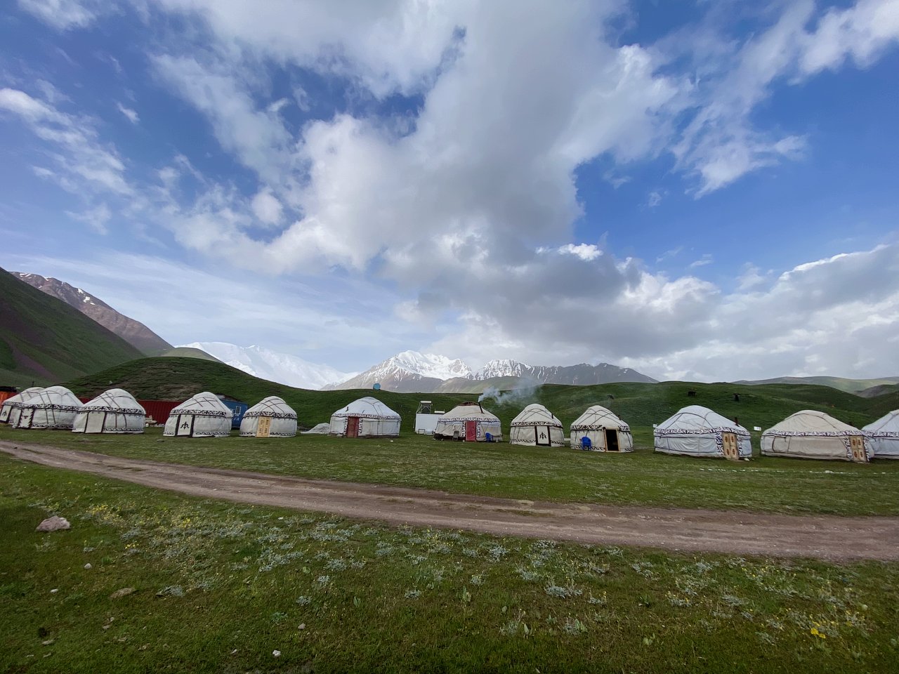
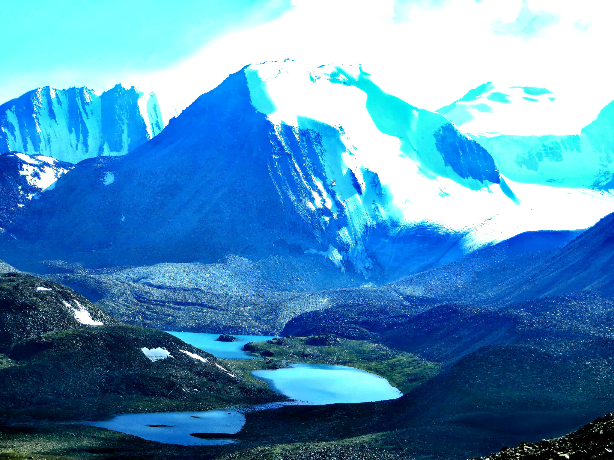
Drive to Song Kul Lake, which is situated at an altitude of approximately 3,016 meters (9,895 feet). Enjoy the scenic drive through the mountains, passing by picturesque valleys and yurt-dotted landscapes. Arrive at Song Kul Lake and check into a yurt camp for a genuine nomadic experience. Take a horseback ride or hike in the nearby hills, which offer panoramic views of the lake and the surrounding mountain ranges. Enjoy the serenity of the area, take photographs, and immerse yourself in the traditional nomadic culture.
Total distance: 320 km, 200 miles.
Level: moderate (altitude location).
Hiking: 2 hours.
Accent and Descent: 3470/2680 meters.
Highest and lowest points: 3250 /1610meters.
Accommodation type: yurt camp.
Accommodation altitude: 3030.00 Meters | 9940.95 Feet (above sea level).
Connection: There is no signal, no connection.
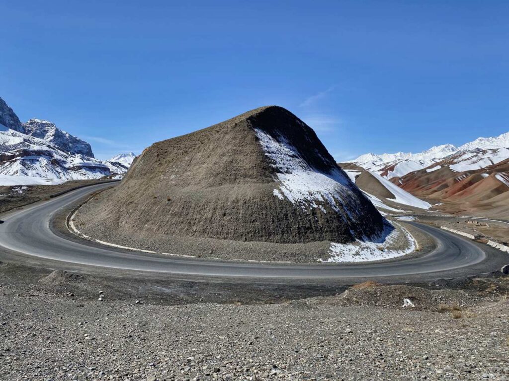
Start from Song-Kol lake, driving through Moldo Pass (3346m) Stop along the way for photo opportunities of dramatic valleys and mountain passes. Arrive at Tash Rabat Caravan sarai, a 15th-century stone structure nestled in the mountains.
Check into a nearby yurt camp then more explore the stone building.
Total distance: 220 km, 137 miles.
Level: moderate (altitude location).
Hiking: 2-4 hours.
Accent and Descent: 3290/3200 meters.
Highest and lowest points: 3387 /1580meters.
Accommodation type: yurt camp.
Accommodation altitude: 3106.00 Meters | 10190.29 Feet (above sea level).
Connection: There is no signal, no connection.
Continue your journey from yurt camp to Kazarman, which will take you through remote mountain roads. The drive may be challenging, but it offers breathtaking views of the Kyrgyz countryside. Arrive in Kazarman and settle into your accommodation for the night.
Brief information on the road:
The road from Issyk-Kul through Kazarman to Jalal-Abad is a new alternative road it is being built on standard condition between the north and south of Kyrgyzstan. 80% of the road is already covered with asphalt, the remaining sections of the road will be completed in the near future. While the road opens, we will use the previous mountain road.
Total distance: 240 km, 150 miles.
Level: moderate (altitude location).
Hiking: 2-4 hours.
Accent and Descent: 3090/4930 meters.
Highest and lowest points: 3387 /1265meters.
Accommodation type: yurt camp.
Accommodation altitude: 1270.00 Meters | 4166.67 Feet (above sea level).
Connection: There is signal, Wi-Fi in the guesthouse.
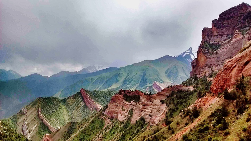
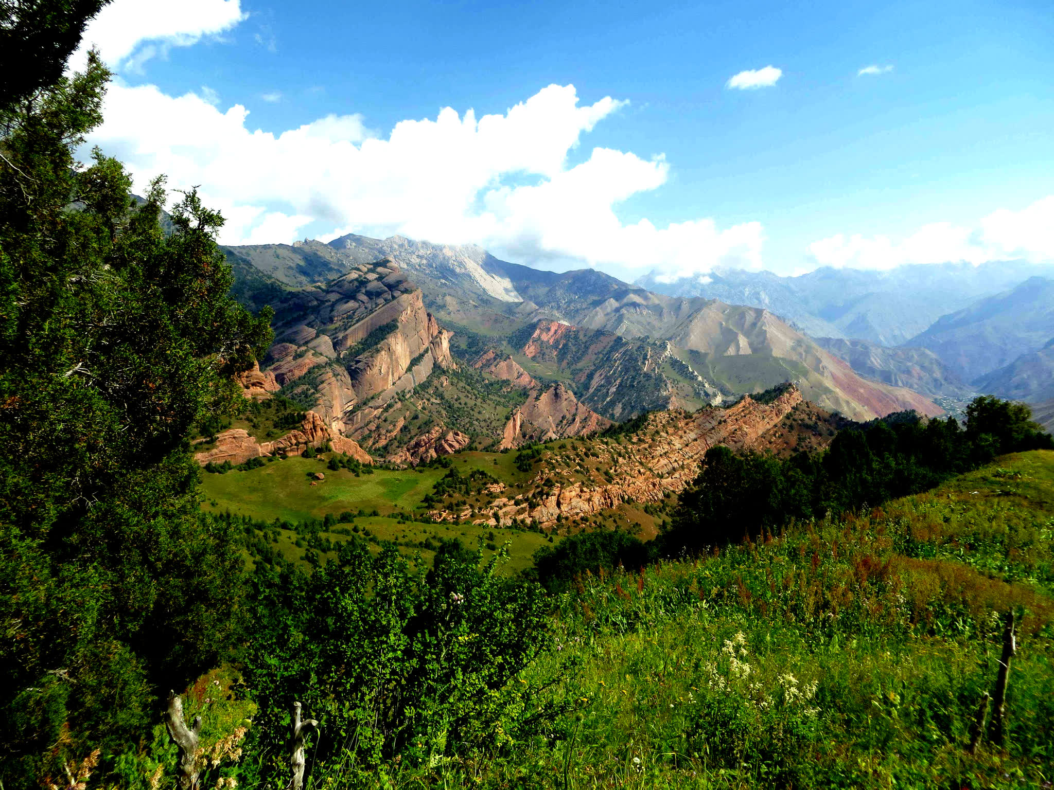
From Kazarman to Arstanbap will provide you with a unique and off-the-beaten-path adventure, offering an opportunity to experience the rugged beauty of Kyrgyzstan's landscapes and the warmth of its local communities.
Arslanbob is famous for having one of the world's largest walnut forests, covering thousands of hectares. The village's economy is heavily dependent on walnut production, and visitors can explore the lush forests and see how the walnuts are harvested and processed.
The village has a diverse population, with both Kyrgyz and Uzbek residents, which creates a unique cultural atmosphere. You can engage with locals, learn about their customs, and experience Kyrgyz and Uzbek traditions. Afternoon hiking to big (85m) and small (35m) waterfalls and market.
Total distance: 230 km, 143 miles.
Level: easy.
Hiking: 2-4 hours.
Accent and Descent: 4000/3780 meters.
Highest and lowest points: 2980 /745meters.
Accommodation type: guesthouse.
Accommodation altitude: 1500.00 Meters | 4921.26 Feet (above sea level).
Village altitude from 1300 to 1700m due to mountain location.
Connection: There is signal, Wi-Fi in the guesthouse.
After breakfast. Continue driving to Uzgen minaret (The Uzgen Minaret is believed to have been constructed in the 11th century during the Karakhanid dynasty's rule. The Karakhanids were a Turkic Muslim dynasty that played a significant role in Central Asian history.) and heading away to Osh.
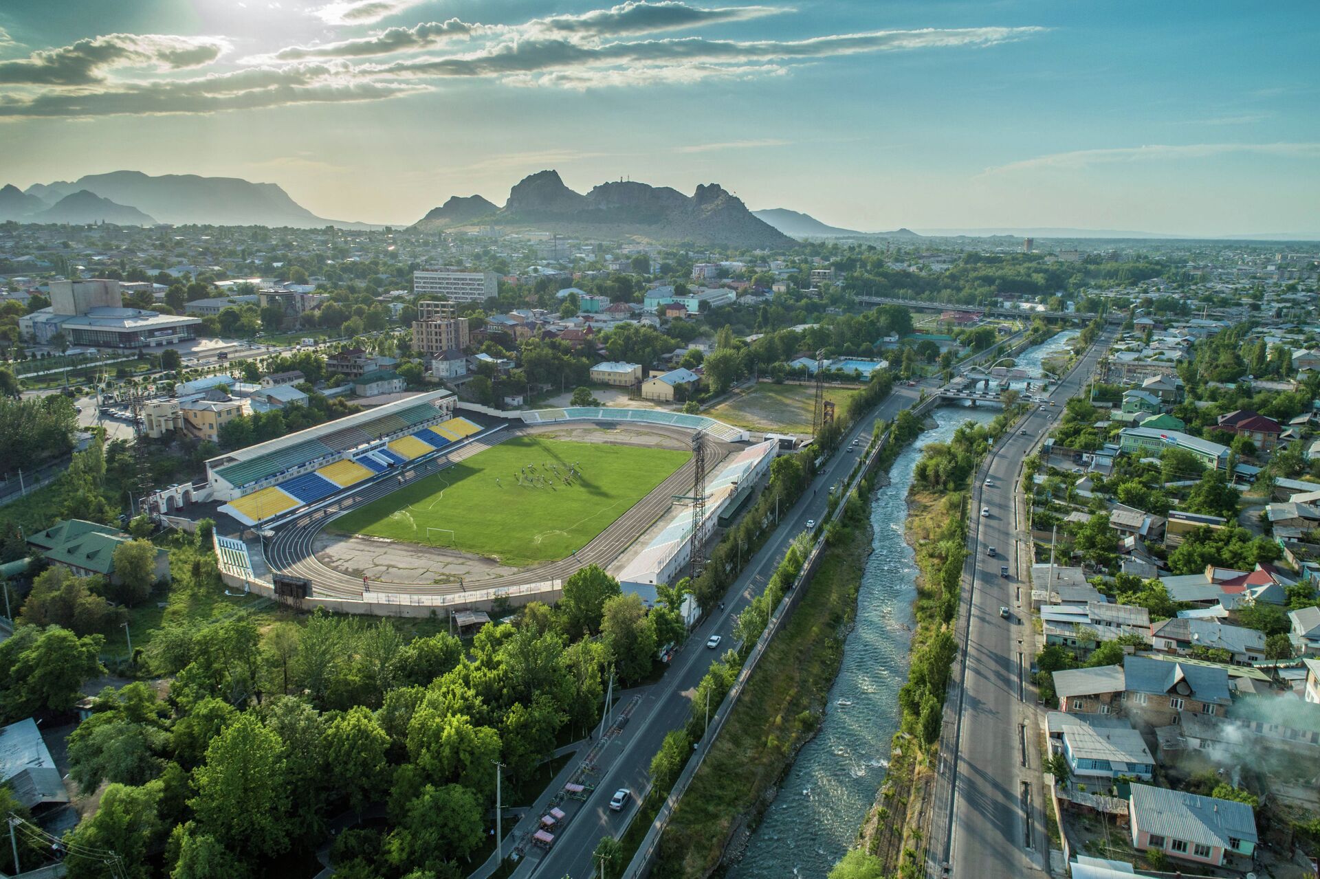
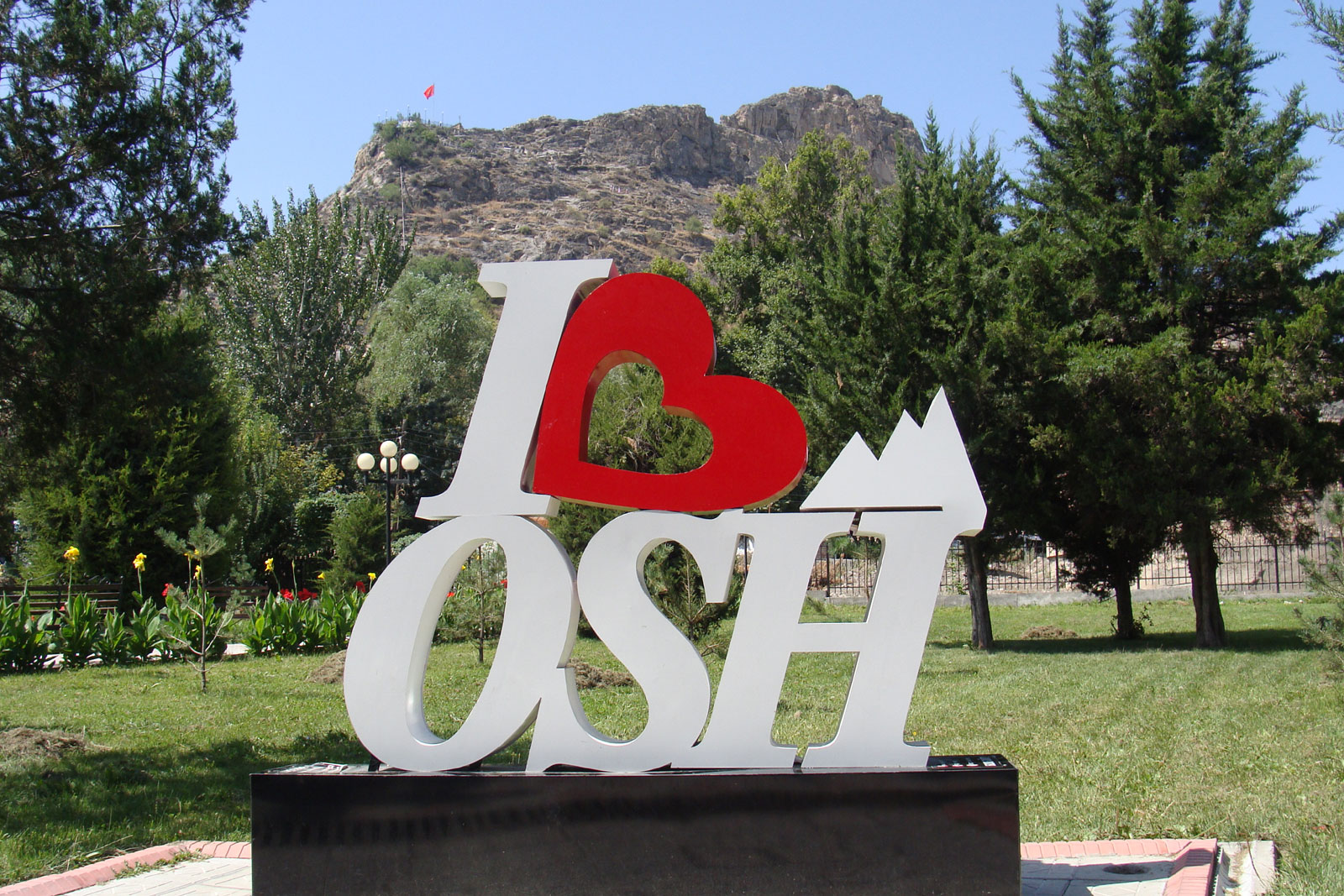
Osh is the second-largest city in Kyrgyzstan and one of the oldest cities in Central Asia, with a history dating back over 3,000 years. It's a vibrant and culturally rich city located in the Fergana Valley in the southern part of the country. After check in the hotel, lunch a café then hiking to panorama view of Sulaiman Mountain including cave museum and evening delicious dinner in a café.
Total distance: 190 km, 118 miles.
Level: easy.
Hiking: 2-4 hours.
Accent and Descent: 1440/2000 meters.
Highest and lowest points: 1540 /745meters.
Accommodation type: hotel.
Accommodation altitude: 1000.00 Meters | 3280.84 Feet (above sea level).
Connection: There is signal, Wi-Fi in the hotel.
Take a scenic drive from Osh, either from the airport or your hotel, to the picturesque village of Kojo Kelen. Along this 95 km journey, which takes about 3 hours, you will enjoy exotic natural landscapes, including majestic mountains, diverse flora and glimpses of unusually shaped red rocks.
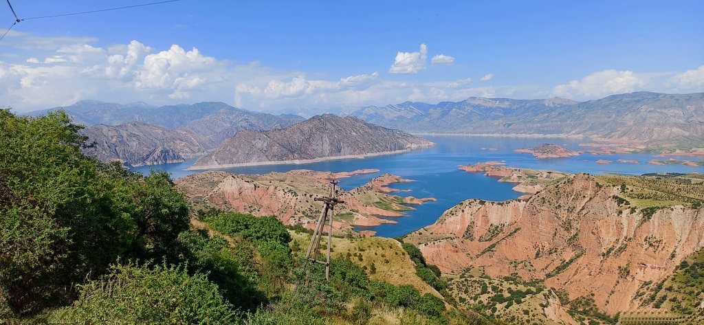
On the way, you will pass by the Papan Reservoir, a vital source of water for the people of Osh and essential for irrigating agricultural lands in both Kyrgyzstan and Uzbekistan.
The road, although not paved, is in reasonable condition and runs alongside the Ak-Buura River, with green mountains covered with juniper lining both sides.
Once you reach Kojo-Kelen, you will enjoy lunch at a local guesthouse. Afterwards, set off on a 2-3 hour acclimatization hike to explore the Blue Grotto and a nearby waterfall.
Accommodation: homestay. The rooms has shared rooms and beds are on traditional floor with hot showers and water running toilets.
Food: lunch and dinner will be prepared by owner in the guesthouse.
Connection: there is electricity, signal (megacom) and Wi-Fi.
Driving distance: 95km, 3hours (excluding stop on the way).
Ascent/Descent: 2260/1050 meters.
Highest and lowest points: 2230 /980 meters.
Accommodation altitude: 2230 meters.
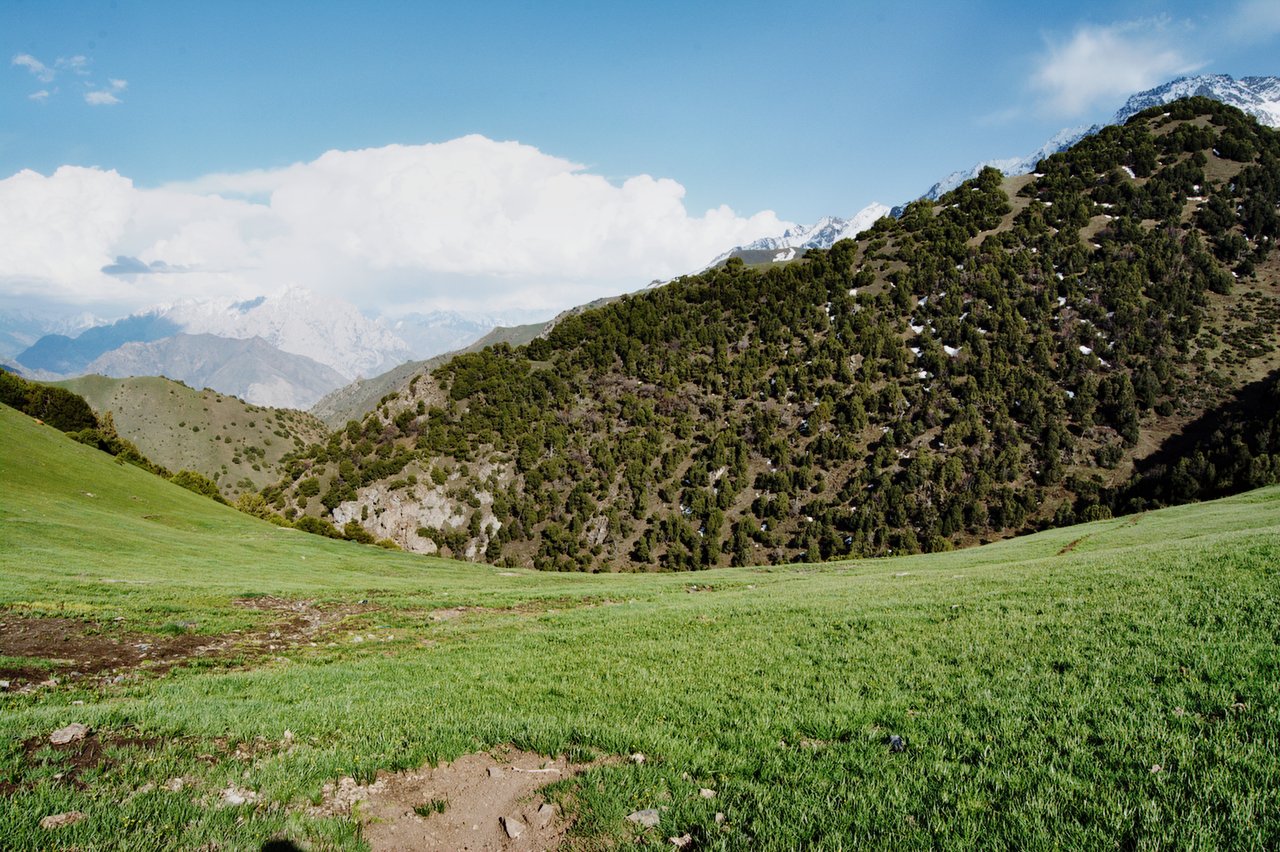
We will begin the second day of the tour on the slopes of the beautiful Cretaceous mountains of Kichik-Alai. First, we cross the Sary-Bel pass (3150m). Then come to camp in Kosh-Moinok.
Kosh-Moinok is another scenic area, located in the south-western part of Kyrgyzstan, not far from Sary-Bell. This location is known for its stunning mountain scenery and tranquil environment. It's often frequented by those looking to explore the Trans-Alay mountain range and enjoy activities such as trekking and camping. The name "Kosh-Moinok" roughly means "double pass through the gorge" reflecting the region's pastoral landscape.
Ascent/Descent: 1010/350 meters.
Highest and lowest points: 3130 /2190 meters.
Accommodation altitude: 2822.00 Meters | 9258.53 Feet.
Accommodation: yurt stay (shared nights on traditional floor, matrass and blankets are available) there are solar shower and flush toilet.
Connection: No electricity, internet and signal.
Food: lunch on the route and dinner will be cooked by hosts in yurt.
Host: The name of owner is Nurdoolot and Begali.
After breakfast start crossing from itself of Kosh-Moynok (3220m) After a short transition descent to the village of Kyzyl-Chara then (3-4 kilometers) along the road through the small village of Sary-Mogol , from here you head to the southern side (left), then path directed along the mountain river, on both sides of the towering rocks, and subalpine and alpine meadows represent a very diverse landscape.
During the hike, at every step you can hear the cries of marmots and birds in these natural areas. As you approach the heights, you feel the marvelous embrace of the surrounding spruce cliffs of the Kichik-Alai mountains.
Trekking distance: 18km, 11 miles.
Time of hiking: 7hours (excluding driving, break and lunch).
Ascent/Descent: 1490/820 meters.
Highest and lowest points: 3495/2412 meters.
Accommodation altitude: 3458.00 Meters | 11345.14 Feet.
Accommodation: yurt stay with shared nights on the traditional floor, there are matrass and blankets and water running toilet are available.
Connection: No electricity, internet and signal.
Food: lunch-box on the route and dinner in yurt camps.
Host: name of woman is Orozgul
The distance to cross the pass may not be long, but the steep ascent requires patience and effort. From the summit of the Sary-Mogol Pass, the landscape transforms into a magical panorama of rugged beauty. Below, the stunning Besh-Kol Lakes (translated as "Five Lakes") shimmer like jewels in the barren terrain. These four interconnected rocky lakes are linked by streams that weave through the landscape before disappearing into an enchanting underground cave—a fascinating natural phenomenon. Descending from the pass, the trail leads you to a peaceful area where a shepherd's yurt stands. From here, our driver will take to Sary-Mogol.
Total distance 31km (Driving distance: 17km (1hour by car).
Trekking distance: 14km, 8.70 miles.
Time of hiking: 6hours (excluding driving, break and lunch).
Ascent/Descent: 770/930meters.
Highest and lowest points: 4270 /3354 meters.
Accommodation altitude: 2976.00 Meters | 9763.78 Feet.
Accommodation: Guesthouse (Alay travel house). The rooms has double, twin and single beds with hot showers and water running toilets.
Connection: there is electricity, internet (Wi-Fi) and signal.
Food: lunch-box on the way and dinner will be prepared by cooking team in guesthouse.
Host: Abdilla and Sharapat
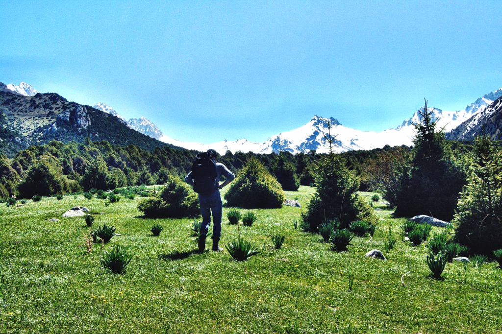
After breakfast, our driver will take you to the Tulpar-Kol Yurt Camp (approximately a 1-hour drive). Once you arrive, leave your heavy bags in the yurt and begin your trek towards the Panorama View Lakes. The trail offers breathtaking panoramic views of the Alai Valley and surrounding peaks, making it a perfect spot for photos and moments of reflection in the serene high-altitude environment. After soaking in the stunning scenery, return to the yurt camp for a well-deserved rest. In the afternoon, take advantage of the extra time to relax, enjoy the tranquil atmosphere, and prepare yourself for the upcoming trekking adventures.
Total distance: 33km.
Driving distance: 22km 40min driving.
Hiking time: 11km, 4 hours (excluding lunch and break time).
Ascent/Descent: 3390/3670 meters.
Highest and lowest points: 4100/3500 meters.
Accommodation altitude: 3500.00 Meters | 11482.94 Feet.
Accommodation type: yurt camp (twin, double and single beds in yurts are available) solar water heater shower, water running western toilets.
Connection: there is solar electricity for phone charge and signal (megacom, beeline, O) and Wi-Fi in 5G
Relax and unwind
If you're tired from previous hikes, you can simply relax and enjoy the breathtaking views of the lake. Perhaps take a short two-hours walk around the lake and rest in preparation for next grand alpine adventure.
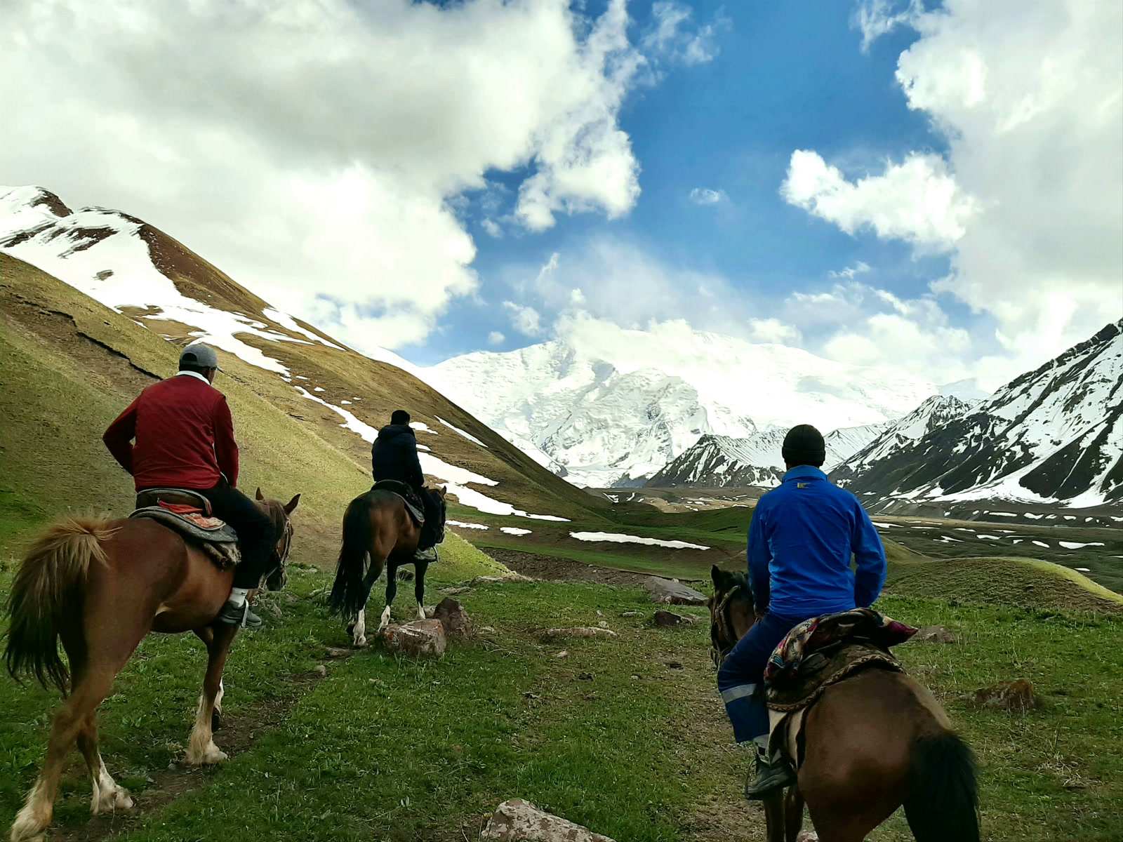
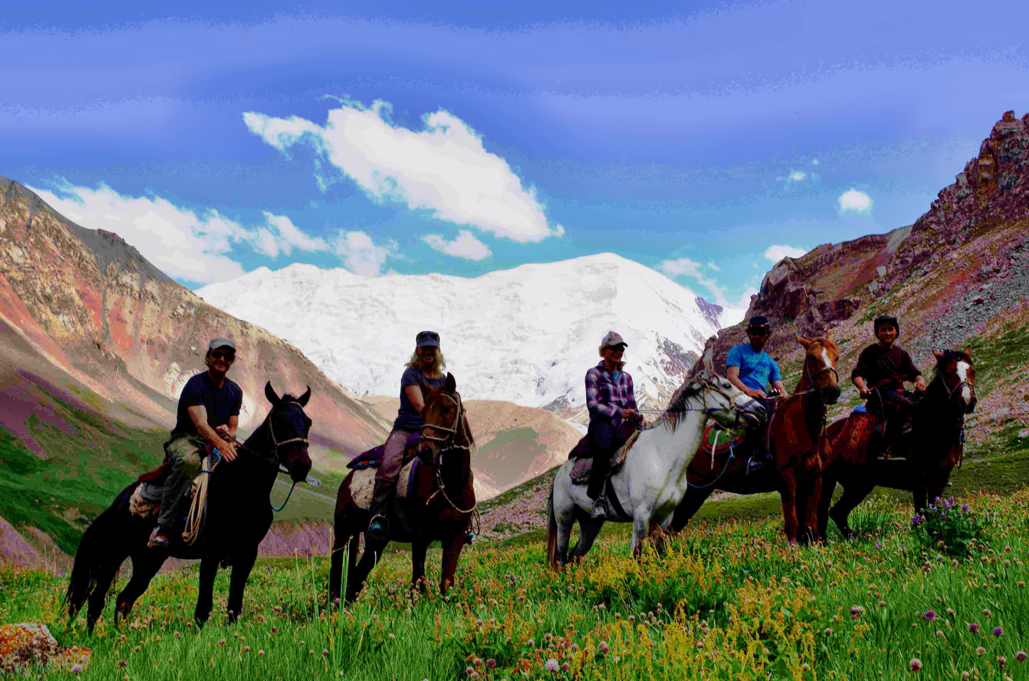
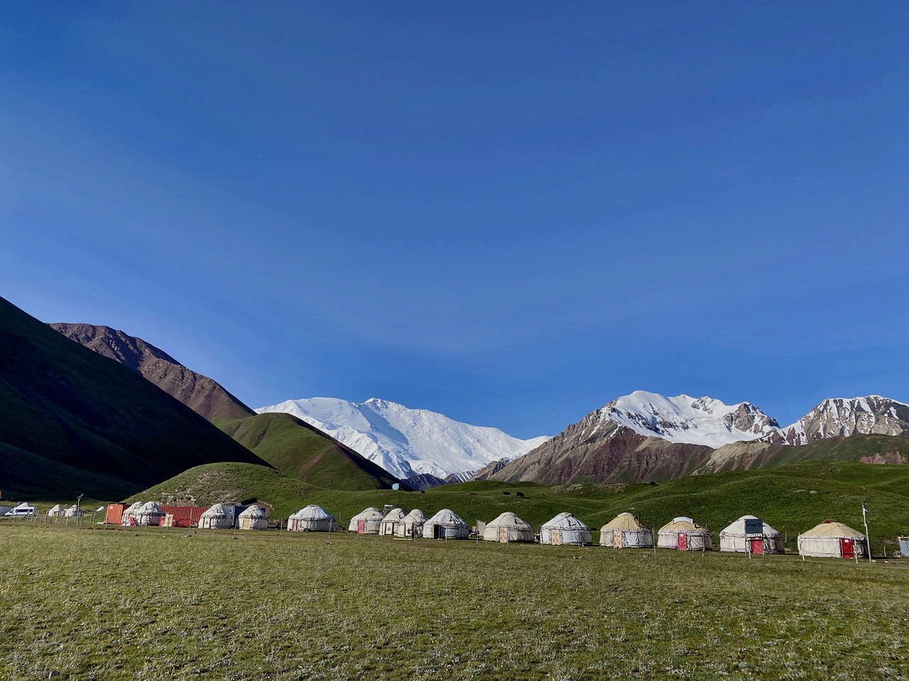
The trek to Advanced Camp is an unforgettable journey that takes you past the Base Camp of Lenin Peak and the breathtaking Traveler's Pass, standing at an altitude of 4120m. After approximately 6-7 hours of trekking, you will arrive at Advanced Camp, also known as Camp 1, situated at 4400m above sea level. This camp is located in a cold, snowy environment, with snow permanently covering the Peaks. From here, the views are truly incredible—you'll have a sweeping panorama of the majestic Lenin Peak, towering above you like a snow-clad giant. Standing so close to this iconic peak is a humbling and awe-inspiring experience.
Total distance: 19km 11.80 miles.
Hiking time: 7hours (excluding lunch and break time).
Ascent/Descent: 810/1700 meters.
Highest and lowest points: 5100/3500 meters.
Accommodation altitude and type: Tent on the wooden floor with matrass (Need to take your sleeping bag) and altitude is 4400.00 Meters | 14435.70 Feet.
Connection: there is no signal But Wi-Fi in 5G (star link) is available.
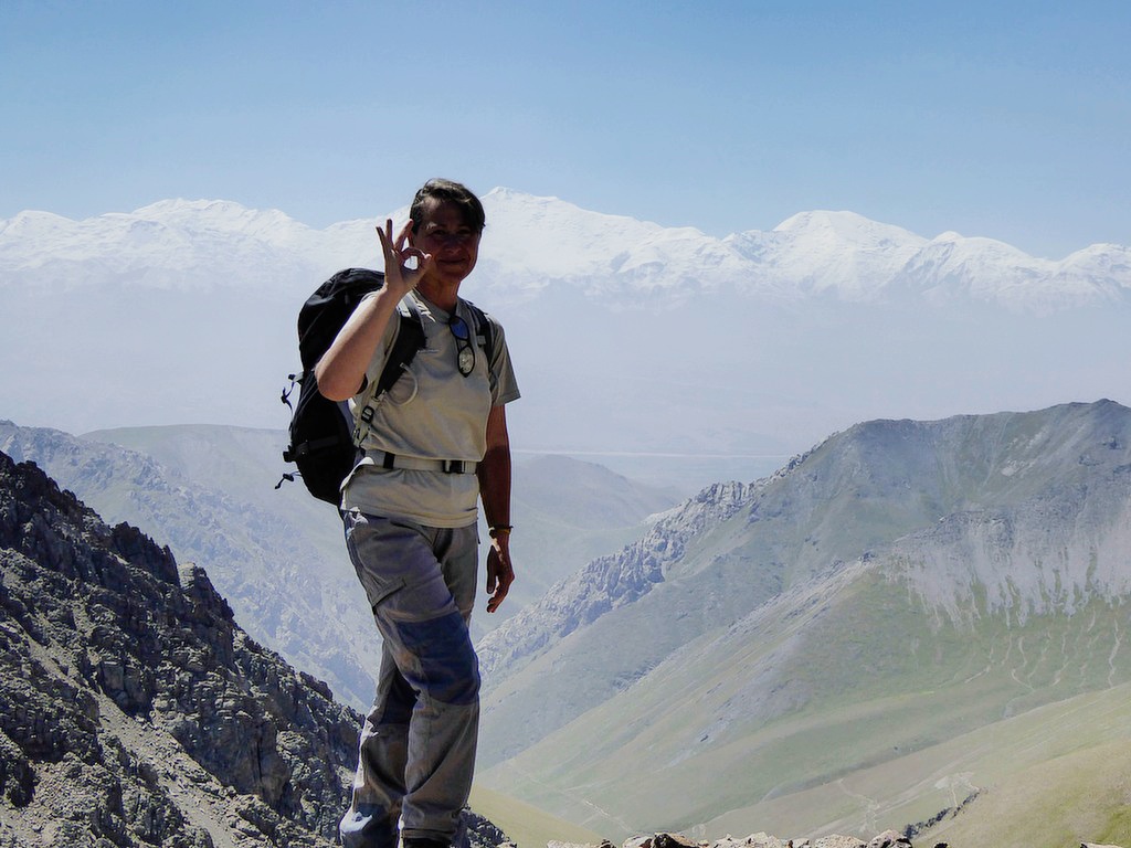
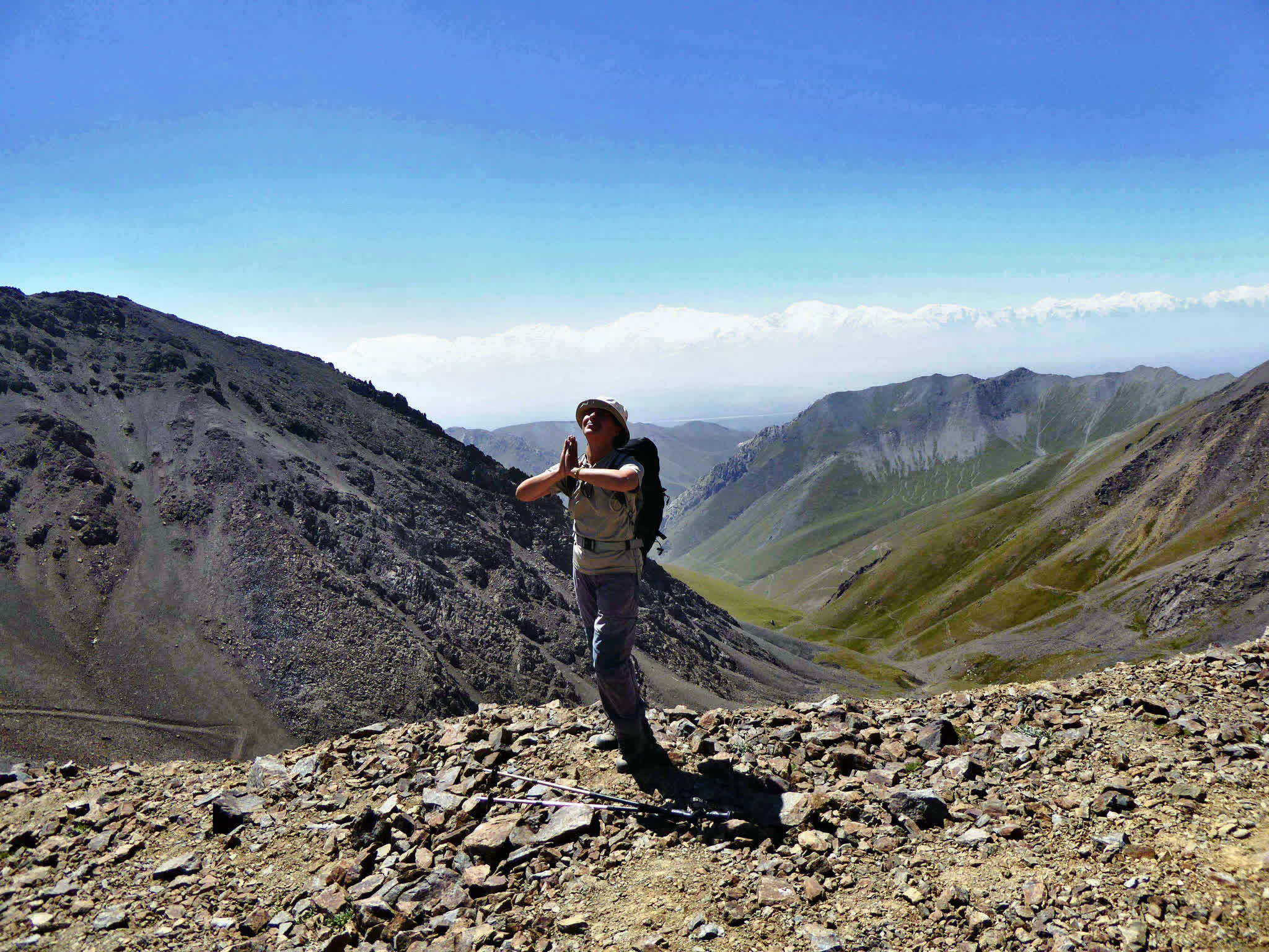
After breakfast, begin your ascent to Peak Yukhin, standing at an impressive altitude of 5130m. This is one of the ideal acclimatization peaks, allowing climbers to reach the summit without the need for crampons or ropes (usual form) However, the climb demands significant physical effort and determination to reach the top.
Upon successfully reaching the summit, take a moment to enjoy the breathtaking views and capture unforgettable photos. After a brief rest at the peak, descend back to Tulpar-Kol. Stay in yurt camp for more relaxing.
Total distance: 19km 11.80 miles.
Hiking time: 6 hours (excluding lunch and break time).
Ascent/Descent: 160/1700 meters.
Highest and lowest points: 5100/3500 meters.
Accommodation altitude: 2976.00 Meters | 9763.78 Feet.
Accommodation type: yurt (same camp).
Connection: there is internet (Wi-Fi) and signal.
Return to Osh, the road will take about 4-5 hours (with a stop along the way for photography). Upon arrival, lunch in a cafe, then the driver will take you to the entrance to the territory of Sulaiman-Too (Mount Sulaiman), the guide will take you through the museum, which is located in the cave of Mount Sulaiman, then to a panoramic view of the city of Osh and the descent to Aravanskiy street, and the historical museum, then a walk through the parks (Navoi) and the bazaar. Along the Ak-Buura River, then transfer to Osh airport and then flight to Bishkek on an evening flight (1 hour)


![IMG-20231106-WA0009[1]](https://alaytravelguide.com/wp-content/uploads/2026/05/IMG-20231106-WA00091.jpg)
Write Your Review