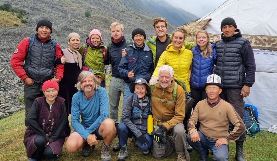
Our trekking tours, developed over many years of practical research and refinement, have become highly popular among European and international nature enthusiasts. These routes are loved by adventurers for their breathtaking landscapes and incredible sensations, making them a must-try in Kyrgyzstan.
In the Alai Valley, the minimum altitude begins at 2,500 meters above sea level and quickly rises higher. Due to the altitude, we recommend this hike for people in moderate physical condition with no altitude-related health problems. The route includes two challenging passes, Sary-Mogol Pass (4,280 m) and Jiptik Pass (4,185 m), with daily treks of 5–6 hours (active walking).
Why Start from Tulpar-Kol?
We design our tours with your comfort and safety in mind:
Acclimatization: Around Tulpar-Kol, there are several short, hour-long trekking routes without high passes, allowing participants to naturally acclimatize before starting the main trek.
Accessibility: Tulpar-Kol offers reliable connections and internet access, which is vital for safety. If anyone feels unwell or experiences mountain sickness, immediate transport by car is available.
Optimal Experience: This starting point provides a safe and enjoyable acclimatization process, enhancing your overall experience.
| Destination | Osh | Tulpar-Kol | Sary-Mogol | Kichik-Alay | Kosh-Moinok | Kojo-Kelen |
|---|---|
| Depature | Yes Required |
| Departure Time | Contact us for more information |
| Return Time | Contact us for more information |
| Included |
|
|
Excluded: |
|
 |
|
Price:
| Number of tourists | 2 | 3 | 4 | 5 | 6 | ||||
|---|---|---|---|---|---|---|---|---|---|
| Price in USD Dollar for the group | $1280 | $1600 | $1920 | $2250 | $2580 |
Difficulty Level
Moderate to Challenging
This trek is suitable for travelers in good physical condition.
The route includes high-altitude passes:
Daily walking time: 5–8 hours.
Maximum altitude: 4,270 m.
Overnight altitude: up to 3,500 m.
Previous trekking experience is recommended but not mandatory.
Participants must be comfortable hiking at high altitude.
Connectivity & Infrastructure
What to Bring Clothing
Equipment
Short itinerary:
Day1. Osh - Tulpar-Kol
Day2. Tulpar-Kol - travel pass - Tulpar-Kol
Day3. Tulpar-Kol - Sary-Mogol
Day4. Sary-Mogol town via Sary-Mogol pass to yurt camp in Kichik-Alay
Day5. From yurt camp to Kosh-Moinok
Day6. Kosh-Moinok to Kojo-Kelen onward drive to Jiptik yurt camp
Day7. Cross the Jiptik pass then drive to Sary-Mogol
Day8. Return to Osh
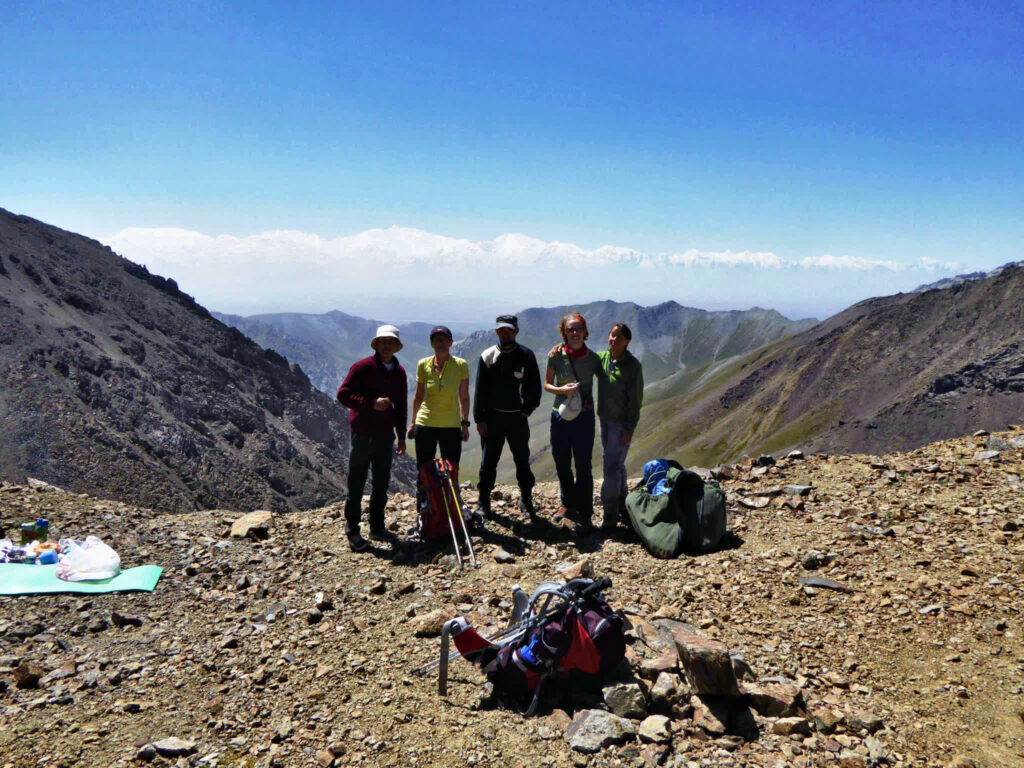
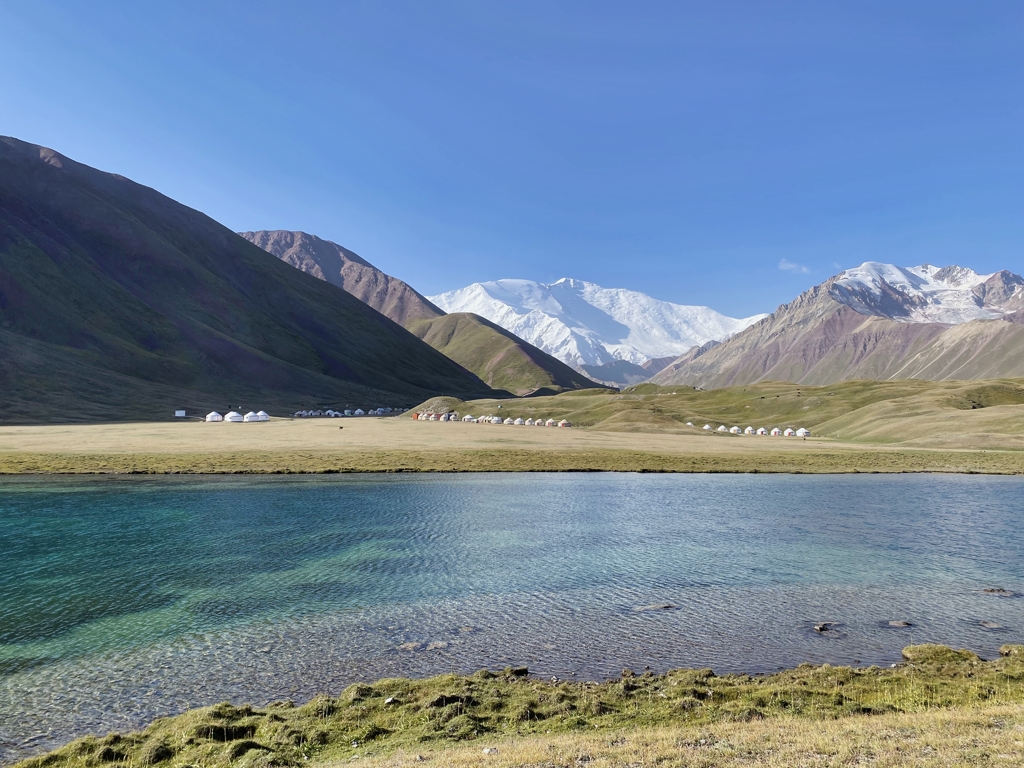
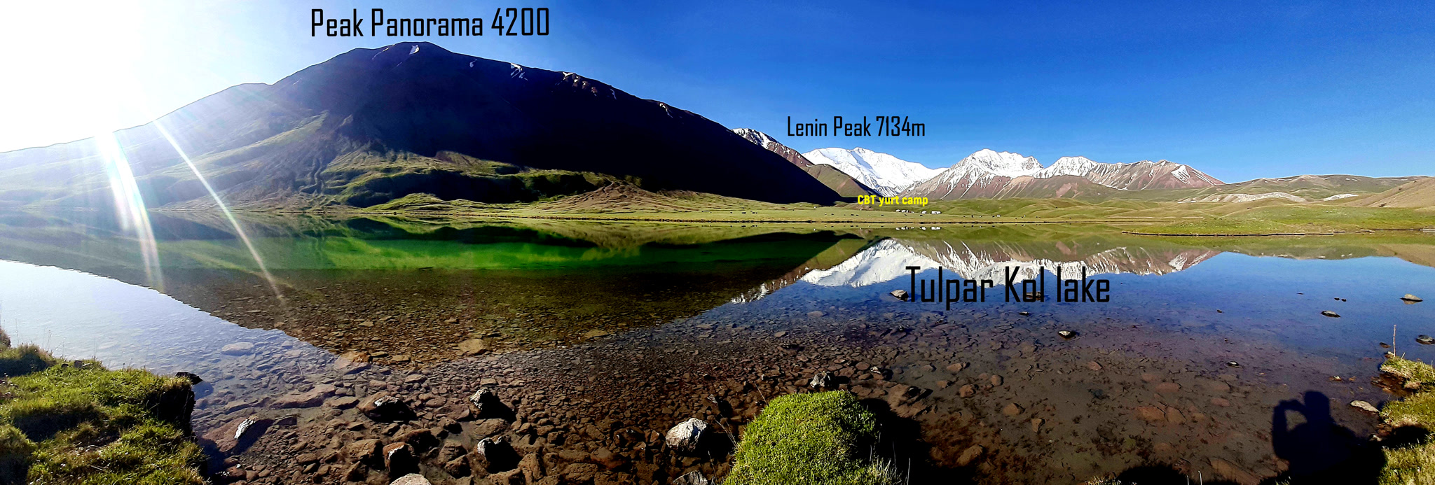
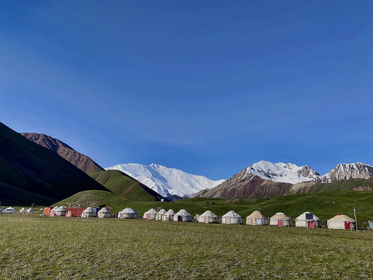
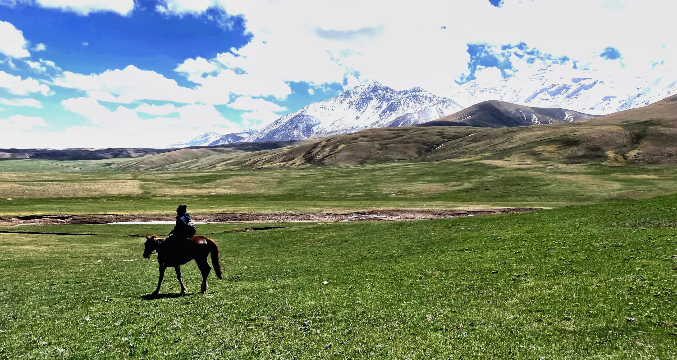
Departure from Osh, in the morning on the way visit the lake Kolduk. Walk around the lakes,enjoy the grandiose view then continue driving to Sary-Mogol, lunch in Alay travel house then, driving(1hour) to Tulpar kol yurt camp. Afternoon walk around the lakes. Tulpar-Kol, known for its picturesque yurt camps, is an incredible destination for all types of travelers, whether active hikers or those looking for a more relaxed experience. Guests can stay in traditional yurts and enjoy activities such as hiking, horseback riding, and multi-day trekking options lasting 3 to 4 days.
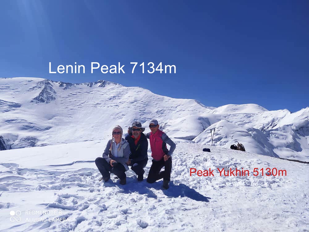
Leave the heavy bags in yurt, walk to the traveler’s pass through the Base Camp enjoy the panoramic view of Lenin Peak, lunch then come back to the yurt with same route. Overnight in same yurt.
Description:
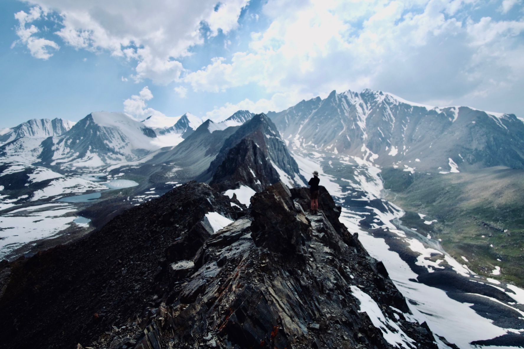
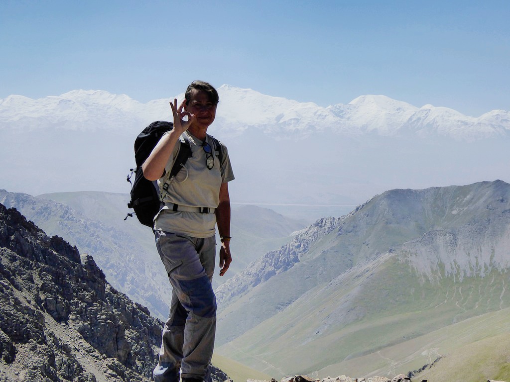
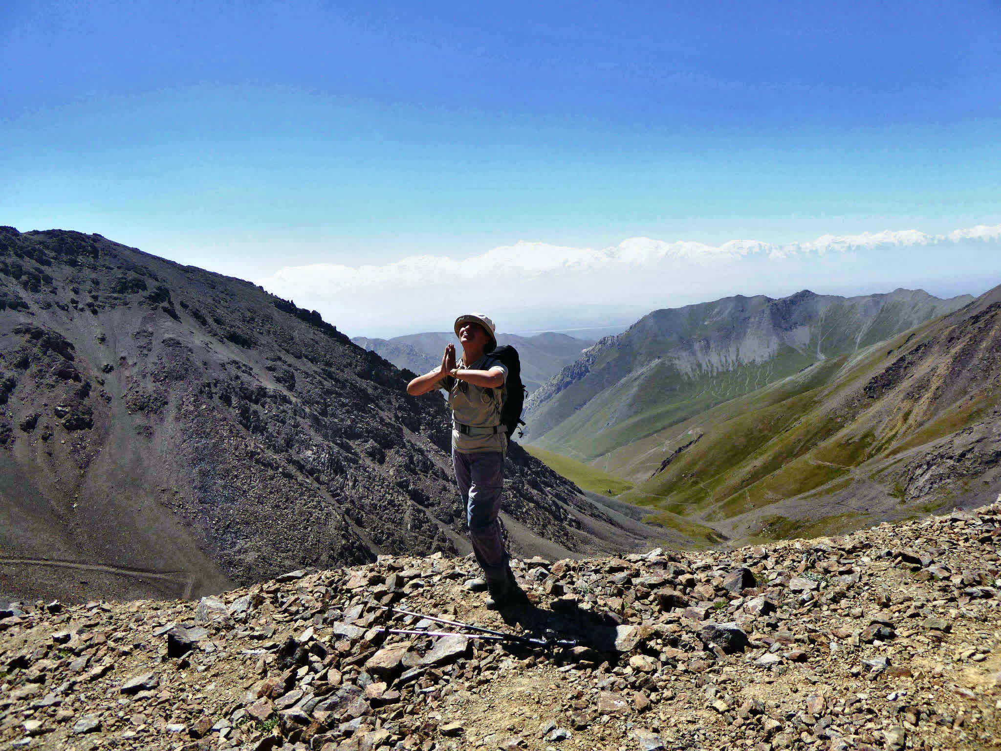
This trail takes you through alpine meadows and ascends to the Travelers' Pass (~4,130 m), offering breathtaking views of the whole view of Lenin Peak and the Alay Valley below. The high altitude and steep sections make this hike more challenging but rewarding.
If you don't want to go all the way to the pass then you will have the opportunity to get to the base camp (there and back 6 km 3 hours).
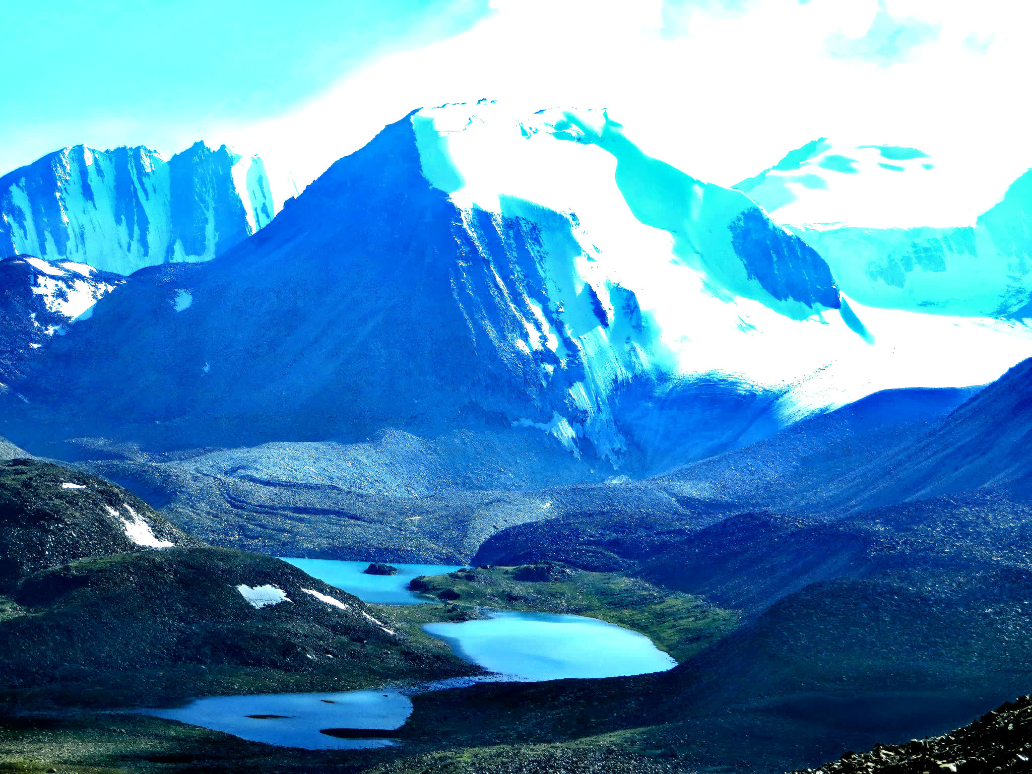
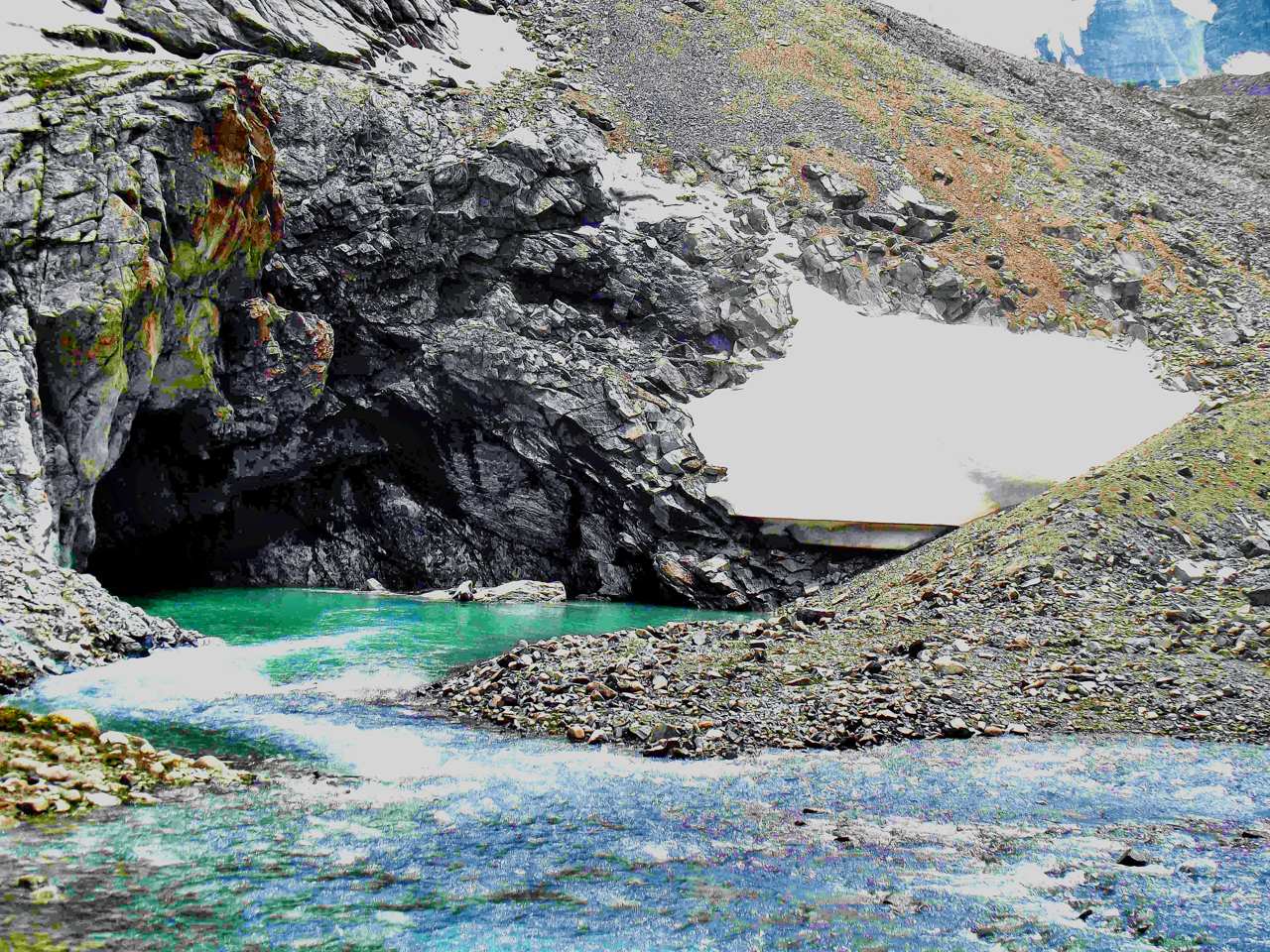
The route from Tulpar-Kol Lake to Tuyuk Canyon is a hidden gem for trekkers in the Alay Valley. This trail not only offers solitude and pristine landscapes but also provides some of the best views of Peak Estonia (6,202 m) and Peak Latvia (6,134 m), two impressive peaks in the Zaalaysky Range.
Trail to Tuyuk Canyon:
There are two options through Peak panorama (4hours up and down-moderate level) and along the lakeside with a road (2hours- easy hiking)
Nomadic Culture: During summer, you might pass herders and yurts, offering opportunities for cultural interaction.
Horse riding is available to Tuyuk canyon by pre-booking After soaking in the stunning scenery, descend towards (3hours) until shepherd’s hut onward transfer to Sary-Mogol
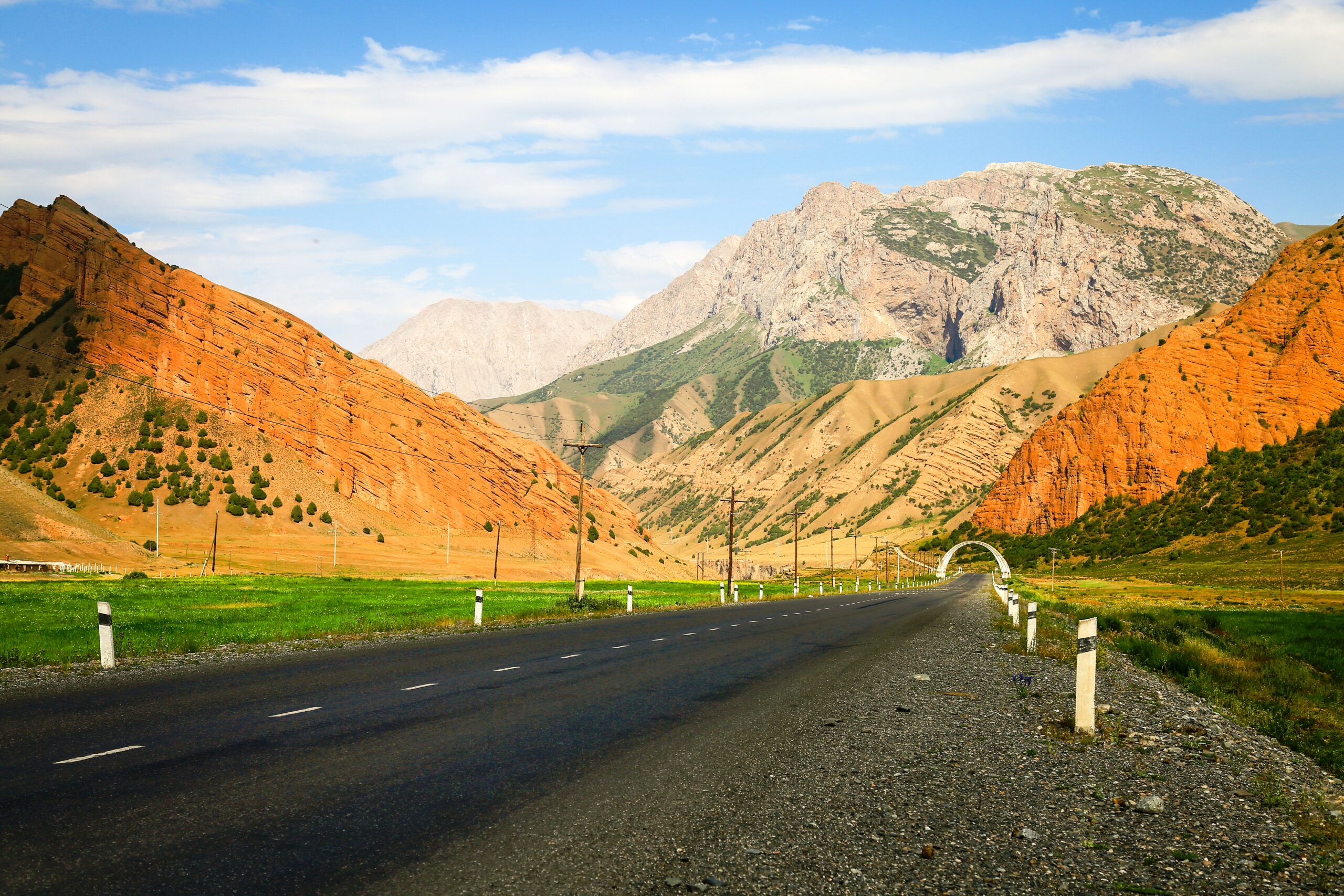
Today we continue our trekking in north range of Allay valley (Trans-Alay). From Sary-Mogol to trailhead we go by car (1h) then trekking starts it is going to be bit taught trek because we go up to the pass called Sary-Mogol pass (4270 meters) and Besh-Kol lake. Our daily route takes for 6-8 hours of walking up in rocky path. At the top of the pass we enjoy the stunning scenery of Besh-Kol lakes. Then keeping the way to other side until the yurt camp.
Head east following the river and slightly descending to the end of the beautiful mountain gorge. Enjoy grandiose views of the Kichik Alay or Trans Alay mountain range, at first we cross a small village under Sary-Mogol further direction of travel turns to the right on the dirty auto road after 2-3 hour we reach a small village Kyzyl-Chara and stop here for lunch in home stay or at a cafes on the way, then forward go on to yurt camp in Koshmoinok.
We will begin next day of the trek on the slopes of the beautiful Cretaceous mountains of Kichik-Alay, straightaway we cross the pass of Sary-Bel (3150m) stunning rocks, amazing view of natural creation.
After descending to Kojo-Kelen, we’ll take a short break at a local home to enjoy a refreshing shower and tea, providing a chance to relax and recharge. Following this, our local driver will transfer (because of long way) you to a yurt camp located near the base of Jiptik Pass—offering a well-explored and thoughtfully planned option for your journey.
After breakfast, the trek continued up to the top of the pass "Jiptik" and cross it until noon (4185 asl). If the sky is clear from the pass you can see a stunning view of the Pamir-Alay valley with Lenin Peak (7134). On the top you will have your lunch and photo shooting. After soaking in the stunning scenery, descend towards Darbaza-Tash traversing picturesque landscapes. Upon reaching Darbaza-Tash, a transfer will take you to Sary-Mogol
Morning after breakfast, at 8a.m you can get to Osh by share taxi or private car as you want (by prior warning)

![IMG-20231106-WA0009[1]](https://alaytravelguide.com/wp-content/uploads/2026/05/IMG-20231106-WA00091.jpg)
Write Your Review